 Antiques (UK)
Africa Maps
Asia Maps
Australia/Oceania Maps
Celestial Maps
Central America/Caribbean Maps
Curiosities Maps
Digital Maps
Europe Maps
Map & Globe Mixed Lots
Map & Globe Reproductions
North America Maps
South America Maps
World & Celestial Globes
World Maps

-
$149.99 GBP

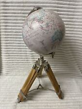 Antique Nautical Authentic Vintage World Globe Floor Tripod Stand D 20cm H 61cm
-
$160.11 GBP
 Vintage Rand McNally 1969 Lunar Moon Globe 12" With Stand & Movable Compass
-
$62.35 GBP
 1986 Dallas Texas Map ORIGINAL Pictorial LARGE BEAUTIFUL Grapevine Cotton Bowl
-
$45.63 GBP
 1956 ARCTIC REGION NORTH POLE MAP Original Alaska Siberia Greenland Canada
-
$7.99 GBP
 Vintage Admiralty Charts 1960s-1980’s
-
$45.00 GBP
 Black Onyx Globe With Semi Precious Gemstone Inlay With Compass
-
$19.99 GBP
 Ubersichtskarte von Mitteleuropa: K51 Koln 1926 Linen Backed Folding Map / VGC
-
$174.99 GBP
 1971 George Philip & Son Ltd Old School Roll Down 178 cm Long WORLD MAP On Linen
-
$9.95 GBP
 PORTSMOUTH HARBOUR, GOSPORT, PORTSEA Hampshire - Rare Vintage WW2 Naval Map 1943
-
$39.99 GBP
 Globemaster Millennium Globe Atlas 12” Raised Relief Beige VGC
-
$7.50 GBP
 100's of Admiralty Charts (the pVintage Admiralty and other Charts 1940's-2010's
-
$4.50 GBP
 Ordnance Survey one inch special map of Worcester & Malvern District. 1924.
-
$11.99 GBP
 VINTAGE 1930 NORWICH CITY PLAN Colour Map - Mounted For Framing
-
$39.13 GBP
 1956 Map Louisiana LARGE ORIGINAL New Orleans Lafayette Baton Rouge Railroads
-
$38.33 GBP
 1956 Switzerland Map Germany Italy Austria France Zurich Brescia Innsbruck
-
$46.34 GBP
 VINTAGE 1956 Mexico Map ORIGINAL Central America Baja RAILROADS United States
-
$19.99 GBP
 Admiralty Fathom Chart (Firth of Clyde - Loch Fyne) No 2159
-
$9.99 GBP
 Vintage Bacon’s New Map of EPPING FOREST, with 8 Page Guide, 1 Shilling.
-
$20.00 GBP
 The Making Of America National Geographic 8 Vintage Maps 1985-1987
-
$3.95 GBP
 RIVER SEINE ESTUARY, France D-Day Invasion OVERLORD Planning - WW2 Map 1943
-
$89.00 GBP
 Philips 10 Inch Terrestrial Globe - Mid century Vintage
-
$9.99 GBP
 Vintage Admiralty Nautical Navigation Sea Chart Dover Harbour No. 1698 (1952)
-
$6.00 GBP
 BRIGG British Geological Survey Map - 1982 Solid and Drift Edition
-
$9.99 GBP
 Antique 1920s London Map - Mounted - Colour ROTHERHITHE LIMEHOUSE WHITECHAPEL 12
-
$4.95 GBP
 THE DEVELOPMENT OF ALLIED STRATEGY NORTH OF THE SEINE, 1944, WW2 Map of OVERLORD
-
$125.00 GBP
 Vintage World Globe CHALLENGE Philips 1962 ON GEOMETRIC BASE
-
$12.50 GBP
 Vintage Admiralty Chart 1426 Loch Linnhe - North Part, 1918 edn Updated 1968
-
$25.00 GBP
 The Excelsior Atlas and Gazetteer of the World Edited by G W Bacon
-
$45.63 GBP
 PHILIPPINES SOUTHEAST ASIA 1956 MAP Original Borneo Manila Celebes Sumatra
-
$55.00 GBP
 Vintage Heavy Brass Globe - Zodiac Symbols
-
$45.63 GBP
 1956 MAP INDIA PAKISTAN BURMA TIBET Nepal Bhutan Afghanistan Persia Ceylon
-
$38.33 GBP
 1956 Ontario Canada Map ORIGINAL Toronto Great Lakes Railroads Townships
-
$9.99 GBP
 National Geographic Map - The Earth's Moon 1969
-
$14.00 GBP
 ORIGINAL VINTAGE JAPANESE MAP OF AICHI PREFECTURE & NAGOYA (78x53cm)
-
$5.00 GBP
 Vintage Map of Birmingham
-
$8.95 GBP
 1984 Vintage Filofax Map Pages - 3 Double sided Pages - Ref MO7
-
$19.99 GBP
 Admiralty Fathom Chart (Firth of Clyde - Loch Fyne) No 2131
-
$10.00 GBP
 Vintage Admiralty Chart 3750 England - River Crouch 1957 Edition
-
$125.00 GBP
 late 1940s or 50s poram map of the island of mallorca / majorca
-
$46.34 GBP
 1956 Norway Sweden Finland Map Soviet Union Germany Poland Iceland Leningrad
-
$24.99 GBP
 Vintage Admiralty Nautical Navigation Chart Loch Crinan Forth Lorne No:2326 1966
-
$15.00 GBP
 Large Vintage Original Hand Drawn Pictorial Historical Map Scarborough Yorkshire
-
$19.99 GBP
 Vintage Admiralty Nautical Navigation Chart Scotland Firth Clyde & Approaches
-
$80.05 GBP
 1895 SINGAPORE CITY STREETS PLAN Antique Map
-
$18.00 GBP
 Ordnance Survey 1964 GEOLOGICAL SURVEY Vintage Cloth Map SHEET 2
-
$4.95 GBP
 THE OPERATIONS OF SECOND BRITISH ARMY EAST OF THE ORNE 18-21 JULY 1944, WW2 Map
-
$52.00 GBP
 Vintage 1930s Small Tin Rotating World Globe on Base J. Chein & Co
-
$28.00 GBP
 Large Marble Sphere
-
$9.99 GBP
 Vintage Admiralty Nautical Chart Sheerness and Approaches No. 3683 (1954)
-
$70.00 GBP
 Vintage Philips 13.5" cardboard terrestrial globe A/F
-
$160.00 GBP
 Vintage World Globe by National Geographic, London 1950s
-
$3.25 GBP
 VINTAGE SEA CHART / NAUTICAL MAP 1961 - The Wash - To Frame?
-
$19.99 GBP
 Vintage Ordnance Survey Map, Aldershot Command c1925 Military, 1" - 1 Mile
-
$19.99 GBP
 1956 Antique Map; Admiralty Chart # 1907, Cloch Point to Little Cumbrae, Striven
-
$3.95 GBP
 GOREY, JERSEY, Channel Islands - Rare Vintage naval WW2 map 1943
-
$8.50 GBP
 1900s South Devon Bartholomew's Reduced Survey 2 miles to 1 inch Sheet 36
-
$29.00 GBP
 VINTAGE ADMIRALTY CHART. No. 3662. LITTLE ADEN HARBOUR. 1957 Edition.
-
$3.00 GBP
 OS maps 7th series, 1 inch maps,3 maps, 1953-1966, good to fair condition
-
$29.99 GBP
 Scanglobe World Antique Danish Illuminated Globe Large - Light
-
$32.00 GBP
 Scan-Globe A/S Illuminated Lamp World Globe Made in Denmark. 1990 Tested & Box
-
$14.00 GBP
 Devon & Cornwall Vintage Maps & Guides Inc. 1950 Bartholomews Exmoor & Dartmoor
-
$20.00 GBP
 Job Lot of Vintage Ordnance Survey Maps x33 Bartholomews Geographic OS
-
$10.00 GBP
 Vintage Admiralty Chart 2007 Scotland - River Clyde 1979 Edition
-
$15.00 GBP
 Vintage Replogle USA, 9 Inch World Classic Series Relief Globe on Wood Base
-
$38.69 GBP
 Brass Antique Style Globe World Nautical Wooden Table Antique Decor Vintage
-
$29.95 GBP
 Blaeu Wall Framed Map Gold Foil Nova Totivs Terrarom Sive Novi Orbis Tabvla
-
$4.95 GBP
 Berwick Upon Tweed Holy Island Area OS Landranger Sheet 75 Paper 1:50,000 2000
-
$6.95 GBP
 THE DAILY TELEGRAPH MAP OF EUROPE 1960's GEOGRAPHIA RARE LARGE 101cm X 76cm N595
-
$159.32 GBP
 1927 Booklovers Map of the British Isles pictorial mounted framed P Paine Bowker
-
$3.25 GBP
 VINTAGE SEA CHART / NAUTICAL MAP 1961 - TORQUAY & BRIXHAM Harbours - To Frame?
-
$15.00 GBP
 Vintage Bacon's Cycling Road Map Of The Environs London N.E.
-
$20.00 GBP
 Admiralty Fathom Chart (Firth of Clyde - Loch Fyne) No 2131
-
$35.00 GBP
 VINTAGE ADMIRALTY CHART. No.3517. PLANS in the PERSIAN GULF. 1977 Edition.
-
$225.00 GBP
 George Philip and Son 19 inch terrestrial globe, dated 1962
-
$7.00 GBP
 OS maps 7th series + 1 New Popular 1 inch maps, 8 maps, good to fair condition
-
$9.99 GBP
 OS Map 24 Lancaster And Fleetwood 1910 Large Sheet Series Two Shillings
-
$35.00 GBP
 Large 12" Vintage Chad Valley World Globe Tin Plate Metal Made In England
-
$79.00 GBP
 Philips’ 13½” Challenge Globe 1961 Mid Century Collectible
-
$39.95 GBP
 World Globe Vintage 1982 Danish Scan-Globe A/S Denmark
-
$14.99 GBP
 Glass globe
-
$15.00 GBP
 Vintage Bacon's New Cycling Road Map Of Reading And District
-
$9.99 GBP
 VINTAGE STREET MAP OF LOS ANGELES & LONG BEACH. 1978
-
$6.99 GBP
 Vintage original - early 1920s - Thomas Cook Map of Central & Southern Europe
-
$10.00 GBP
 Vintage Admiralty Chart 44 Ireland, Dundalk Bay Area, 1883 Edition Updated 1969
-
$295.00 GBP
 12 Inch Philips Terrestrial Globe. Art Deco 1930's Vintage World Desk Globe
-
$6.00 GBP
 EGTON Institute of Geological Sciences Map - 1970 Drift Edition
-
$12.00 GBP
 Stanford's 1930s Map of Canals & Rivers Navigable by Small Craft
-
$8.50 GBP
 OS SCOTLAND Sheet 11, 1/4inch:1mile . 1st edition c1903, revised 1907.
-
$8.50 GBP
 1900s Dorset Bartholomew's Reduced Survey 2 miles to 1 inch Sheet 34
-
$11.99 GBP
 Vintage Bartholomew's pocket plan of Glasgow & suburbs Scotland map index guide
-
$250.00 GBP
 Royal Geographical Society silver map of the world 1976
-
$20.00 GBP
 1930/40s Vintage Bartholomew’s Town Plan of Oxford 22in x 15in 12in to mile
-
$11.99 GBP
 VINTAGE 1930 HULL CITY PLAN Colour Map - Mounted For Framing
-
$25.00 GBP
 1942 43 ww2 OLD map of DARLINGTON
-
$14.99 GBP
 ADMIRALTY SEA CHART. No. 1827. HARBOURS on the SOUTH-EAST COAST of ENGLAND. 1987
-
$7.00 GBP
 Road Map of Sri Lanka Survey Department 1984 Folded Ceylon
-
$7.30 GBP
 Vintage Bacon's Cycling Road Map 50 Miles Around Birmingham
-
$9.99 GBP
 Vintage Coloured Map Of Kent -c1895 Showing Ashford/ Maidstone/Canterbury/Dover
-
$45.54 GBP
 VINTAGE Denmark Germany Sweden Map ORIGINAL Europe Berlin Hamburg Copenhagen
-
$46.34 GBP
 1956 MIDDLE EAST Iran Afghanistan MAP Tehran Kabul Pakistan Iraq Bahrain Qatar


