 Antiques (UK)
-
$95.00 GBP

 Vintage Philips Educational Map 'The Journeys of St Paul' - 1967
-
$124.09 GBP
 1905 Chautauqua Industrial Art Desk Lewis E. Myers & Co w orig eraser
-
$265.00 GBP
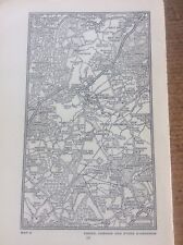
 Antique Map London Post Office Directory 1885 South London
-
$180.14 GBP
 Palm Beach Atlas Sheets 25 and 25-A - Via Vizcaya to Via Bellaria
-
$9.99 GBP
 National Geographic Map - The Earth's Moon 1969
-
$49.00 GBP
 ANTIQUE 18TH CENTURY PLAN OF THE NAVIGABLE CANAL COVENTRY TO STAFFORDSHIRE
-
$4.99 GBP
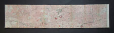
 ANTIQUE 1918 LONG LONDON STREET MAP ROTHERHITHE ACROSS TO SHEPHERDS BUSH
-
$45.00 GBP
 Antique Map Of Warwickshire,colour And Framed 16 Inches Tall ,watermark Bottom R
-
$34.99 GBP
 National Geographic Map - Antarctic Regions - 1932 - Vintage
-
$9.99 GBP
 National Geographic Map Of The Top Of The World Oct 1949
-
$14.99 GBP
 National Geographic Map - Europe and The Near East - 1949 - Vintage
-
$14.99 GBP
 National Geographic Traveler's Map of Italy - 1970 - Vintage
-
$19.99 GBP
 National Geographic Map - West Indies and Central America - 1970 - Vintage
-
$180.14 GBP
 Palm Beach Atlas Sheets 1 and 1-A North End of Palm Beach and the Inlet
-
$100.08 GBP
 River Flowing Through A Lake Into The Sea Vinland Of The Northmen Map Heliotype
-
$249.99 GBP
 Antique Vintage Frederick de Wit Munster Germany Münster 1655 Dutch Cartographer
-
$19.99 GBP
 National Geographic Map - British Isles - 1958 - Vintage
-
$12.99 GBP
 National Geographic Map - Australia - 1963 - Vintage
-
$14.99 GBP
 National Geographic Map - Lands Of The Eastern Mediterranean - 1959 - Vintage
-
$19.99 GBP
 National Geographic Map - Indian Ocean Floor - 1967 - Vintage
-
$19.99 GBP
 National Geographic Map - British Isles - 1949 - Vintage
-
$19.99 GBP
 National Geographic Map - Northern And Southern Hemispheres - 1943 - Vintage
-
$14.99 GBP
 National Geographic Map - West Indies - 1954 - Vintage
-
$19.99 GBP
 National Geographic Map - Northwestern Africa - 1966 - Vintage
-
$24.99 GBP
 National Geographic Map - Indian Ocean- 1941 - Vintage
-
$19.99 GBP
 National Geographic Map - Australia - 1948 - Vintage
-
$14.99 GBP
 National Geographic Map - Mexico and Central America - 1953 - Vintage
-
$14.99 GBP
 National Geographic Map - the World - 1951 - Vintage
-
$180.14 GBP
 Palm Beach Atlas Sheets 18 and 18A - Barton Ave to Sea View Ave
-
$38.99 GBP
 Interesting Antique Map Of Devonshire/Devonia With Coats Of Arms & Pictures
-
$900.00 GBP
 Huge Scale Diagram of 3rd Rate Maritime Nautical War Ship
-
$100.08 GBP
 Palm Beach Atlas Sheet 26-A Borders Mar-A-Lago Palmsicle Island
-
$14.99 GBP
 National Geographic Map - the World - 1957 - Vintage
-
$24.99 GBP
 National Geographic Map - Arctic Regions - 1925 - Vintage
-
$24.99 GBP
 National Geographic Map - Africa - 1943 - Vintage
-
$14.99 GBP
 National Geographic Map - West Indies - 1962 - Vintage
-
$12.99 GBP
 Antique/Vintage Map of Western Dronning Maud Land - 1955
-
$39.99 GBP
 National Geographic Map - Africa - 1935 - with Index Booklet - Vintage
-
$150.11 GBP
 Distance Table Postal rates 1769 Bader decorative Map Key European cities
-
$180.14 GBP
 Palm Beach Atlas Sheets 14 and 14A - Wells Road South to Root Trail/Oleander Av
-
$17.99 GBP
 National Geographic Map of The Heavens -Monthly Star Chart Both Hemispheres 1970
-
$5.99 GBP
 Old Antique Historical map 1741 1700 Cartagena Columbia War Jenkins Ear Reprint
-
$2.99 GBP
 ANTIQUE 1918 LONDON STREET MAP STRAND, HOLBORN & BLOOMSBURY REMOVED FROM BOOK
-
$2.80 GBP
 CANTERBURY, KENT. REPRODUCTION OF SIXTEENTH CENTURY MAP
-
$30.00 GBP
 Vintage Auto Mapic Road Map of Great Britain
-
$37.00 GBP
 ORIGINAL Pratts High Test Map of The Great North Road Alfred E Taylor 1930 38X93
-
$9.99 GBP
 Virginia Water Sunninghill Chobham c1920 Map London South of the Thames 5.25x4”
-
$19.99 GBP
 National Geographic Map - South America - 1950 - Vintage
-
$19.99 GBP
 National Geographic Map - Eastern South America - 1955 - Vintage
-
$175.00 GBP
 Educational old pulldown school, chart map of the World in English 1983
-
$24.99 GBP
 National Geographic Map - The Nile Valley - 1965 - Vintage
-
$26.00 GBP
 Antique Map of The British Graham Land Expedition & earlier Antarctic Expeds
-
$10.00 GBP
 Vintage styled Map of The West Indies wooden frame
-
$60.00 GBP
 1819 Large Rare MAP Of CALNE SWINDON MARLBOROUGH Avebury Silbury Hill WILTSHIRE
-
$5.75 GBP
 Vintage 1949 War Office Colour Military Map PWellhi Wales militaria Army Display
-
$38.00 GBP
 MAP/BATTLE PLAN CAMPAIGN OF 1356 POITIERS SHOWING FRENCH & ENGLISH GUIENNE
-
$9.99 GBP
 Farnborough Keaton Cudham Downe c1920 Map London South of the Thames 5x4”
-
$9.99 GBP
 Coulsdon Chandon Redhill c1920 Map London South of the Thames 7x4”
-
$5.45 GBP
 MAP + ENGRAVINGS ISLE OF THANET RAMSGATE HARBOUR FORELAND LIGHT HOUSE
-
$9.99 GBP
 Gomshall Wotton Abinger c1920 Antique Map London South of Thames 7x4”
-
$19.95 GBP
 BOER WAR ERA MAP/BATTLE PLAN BULLER'S ADVANCE THROUGH NATAL MAY-JUN 1900 TROOPS
-
$4.99 GBP
 ANTIQUE 1918 LONG LONDON STREET MAP HACKNEY MARSH ACROSS TO CRICKLEWOOD
-
$14.99 GBP
 VICTORIAN WALKER'S COUNTY POCKET MAP of SOMERSETSHIRE PAPER on LINEN 1842
-
$17.26 GBP
 Vintage Philips Railway Map of the British Isles by George Philip Son Ltd c1930
-
$19.99 GBP
 1965 ARGENTINA River Plate CABO Dos BAHIAS Navigation Sea MAP 28" x 41" B33
-
$9.99 GBP
 Farningham Eynsford Shoreham Kingsdown c1920 Map London South of the Thames 5x4”
-
$9.99 GBP
 Dorking Redmore Leith Hill Surrey c1920 Map London South of the Thames 7x4”
-
$19.95 GBP
 BOER WAR ERA MAP/BATTLE PLAN- The Brandwater Basin. 1900
-
$4.99 GBP
 ANTIQUE 1918 LONG LONDON STREET MAP NEW CROSS ACROSS TO THE EAST END
-
$35.00 GBP
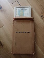 Vintage Auto Mapic Road Map of Great Britain 1950-60 with original box.
-
$9.99 GBP
 Guildford Worplesdon Compton Shalford c1920 Map London South of the Thames 7x4”
-
$95.00 GBP
 ORIGINAL VINTAGE MAP OF PALESTINE AT THE TIME OF CHRIST CIRCA 1965
-
$9.99 GBP
 Caterham Godstone Woldingham c1920 Map London South of the Thames 5x4”
-
$17.99 GBP
 Antique/Vintage Map of The Arctic Flights of the Aries - 1946
-
$3.99 GBP
 ANTIQUE 1918 LONDON STREET MAP WESTMINSTER & PICCADILLY REMOVED FROM OLD BOOK
-
$4.99 GBP
 San Francisco and Northern Peninsula Street Map - possibly 1985 or 1986
-
$14.99 GBP
 1971 GABBARD & GALLOPER BANKS to HOOK of HOLLAND Sea Chart MAP 28" x 44" C09
-
$38.00 GBP
 MAP/BATTLE PLAN MALPLAQUET AUG 31st SEPT 11TH 1709 ORANGE LOTTUM ORKNEY BRITISH
-
$12.62 GBP
 1855 Battle of Alexandria Egypt map. Antique. Napoleonic Wars. Military map.
-
$38.00 GBP
 MAP/BATTLE PLAN BRITISH NATIVE ALLIES SOOTY PATNA BUXAR BABUL NULLAH SHOLINGHUR
-
$9.99 GBP
 Limpsfield Westerham Crockham Hill c1920 Antique Map London South of Thames 5x4”
-
$15.00 GBP
 Historical Map- Hispania / Spain (44 X 32cm)
-
$15.00 GBP
 Historical Map- The Principal Battle Fields in Greek & Roman History (44 X 32cm)
-
$4.99 GBP
 Rand McNally - Central and Western United States Map - Possibly 1987
-
$9.99 GBP
 c1920 Map of Esher Cobham Stoke D’Abernon London South of the Thames 7”x4”
-
$15.00 GBP
 Historical Map- Asia Minor (44 X 32cm)
-
$3.50 GBP
 REPRODUCTION SIXTEENTH CENTURY MAP OF CANTERBURY, KENT.
-
$38.00 GBP
 MAP/BATTLE PLAN OUDENARDE JUNE 30th-JULY 11th 1708 MARLBOROUGH EUGENE
-
$9.99 GBP
 Sevenoaks Kemsing & Seal c1920 Antique Map London South of Thames 5x4”
-
$4.35 GBP
 Essex Grays Vintage 1914 Map Local Town Centre
-
$4.99 GBP
 ANTIQUE 1918 LONG LONDON STREET MAP VICTORIA PARK ACROSS TO WILLESDEN
-
$19.95 GBP
 BOER WAR ERA MAP/BATTLE PLAN- Sketch Of Sannah's Post. 1900
-
$4.28 GBP
 G9187 Canton Ticino - Svizzera - 1953 Mappa epoca - Vintage map
-
$15.00 GBP
 Historical Map- Gallia / Western Europe (44 X 32cm)
-
$7.02 GBP
 Greece Vintage 1960's Folding School Wall Geophysical Map of EUROPE N. ALIKIOTIS
-
$12.36 GBP
 Invasion of Naples 1806 by France. 1855 Antique Napoleonic Wars map. South Italy
-
$12.56 GBP
 1855 Napoleonic Wars map. Battle of Medina de Rioseco 1808. Valladolid, Spain.
-
$9.99 GBP
 Leatherhead Ashtead Chessington c1920 Antique Map London South of Thames 7x4”
-
$100.08 GBP
 Palm Beach Atlas Sheet 17-A - The Breakers Cocoanut Walk to Barton Ave Whitehall
-
$27.22 GBP
 Panama Map Chart 1996 Used 29" x 22 1/2" Nice!


