 Antiques (UK)
-
$75.00 GBP

 Guthrie 1808 Antique Map. West Indies Caribbean
-
$19.99 GBP
 1863 Jamaica Haiti Hispaniola Hand Coloured Weekly Dispatch Map
-
$239.50 GBP
 Antique Print-SAINT VINCENT-MONTSERRAT-CARIBBEAN-Nieuhof-1682
-
$60.00 GBP
 1855 Guadeloupe, Marie Galante, Antigua Large Hand Coloured Map by George Philip
-
$44.99 GBP
 BARBADOS. Vintage map. West Indies Caribbean 1910 old antique plan chart
-
$29.00 GBP
 West Indies. Antilles Caribbean Jamaica Trinidad. TIMES 1957 old vintage map
-
$9.99 GBP
 Antique map of The West Indies by F.P. Becker c.1850s
-
$4.99 GBP
 Vintage National Geographic Map - West Indies & Cent America 1970 - 96cm x 67cm
-
$12.99 GBP
 CUBA. Vintage map. Inset Puerto Rico. West Indies. Caribbean 1910 old
-
$10.99 GBP
 BRIDGETOWN. Vintage town map. Barbados. West Indies. Caribbean 1910 old
-
$120.00 GBP
 'Carte de l'Isle de la Barbade'. Barbados. West Indies. BELLIN 1759 old map
-
$125.00 GBP
 Antique "Map of the Island of St. Christopher's" (Saint Kitts and Nevis) 1794
-
$6.50 GBP
 1902 map of Mexico antique vintage Britannica 10th
-
$19.99 GBP
 1863 Central America Original Antique Hand Coloured Weekly Dispatch Map
-
$60.00 GBP
 1855 St Vincent & Barbados Large Antique Hand Coloured Map by George Philip
-
$60.00 GBP
 1855 Martinique & Dominica Large Antique Hand Coloured Map by George Philip
-
$42.00 GBP
 BARBADOS. Vintage map. West Indies Caribbean 1931 old vintage plan chart
-
$19.00 GBP
 WEST INDIES. Cuba Jamaica Haiti Domincan Republic Puerto Rico 1962 old map
-
$33.99 GBP
 JAMAICA. Vintage map. West Indies. Caribbean 1910 old antique plan chart
-
$120.00 GBP
 1869 Admiralty Sea Chart Map 1930s Edition West Indies Barbados
-
$49.00 GBP
 VINTAGE ADMIRALTY CHART. No.867. The NARROWS, GRASSY BANK, BERMUDA. 1949 Edn.
-
$34.00 GBP
 Nautical Chart No. 2267 Caribbean Sea - Ports on the North Coast of Columbia
-
$50.00 GBP
 BARBADOS. Vintage map. West Indies Caribbean 1923 old vintage plan chart
-
$19.99 GBP
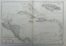
 1884 West Indies & Central America Hand Coloured Antique Map by Johnston
-
$20.99 GBP
 Jamaica, Kingston - an old - vintage map by Michael Hay, 1738
-
$24.95 GBP
 1842 ORIGINAL ANTIQUE MAP WEST INDIES & SW UNITED STATES -JOHN ARROWSMITH LONDON
-
$7.00 GBP
 Shell Oil - 1963 - Foldable Highway Road Map of Mexico and Central America
-
$18.00 GBP
 Vintage Bermuda Islands pocket map
-
$24.99 GBP
 1860 West Indies & Central America Hand Coloured Antique Map by Blackie
-
$19.99 GBP
 1863 Central America Colombia Venezuela Hand Coloured Weekly Dispatch Map
-
$162.19 GBP
 México de Bry Theodore
-
$19.99 GBP
 1895 West Indies Original Antique Map 125 Years Old
-
$8.00 GBP
 WEST INDIES.Cuba Puerto Rico Hispaniola Virgin Islands St Croix Haiti 1920 map
-
$170.00 GBP
 BRITISH WEST INDIES. Jamaica Antilles Virgin Cayman Islands. SDUK 1844 old map
-
$10.00 GBP
 1880s Antique Map of ENVIRONS MANCHESTER Bacon Atlas of the British Isles
-
$100.00 GBP
 West Indies antique map c 1887 Edward Stanford political detailed wall decor
-
$24.78 GBP
 1912 ANTIQUE MAP OF WEST INDIES CARIBBEAN PUERTO RICA JAMAICA BERMUDA CUBA
-
$90.00 GBP
 Nautical Chart "Guadeloupe to Trinidad" (Southern Caribbean) U.K. Admiralty 1947
-
$156.10 GBP
 1816 John Thomson Large Antique Map Grenada, Tobago, Curacao Trinidad Caribbean
-
$19.99 GBP
 1902 West Indies & Central America Original Antique Map by G.W. Bacon
-
$170.00 GBP
 Am�r. Sep. Ile de Cuba #67. Cuba & Jamaica Cayman Islands. VANDERMAELEN 1827 map
-
$7.99 GBP
 BRITISH WEST INDIES. Showing British Islands/colonies. Caribbean 1910 old map
-
$80.00 GBP
 'Carte de l'Isle de la Grenade'. Grenada. West Indies. BELLIN 1759 old map
-
$19.99 GBP
 1902 Cuba & Jamaica Original Antique Map by G.W. Bacon
-
$49.00 GBP
 ANTIQUE ADMIRALTY CHART. No.1931. GOLFO de NICUYA, COSTA RICA. 1911 Edition.
-
$60.00 GBP
 Antique Map "Grenada To Britain" George & Son Philip, 1851.
-
$18.00 GBP
 ADMIRALTY SEA CHART Approaches To Barbados West Indies Sea Chart No. 2485 1980
-
$150.00 GBP
 Map "Carte des Iles-Antilles ou Indes Occidentales" (Caribbean) Brué, 1827
-
$20.00 GBP
 1880s Antique Map of ENVIRONS EDINBURGH Bacon Atlas of the British Isles
-
$49.00 GBP
 VINTAGE ADMIRALTY CHART. No.587. BURICA POINT to MANGROVE BLUFF. 1914 Edn
-
$175.00 GBP
 Map "A Plan of the Siege of the Havana drawn by an Officer on the Spot, 1762"
-
$10.21 GBP
 Sunken Buried Treasure Shipwreck Map Pirates Captain Kidd Blackbeard Calico Jack
-
$60.00 GBP
 Nautical Chart "Plans in Aruba, Bonaire and Curaçao Islands" U.K. Admiralty 1947
-
$115.00 GBP
 Antique Map "Central America" John Tallis, 1851
-
$13.00 GBP
 Main currents of the American Mediterranean.Caribbean/Gulf of Mexico 1885 map
-
$170.00 GBP
 BRITISH WEST INDIES Jamaica Trindad Antilles Virgin Cayman Islands SDUK 1844 map
-
$59.00 GBP
 VINTAGE ADMIRALTY CHART. No. 697. DOMINICA. WEST INDIES. 1914. Edition.
-
$19.99 GBP
 1903 large colour fold out map titled " jamaica & the lesser antilles "
-
$18.00 GBP
 Vintage Map of ‘Costa Rica’ 1960s - Framed & Mounted
-
$300.00 GBP
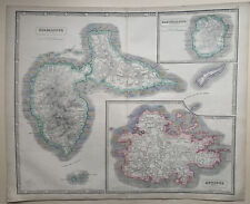
 'Map of the Island Antigua', by Bryan EDWARDS. West Indies. Caribbean 1794
-
$12.00 GBP
 HAVANA. Vintage town plan. Railways & streetcar lines. Cuba. Caribbean 1923 map
-
$25.95 GBP
 1900 Johnston Atlas Colour Map West India Islands Central America Caribbean Cuba
-
$30.45 GBP
 West Indies & Central America 1860 Map engraved by Johnston outline colour
-
$60.00 GBP
 Windward or South Caribbean Islands. Barbados St. Lucia Trinidad. LOWRY 1860 map
-
$30.00 GBP
 West Indies 1796 engraved map - real bargain!
-
$30.00 GBP
 St. VINCENT & THE GRENADINES, WEST INDIES, 1908 ADMIRALTY SEA CHART. No. 791
-
$17.99 GBP
 PORT OF SPAIN. Vintage map. Trinidad. West Indies. Caribbean 1910 old
-
$6.99 GBP
 WEST INDIES & PHILIPPINES During the Spanish American War Antique Map 1912
-
$21.99 GBP
 WEST INDIES. Dominica St Kitts Antigua St Lucia Montserrat 1910 old map
-
$70.00 GBP
 Antique Map "Isthmus of Panama" John Tallis, 1851
-
$36.49 GBP
 Mitchell Antique Hand Color Map Cuba Havana Bahama Cayman Caribbean 1880 Havanna
-
$90.00 GBP
 Antique Map "Carta dell'isola di S. Cristoforo" (St Kitts Island) Bellin, 1770
-
$160.00 GBP
 Grand Bahama & Great Abaco Islands. Bahamas. ADMIRALTY sea chart 1886 (1968) map
-
$15.33 GBP
 1908 ANTIQUE MAP OF WEST INDIES CARIBBEAN ANTILLES PUERTO RICO JAMAICA / GUYANA
-
$6.00 GBP
 PANAMA CANAL. Vintage map. Railway. Shows canal zone. Caribbean 1931 old
-
$13.00 GBP
 BRIDGETOWN. Vintage town map. Barbados. West Indies. Caribbean 1931 old
-
$7.99 GBP
 Antique Map 1906 - Mexico, Central America With British Honduras - Harmsworth
-
$35.00 GBP
 Jamaica, antique Tallis map with vignettes C. 1855
-
$54.00 GBP
 GRENADINES. Grenada & St Vincent. Also Tobago. West Indies vintage map 1910
-
$25.00 GBP
 BERMUDA ISLANDS, GRASSY BAY, IRELAND ISLAND, 1888 ADMIRALTY SEA CHART. No.1074
-
$325.00 GBP
 'A Map of the Island of Barbadoes', by Bryan EDWARDS. BARBADOS. West Indies 1794
-
$35.00 GBP
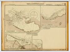 VINTAGE ADMIRALTY CHART. No. 451. Plans in NORTH WEST JAMAICA. 1933 Edition.
-
$6.50 GBP
 ADMIRALTY SEA CHART. # 371. WEST INDIES. NORTHERN MARTINIQUE. 1991.
-
$260.00 GBP
 Antique Map "Carta della Jamaica" Anonymous, c. 1770
-
$425.00 GBP
 Map "Carte Reduite de L'Isle de La Jamaique aux Vaisseaux du Roy" Bellin, 1753
-
$125.00 GBP
 ANTIQUE ADMIRALTY CHART. No.657, PANAMA CANAL and APPROACHES, 1915 Edition.
-
$14.99 GBP
 GUATEMALA & PANAMA, CENTRAL AMERICA - 1856 Antique Map by SWANSTON
-
$25.00 GBP
 1920 MAP OF WEST INDIES Jamaica Cuba Panama Canal Haiti Plate 96 Times Atlas
-
$11.99 GBP
 MEXICO - Inset of Area between Mexico and Vera Cruz - Antique Stieler Map 1891
-
$11.99 GBP
 CARIBBEAN, CUBA JAMAICA PUERTO RICO etc Area Plan - 1909 Mounted Antique Map
-
$9.99 GBP
 CENTRAL AMERICA and WEST INDIES - Antique Map 1899 From The Times Atlas
-
$9.00 GBP
 HAVANA. Vintage town plan. Railways & streetcar lines. Cuba. Caribbean 1935 map
-
$38.00 GBP
 DOMINICA & ST LUCIA. Vintage map. West Indies Caribbean 1935 old vintage
-
$10.00 GBP
 1880s Antique Map of ENVIRONS CORK Bacon Atlas of the British Isles LARGE MAP
-
$5.99 GBP
 Nautical Charts Anguilla Sombrero Island BA 2047 + Admiralty letter
-
$17.00 GBP
 Vintage Map of Cuba And Jamaica - 1960's - Framed & Mounted
-
$15.95 GBP
 Nautical Chart Water Depth Map Seacore And Other Papers
-
$45.00 GBP
 VINTAGE ADMIRALTY CHART. No.697. DOMINICA. 1914 Edition.
-
$19.99 GBP
 1897 West Indies Original Antique Map by A & C Black
-
$19.99 GBP
 1893 Cuba, Jamaica & The Lesser Antilles Antique Map by G.W. Bacon


