 Antiques (UK)
Africa Maps
Asia Maps
Australia/Oceania Maps
Celestial Maps
Central America/Caribbean Maps
Curiosities Maps
Digital Maps
Europe Maps
Map & Globe Mixed Lots
Map & Globe Reproductions
North America Maps
South America Maps
World & Celestial Globes
World Maps

-
$132.10 GBP

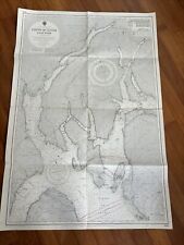
 1801 Gustaf Klint Large Map Sea Chart Celtic Sea Ireland to Bristol, Cornwall et
-
$275.00 GBP
 1967 SINGAPORE harbour ship captain's sounding map/chart 107cm x 76cm large size
-
$24.99 GBP
 1860 North Polar Regions Hand Coloured Antique Map by Blackie
-
$39.00 GBP
 VINTAGE ADMIRALTY CHART. No.760. MADAGASCAR. 1933 Edition
-
$7.99 GBP
 Vintage Admiralty Charts 1960s-1980’s
-
$7.50 GBP
 100's of Admiralty Charts (the pVintage Admiralty and other Charts 1940's-2010's
-
$9.99 GBP
 Vintage Admiralty Nautical Navigation Sea Chart Dover Harbour No. 1698 (1952)
-
$9.95 GBP
 PORTSMOUTH HARBOUR, GOSPORT, PORTSEA Hampshire - Rare Vintage WW2 Naval Map 1943
-
$19.99 GBP
 Admiralty Fathom Chart (Firth of Clyde - Loch Fyne) No 2131
-
$19.99 GBP
 Vintage Admiralty Nautical Navigation Chart Scotland Firth Clyde & Approaches
-
$24.99 GBP
 Vintage Admiralty Nautical Navigation Chart Loch Crinan Forth Lorne No:2326 1966
-
$3.25 GBP
 VINTAGE SEA CHART / NAUTICAL MAP 1961 - The Wash - To Frame?
-
$29.00 GBP
 VINTAGE ADMIRALTY CHART. No. 3662. LITTLE ADEN HARBOUR. 1957 Edition.
-
$55.00 GBP
 ANTIQUE ADMIRALTY CHART. No. 1167, BURRY INLET, WALES. 1887 Edition.
-
$220.00 GBP
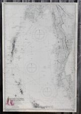 1967 ANDAMAN Nicobar Islands INDIA ship captain's LARGE sounding chart 103x70cm
-
$40.00 GBP
 MALDIVE ISLANDS, Sheet 1, INDIAN OCEAN, 1918 BRITISH ADMIRALTY SEA CHART. No.66a
-
$10.00 GBP
 Admiralty Chart 871 - Rivers Tamar, Lynher & Tavy
-
$10.00 GBP
 Vintage Admiralty Chart 3750 England - River Crouch 1957 Edition
-
$19.99 GBP
 1956 Antique Map; Admiralty Chart # 1907, Cloch Point to Little Cumbrae, Striven
-
$19.99 GBP
 Admiralty Fathom Chart (Firth of Clyde - Loch Fyne) No 2159
-
$3.25 GBP
 VINTAGE SEA CHART / NAUTICAL MAP 1961 - TORQUAY & BRIXHAM Harbours - To Frame?
-
$12.50 GBP
 Vintage Admiralty Chart 1426 Loch Linnhe - North Part, 1918 edn Updated 1968
-
$10.00 GBP
 Vintage Admiralty Chart 2007 Scotland - River Clyde 1979 Edition
-
$20.00 GBP
 Admiralty Fathom Chart (Firth of Clyde - Loch Fyne) No 2131
-
$35.00 GBP
 VINTAGE ADMIRALTY CHART. No.3517. PLANS in the PERSIAN GULF. 1977 Edition.
-
$13.95 GBP
 ADMIRALTY SEA CHART. No. 2207 POINT OF ARDNAMURCHAN TO SOUND OF SLEAT 2008
-
$3.95 GBP
 GOREY, JERSEY, Channel Islands - Rare Vintage naval WW2 map 1943
-
$9.99 GBP
 Vintage Admiralty Nautical Chart Sheerness and Approaches No. 3683 (1954)
-
$49.00 GBP
 VINTAGE ADMIRALTY CHART. No. 758. MADAGASCAR, NORTHERN PORTION. 1873 Edition.
-
$49.00 GBP
 VINTAGE ADMIRALTY CHART. No.2249. RIVER DART. 1943 Edition.
-
$49.00 GBP
 VINTAGE ADMIRALTY CHART. No.1001. DAKAR, SENEGAL. 1940 Edition.
-
$19.99 GBP
 1856 Abyssinia Hand Coloured Antique Map by G.H. Swanston & Augustus Petermann
-
$10.00 GBP
 Vintage Admiralty Chart 44 Ireland, Dundalk Bay Area, 1883 Edition Updated 1969
-
$24.99 GBP
 Vintage Admiralty Nautical Navigation Chart Scotland West Coast Sleat Sound
-
$10.00 GBP
 Vintage Admiralty Chart 2450, Portland to Owers 1922 Edition Updated 1942
-
$10.00 GBP
 Vintage Admiralty Chart 1826 Burrow Head To Liverpool, 1953 Edition Updated 1973
-
$3.25 GBP
 VINTAGE SEA CHART / NAUTICAL MAP 1961 Ireland - Westport Bay - To Frame?
-
$24.99 GBP
 Vintage Admiralty Nautical Navigation Chart Scotland West Coast Sound & Mull
-
$49.00 GBP
 ANTIQUE ADMIRALTY CHART. No.1413. HOLYHEAD BAY, WALES. 1892 Edition.
-
$49.00 GBP
 CARIMATA STRAIT. BORNEO. ADMIRALTY SEA CHART. No.2160. 1919. Edition.
-
$29.99 GBP
 Vintage Admiralty Chart ~ Scotland ~ Orkney Islands ~ Southern Sheet ~ 2179
-
$19.99 GBP
 1958 Antique Map; Admiralty Chart # 2164 Firth Of Clyde To Large Channel
-
$24.99 GBP
 Vintage Admiralty Nautical Navigation Chart Scotland Firth Of Lorne No:2476
-
$24.99 GBP
 Vintage Admiralty Nautical Navigation Chart Scotland Firth Clyde Western Approac
-
$9.99 GBP
 Vintage Admiralty Sea Chart The Solent Nab Tower To Spithead No.L(D5)2050 (1955)
-
$20.00 GBP
 Admiralty Fathom Chart (River Medway - Stangate to Rochester) No 1834
-
$3.25 GBP
 VINTAGE SEA CHART / NAUTICAL MAP 1961 - Holland - Flushing Breskens Groningen
-
$3.25 GBP
 VINTAGE SEA CHART / NAUTICAL MAP 1961 - Mersea Quarters- To Frame?
-
$3.25 GBP
 VINTAGE SEA CHART / NAUTICAL MAP 1961 - Salcombe - To Frame?
-
$7.99 GBP
 Antique Map Shipping Map United States Atlantic Coast Canada Lakes Dated 1951
-
$3.25 GBP
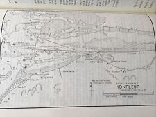 VINTAGE SEA CHART / NAUTICAL MAP 1961 - Honfleur
-
$3.25 GBP
 VINTAGE SEA CHART / NAUTICAL MAP 1961 - River Dart - Devon - To Frame?
-
$45.00 GBP
 VINTAGE ADMIRALTY CHART. No.990. OKINAWA SHIMA. NAHA KO. JAPAN. 1897 Edition.
-
$3.35 GBP
 BAIE DE LAMPAUL, France D-Day Planning - Rare Vintage WW2 Map 1943
-
$3.25 GBP
 VINTAGE SEA CHART / NAUTICAL MAP 1961 - Holland - Delfzul, Langeoog, Ijmuiden
-
$9.99 GBP
 Vintage Admiralty Nautical Sea Chart The Downs South East No. L(D5) 1828 (1958)
-
$4.95 GBP
 RIVER BLACKWATER, Bradwell Quay, Essex WW2 Naval Map 1943, topology
-
$3.25 GBP
 VINTAGE SEA CHART / NAUTICAL MAP 1961 - Hamble River - To Frame?
-
$49.00 GBP
 VINTAGE ADMIRALTY CHART. No.8e. RED SEA, IN FIVE SHEETS - 5. 1917 Edition.
-
$3.25 GBP
 VINTAGE SEA CHART / NAUTICAL MAP 1961 Ireland - Teelin & Killybegs Harbours
-
$3.25 GBP
 VINTAGE SEA CHART / NAUTICAL MAP 1961 Milford Haven X 4 Charts
-
$49.00 GBP
 VINTAGE ADMIRALTY CHART. No.883. SCILLY ISLES, St MARY'S, CROW SOUND. 1900 Edn.
-
$3.39 GBP
 MINEHEAD, Somerset - Detailed vintage WW2 Map 1943
-
$3.25 GBP
 VINTAGE SEA CHART / NAUTICAL MAP 1961 - Lowestoft Harbour & Great Yarmouth Haven
-
$49.00 GBP
 VINTAGE ADMIRALTY CHART. No.1160. BARNSTABLE to BIDEFORD. ILFRACOMBE. 1860 Edn.
-
$3.25 GBP
 VINTAGE SEA CHART / NAUTICAL MAP 1961 - Rivers ALDE & ORE - To Frame?
-
$3.25 GBP
 VINTAGE SEA CHART / NAUTICAL MAP 1961 - YEALM RIVER - To Frame?
-
$29.99 GBP
 Vintage Admiralty Chart ~ Scotland ~ Orkney Islands ~ Northern Sheet ~ 2180
-
$3.25 GBP
 VINTAGE SEA CHART / NAUTICAL MAP 1961 - COWES & River Medina - To Frame?
-
$7.50 GBP
 BUDE, Cornwall, rare WW2 Naval Map 1943
-
$14.99 GBP
 ADMIRALTY SEA CHART. No. 1827. HARBOURS on the SOUTH-EAST COAST of ENGLAND. 1987
-
$45.00 GBP
 Vintage Admiralty Chart 1446 SCOTLAND - ABERDEEN HARBOUR
-
$3.25 GBP
 VINTAGE SEA CHART / NAUTICAL MAP 1961 - Newhaven & Littlehampton - To Frame?
-
$49.00 GBP
 ANTIQUE ADMIRALTY CHART. No.2682. BRISTOL CHANNEL. 1920 Edition.
-
$7.50 GBP
 BRIGHTLINGSEA HARBOUR, Essex WW2 Naval Map 1943 (inc. Railways)
-
$49.00 GBP
 VINTAGE ADMIRALTY CHART. No.1826. BURROW HEAD to LIVERPOOL . 1953 Edition.
-
$2.99 GBP
 VINTAGE SEA CHART / NAUTICAL MAP 1961 - Ireland - Kinsale - To Frame?
-
$125.00 GBP
 1693 Greenvile Collins Sea Chart Lands End Cornwall Scilly Islands Antique Map
-
$3.25 GBP
 VINTAGE SEA CHART / NAUTICAL MAP 1961 - Bembridge - To Frame?
-
$49.00 GBP
 VINTAGE ADMIRALTY CHART. No.2167. CROMARTY FIRTH. 1921 Edition.
-
$3.25 GBP
 VINTAGE SEA CHART / NAUTICAL MAP 1961 - Poole / Brownsea Island - To Frame?
-
$49.00 GBP
 VINTAGE ADMIRALTY CHART. No.3124. YAQUINA RIVER to CAPE DISAPPOINTMENT 1900 Edn.
-
$19.99 GBP
 1955 Antique Map; Admiralty Chart 2649 English Channel Western Portion
-
$3.45 GBP
 TREPORT, France D-Day Planning - Rare Vintage WW2 Overlord Map 1943
-
$59.00 GBP
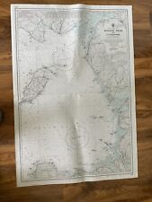
 VINTAGE ADMIRALTY CHART. No.2060B. NORTH ATLANTIC OCEAN, WESTERN. 1923 Edition.
-
$3.25 GBP
 VINTAGE SEA CHART / NAUTICAL MAP 1961 - Swansea & Barry - To Frame?
-
$12.50 GBP
 ADMIRALTY SEA CHART. BARRY & CARDIFF ROADS.No. 1182. SOUTH WALES. 1974-2012
-
$16.00 GBP
 OLD ANTIQUE MAP SEA CHART STRAITS OF GIBRALTAR c1900 by MCLURE
-
$45.00 GBP
 VINTAGE ADMIRALTY CHART. No. 2676. LOCH ALSH and LOCH DUICH. 1905 Edition.
-
$49.00 GBP
 VINTAGE ADMIRALTY CHART. No.1947. ADMIRALTY INLET to PUGET SOUND. 1954 Edn.
-
$12.00 GBP
 ADMIRALTY SHIPPING CHART ROUTEING NORTH ATLANTIC OCEAN 5124 (9) SHIPPING MAP
-
$3.75 GBP
 Coast around LITTLEHAMPTON, Sussex - Rare Vintage WW2 Naval Map 1943 topology
-
$49.00 GBP
 VINTAGE ADMIRALTY CHART. No.3122. CALIFORNIA & OREGON Coastline. 1900 Edn.
-
$49.00 GBP
 VINTAGE ADMIRALTY CHART. No.1415. DUBLIN BAY, IRELAND. 1912 Edition.
-
$8.99 GBP
 Vintage admiralty marine sea chart 1137 approaches to St Helier Jersey yachting
-
$9.99 GBP
 Vintage Marine chart sheet map of English Chanel French coast English coast
-
$3.45 GBP
 TORQUAY, Devon - Rare vintage nautical WW2 Map 1943 (topology)
-
$3.25 GBP
 VINTAGE SEA CHART / NAUTICAL MAP 1961 - TEIGNMOUTH - To Frame?
-
$49.00 GBP
 VINTAGE ADMIRALTY CHART. No.599. CAPE VERDE, R. GAMBIA, WEST AFRICA, 1916 Edn
-
$16.95 GBP
 Vintage Admiralty Chart Noordzeekaal Netherlands No.124.


