 Antiques (UK)
Africa Maps
Asia Maps
Australia/Oceania Maps
Celestial Maps
Central America/Caribbean Maps
Curiosities Maps
Digital Maps
Europe Maps
Map & Globe Mixed Lots
Map & Globe Reproductions
North America Maps
South America Maps
World & Celestial Globes
World Maps

-
$100.00 GBP

 Australian States Original 1873 Map Folio (6) Chapman And Hall +New Zealand
-
$195.00 GBP
 Original Antique Map Engraving of COUNTY OF SUSSEX, 1828, C & J Greenwood, Large
-
$5.00 GBP
 1902 Map of Northumberland Durham Isle of Man antique vintage Britannica 10th
-
$38.43 GBP
 1912 Carolingian Empire Map EUROPE France Burgundy Germany Austria Medieval
-
$6.00 GBP
 1909 map street plan of St Augustine Florida USA antique vintage Baedeker
-
$9.00 GBP
 1909 Map of London West End from Hyde Park and Belgravia to the Thames vintage
-
$19.99 GBP
 Ubersichtskarte von Mitteleuropa: K51 Koln 1926 Linen Backed Folding Map / VGC
-
$8.99 GBP
 1903 Plan of Glasgow City Map John Bartholemew Scotland 121 years old
-
$6.50 GBP
 1902 Map of Scotland Central Part antique vintage Britannica 10th
-
$6.50 GBP
 1902 Map of Australia antique vintage Britannica 10th
-
$6.50 GBP
 County map of Argyll and Bute Scotland c1900 vintage antique
-
$30.00 GBP
 1882 Map of the Shaktu Valley Punjab Waziristan Pakistan antique vintage
-
$9.00 GBP
 1909 Map of London West End from Baker Street to Soho vintage antique Baedeker
-
$46.44 GBP
 PHILIPPINES SOUTHEAST ASIA 1956 MAP Original Borneo Manila Celebes Sumatra
-
$95.00 GBP
 Framed Map Descriptive of London Poverty North Western District 1898-9
-
$52.00 GBP
 WINCARNIS MOTOR & CYCLIST MAP x13, c1920’s J Bartholomew, a BARGAIN at £4.00/ea
-
$5.00 GBP
 1909 map street plan of Salt Lake City Utah USA antique vintage Baedeker
-
$19.99 GBP
 Admiralty Fathom Chart (Firth of Clyde - Loch Fyne) No 2159
-
$6.50 GBP
 County map of Sutherland Scotland c1900 vintage antique
-
$10.00 GBP
 1909 Map of area around London vintage antique street plan Baedeker
-
$15.00 GBP
 1882 Map of the southern part of Lake Tanganyika Africa antique vintage
-
$14.42 GBP
 1897 Durham large antique map. 128 years old. Sunderland, Hartlepool.
-
$6.50 GBP
 1902 Map of Oxford Essex Sussex Surrey antique vintage Britannica 10th
-
$11.33 GBP
 1895 Berkshire antique map. Newbury, Reading, Windsor. 129 years old. Victorian.
-
$6.50 GBP
 County map of Ross and Cromarty Scotland c1900 vintage antique
-
$6.50 GBP
 1902 Map of Cornwall Devon Dorset Channel Island antique vintage Britannica 10th
-
$25.00 GBP
 1882 Map of Lake Tanganyika Tanzania Congo Zambia Burundi Africa antique vintage
-
$20.00 GBP
 A framed map of London c1904
-
$45.63 GBP
 ITALY Map 1875 ORIGINAL Large Steamship Routes Railways Telegraph Lines
-
$43.14 GBP
 1899 India Map ORIGINAL Southern Sri Lanka Ceylon RAILROADS STEAMSHIPS Bombay
-
$39.13 GBP
 1899 Denmark Map ORIGINAL Copenhagen Iceland Odense STEAMSHIPS RAILWAYS
-
$45.63 GBP
 OLD 1889 KANSAS Map ORIGINAL Dodge City Topeka Railways Counties Townships
-
$7.00 GBP
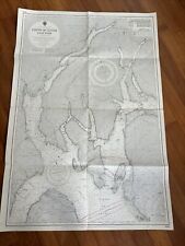
 1987 Nautical Navigation Chart: Ports And Harbours On The East Coast of Scotland
-
$20.00 GBP
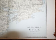 1880s Antique Map of ENVIRONS CORK Bacon Atlas of the British Isles LARGE MAP
-
$5.00 GBP
 1979 Nautical Navigation Chart: Southern Approach To North Channel (N. Ireland)
-
$124.97 GBP
 Antique John Ogilby LONDON TO BARWICK ROAD MAP framed 18th century tinted print
-
$19.99 GBP
 Admiralty Fathom Chart (Firth of Clyde - Loch Fyne) No 2131
-
$80.05 GBP
 1895 SINGAPORE CITY STREETS PLAN Antique Map
-
$46.34 GBP
 1899 London ENGLAND Map ORIGINAL River Thames Ipswich RAILROADS Battlefields
-
$43.94 GBP
 1878 Blackfoot Basin Idaho Map Soda Springs Georgetown Bear River EXPLORATION
-
$10.00 GBP
 1902 Map of London and Vicinity antique vintage Britannica 10th
-
$14.42 GBP
 1897 Hampshire South large antique map. 127 years old. Isle of Wight, Portsmouth
-
$14.95 GBP
 1898 Brecon (Brecknock), Radnor & Herefordshire large map. 125 yrs old. Hereford
-
$6.00 GBP
 3 antique maps of Wales in original colour by William Hughes pub c 1868
-
$8.99 GBP
 1903 The Trossachs Map John Bartholemew Scotland 121 years old Loch Lomond
-
$6.50 GBP
 1902 Map of India Southern Part Sri Lanka antique vintage Britannica 10th
-
$19.99 GBP
 1956 Antique Map; Admiralty Chart # 1907, Cloch Point to Little Cumbrae, Striven
-
$9.00 GBP
 1909 Map of London The City from St Paul's to the Tower vintage antique Baedeker
-
$10.00 GBP
 4 antique maps of UK Islands in original colour by William Hughes pub c. 1868
-
$25.00 GBP
 1861 EGYPT Lower NUBIA Keith Johnston Royal Atlas 24 by 19 inches Large
-
$14.99 GBP
 MAP OF KENT CIRCA 1700'S 48 x 36cm 1970'S REPRODUCTION
-
$13.39 GBP
 1896 Skye, Harris & Ross-shire map. Victorian Scottish print. Portree Lochcarron
-
$280.21 GBP
 PERSIAN SHAH QAJAR PERIOD EDWARD STANFORD MAP VERY RARE
-
$20.00 GBP
 Admiralty Fathom Chart (Firth of Clyde - Loch Fyne) No 2131
-
$6.50 GBP
 1902 Map of Africa Central Part antique vintage Britannica 10th
-
$9.00 GBP
 1909 Map of London Holborn Fleet Street Strand vintage antique Baedeker
-
$6.50 GBP
 County map of Inverness Scotland c1900 vintage antique
-
$6.50 GBP
 1902 Map of Ireland antique vintage Britannica 10th
-
$15.00 GBP
 1909 Map of North London vintage antique street plan Baedeker
-
$6.50 GBP
 1902 map of the West Indies Caribbean antique vintage Britannica 10th
-
$15.00 GBP
 1909 Railway Trams Underground Map of London vintage antique plan Baedeker
-
$7.95 GBP
 1922 Map The Times Atlas Bartholomew SOUTHERN RUSSIA Plate 46
-
$6.50 GBP
 1902 Map of Europe antique vintage Britannica 10th
-
$15.00 GBP
 Antique Map of AFRICA by V Molin, 1843
-
$8.99 GBP
 1903 The Land of Burns Map John Bartholemew Scotland 121 year old Ayr Kilmarnock
-
$25.00 GBP
 Antique Map LONDON & Vicinity, Benjamin Smith Original 1902
-
$12.89 GBP
 Antique 1901 Oxfordshire large map. 120 years old. Oxford, Banbury.
-
$65.00 GBP
 Large Antique map of Dublin No 2 printed by Headley Brothers, Kent Harry Margary
-
$169.99 GBP
 Kerry Lee Cambridge Pictorial Poster Map Framed Lithograph Mid Century Rare
-
$6.50 GBP
 County map of the Orkney Islands Scotland c1900 vintage antique
-
$13.12 GBP
 1895 Leeds city map. Victorian print. For Framing. River Aire Holbeck. Yorkshire
-
$13.99 GBP
 Antique Print Map Of Switzerland & The Passes Of The Alps Dated C1870's Europe
-
$6.50 GBP
 County map of Elgin and Nairn Scotland c1900 vintage antique
-
$5.00 GBP
 1909 map street plan of Minneapolis Minnesota USA antique vintage Baedeker
-
$14.99 GBP
 1897 Antique Map; Plymouth, Stonehouse & Devonport
-
$20.00 GBP
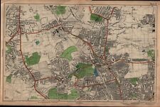 Finchley, Muswell Hill - London map 100 years ago
-
$34.00 GBP
 Saxton Map of C16th Norfolk. Framed Vintage Reproduction
-
$13.12 GBP
 1895 Hertfordshire county map. Victorian. Hertford, Stevenage, St Albans.
-
$6.50 GBP
 County map of Renfrew Scotland c1900 vintage antique
-
$5.00 GBP
 1909 map street plan of St Paul Minnesota USA antique vintage Baedeker
-
$20.00 GBP
 1882 Map of part of the Bolivian Table land antique vintage
-
$15.95 GBP
 Original Vintage LONDON PICTORIAL MAP - Geographers' Map Co. Ltd. - Folded Paper
-
$5.00 GBP
 1909 map of St Mary's River Michigan Ontario antique vintage Baedeker
-
$15.45 GBP
 1843 LINCOLNSHIRE antique map by A Fullarton. 180 years old. Boston, Grantham.
-
$9.95 GBP
 Map 1935: Soviet Union European Territory, Poland East Prussia Lithuania #17/2
-
$13.99 GBP
 Antique Map England & Wales C1870's Map Of UK Europe World Atlas
-
$35.00 GBP
 Yorkshire North Riding, decorative map, 1850, genuine antique by Thomas Moule
-
$7.50 GBP
 Map 1935: China Japan & Korea Print Maps Original Vintage #31
-
$19.95 GBP
 Map of Palaestina Palestine. Vintage Original Colour Print PHA 1872 Phillips
-
$20.00 GBP
 1880s Antique Map of ENVIRONS MANCHESTER Bacon Atlas of the British Isles
-
$4.95 GBP
 Map 1913: The World On Mercator’s Projection Vintage Antique Original #1
-
$4.95 GBP
 Map 1913: British Isles Showing Railways Europe Vintage Antique #2 3
-
$4.95 GBP
 Map 1913: British Isles Showing Railways England & Wales Vintage Antique #4 5
-
$4.95 GBP
 Map 1913: Africa West Africa Central Africa South Africa Vintage Antique 22/23
-
$11.95 GBP
 Map Of Holland & Belgium Netherlands Print Antique Political 1905 #10
-
$25.00 GBP
 1861 EUROPEAN RUSSIA Keith Johnston Royal Atlas 24 by 19 inches Large
-
$13.99 GBP
 Antique Print Map Of The Roman Empire History C1870's Map Of Europe In A.D 117
-
$7.99 GBP
 Torquay Devon Vintage Map 1946 New Popular Edition Ordnance Survey Sheet 88
-
$38.43 GBP
 1898 SPAIN PORTUGAL Map Europe Barcelona Lisbon Madrid Porto Seville ORIGINAL
-
$38.33 GBP
 1899 Northeast Africa Map ORIGINAL Somalia Egypt Tripoli STEAMSHIP RAILWAYS


