 Antiques (UK)
Africa Maps
Asia Maps
Australia/Oceania Maps
Celestial Maps
Central America/Caribbean Maps
Curiosities Maps
Digital Maps
Europe Maps
Map & Globe Mixed Lots
Map & Globe Reproductions
North America Maps
South America Maps
World & Celestial Globes
World Maps

-
$29.99 GBP

 1828 Lower Saxony by Daniel Lizars Large Hand Coloured Antique Map
-
$29.99 GBP
 1828 North Scotland by Daniel Lizars Large Hand Coloured Antique Map
-
$29.99 GBP
 1828 Egypt by Daniel Lizars Large Hand Coloured Antique Map
-
$39.99 GBP
 1828 Spain & Portugal by Daniel Lizars Large Hand Coloured Antique Map
-
$9.00 GBP
 County map of Hertfordshire England hand coloured c1860
-
$18.50 GBP
 ROYSTON, HUNTINGDON, STILTON, STAMFORD, original antique road map, Bowen, 1720
-
$20.00 GBP
 Devonshire, 1784 county map, genuine antique 240 years old!
-
$29.95 GBP
 1720 ANTIQUE COPPER ENGRAVED WARD MAP COW CROSS LONDON - STRYPE / STOW
-
$20.00 GBP
 Hampshire, 1784 county map, genuine antique 240 years old!
-
$31.01 GBP
 Sussex map by John Aikin 1803 England Delineated Original with text
-
$81.69 GBP
 Eclipse of the Sun through a telescope Original engraved Mallet 1683 map
-
$81.69 GBP
 Thunderstorm lightning Ships Celestial original engraved Mallet map c1683
-
$81.69 GBP
 Ships on Stormy Sea original 17th century engraved print 1683 Alain Mallet
-
$149.00 GBP
 Cook Carte Nle Galles Meridle Tribulation Endeavour 1774
-
$50.00 GBP
 1831 Atlantic Ocean Daniel Lizars Large Hand Coloured Original Antique Map
-
$39.99 GBP
 1828 Atlantic Ocean Sea Chart by Daniel Lizars Large Hand Coloured Antique Map
-
$81.69 GBP
 View Globe 17th century print by original engraved c1683 alain mallet
-
$9.00 GBP
 County map of Shropshire England hand coloured c1860
-
$48.00 GBP
 POLAND, LITHUANIA, John Senex original antique map 1749
-
$9.00 GBP
 County map of Durham England hand coloured c1860
-
$9.00 GBP
 County map of Essex England hand coloured c1860
-
$30.00 GBP
 Original antique genuine Owen & Bowen road strip map through Peterborough 1720
-
$9.00 GBP
 County map of Sussex England hand coloured c1860
-
$84.71 GBP
 Indonesia map Buton Island c1778 Old Map Carte du Detroit de Bouton
-
$85.72 GBP
 Galleon Ancient ship original 17th century engraved c1683 Alain Mallet
-
$92.73 GBP
 Planisphere Du Monde and map of France 1683 Original copperplate Alain Mallet
-
$9.00 GBP
 County map of West Riding Yorkshire England hand coloured c1860
-
$18.50 GBP
 YORKSHIRE, DURHAM, DARLINGTON, NEWCASTLE, original antique road map, Bowen, 1720
-
$49.99 GBP
 1828 Hungary by Daniel Lizars Large Hand Coloured Antique Map
-
$79.99 GBP
 1828 Russian Empire by Daniel Lizars Large Hand Coloured Antique Map
-
$81.25 GBP
 1807 Manchester & Salford City Plan Original Antique Map by Cole & Roper
-
$39.99 GBP
 1828 Holland by Daniel Lizars Large Hand Coloured Antique Map
-
$9.00 GBP
 County map of Suffolk England hand coloured c1860
-
$9.00 GBP
 County map of Westmoreland England hand coloured c1860
-
$29.99 GBP
 1828 Chile & La Plata by Daniel Lizars Large Hand Coloured Original Antique Map
-
$9.00 GBP
 County map of part of North Riding Yorkshire England hand coloured c1860
-
$31.16 GBP
 map Nottinghamshire 1803 by John Aikin England Delineated Original with text
-
$9.00 GBP
 County map of Rutlandshire England hand coloured c1860
-
$65.00 GBP
 c1840 David Lizars Map - Holland Netherlands MAP CHART hand coloured
-
$133.53 GBP
 1801 Gustaf Klint Large Map Sea Chart Celtic Sea Ireland to Bristol, Cornwall et
-
$29.99 GBP
 1828 North England & Wales by Daniel Lizars Large Hand Coloured Antique Map
-
$29.99 GBP
 1828 Franconia by Daniel Lizars Large Hand Coloured Antique Map
-
$29.99 GBP
 1828 British Isles by Daniel Lizars Large Hand Coloured Antique Map
-
$29.99 GBP
 1828 Upper & Lower Rhine by Daniel Lizars Large Hand Coloured Antique Map
-
$29.99 GBP
 1828 Upper Saxony by Daniel Lizars Large Hand Coloured Antique Map
-
$20.00 GBP
 RADNORSHIRE COUNTY MAP, BRITANNIA DEPICTA, original antique map, Bowen, 1720
-
$29.99 GBP
 1828 Swabia by Daniel Lizars Large Hand Coloured Antique Map
-
$9.00 GBP
 County map of Northumberland England hand coloured c1860
-
$29.99 GBP
 1828 Germany & Prussia by Daniel Lizars Large Hand Coloured Antique Map
-
$9.00 GBP
 County map of Middlesex England hand coloured c1860
-
$29.99 GBP
 1828 Westphalia by Daniel Lizars Large Hand Coloured Antique Map
-
$35.00 GBP
 SURREY, MICKLEHAM, DORKING, CAPEL, WARNHAM, original antique map, MOGG, 1817
-
$17.50 GBP
 GRANTHAM, TUXFORD, ROSSINGTON, DONCASTER, original antique road map, Bowen, 1720
-
$18.99 GBP
 1843 Britannia Antiqua Map - S.Hall
-
$29.99 GBP
 1828 Scandinavia by Daniel Lizars Large Hand Coloured Antique Map
-
$29.99 GBP
 1828 Colombia, Venezuela, The Guianas by Daniel Lizars Large Hand Coloured Map
-
$50.00 GBP
 Robert Morden antique map of County Durham 1695, Framed
-
$29.99 GBP
 1828 Denmark by Daniel Lizars Large Hand Coloured Antique Map
-
$29.99 GBP
 1828 Bavaria by Daniel Lizars Large Hand Coloured Antique Map
-
$5202.91 GBP
 c 1825 Geographical Playing cards - attributed to René Janet
-
$20.00 GBP
 1794 Huntingdonshire Original Antique Map by Thomas Conder
-
$9.00 GBP
 County map of Wiltshire England hand coloured c1860
-
$18.50 GBP
 YORKSHIRE, TADCASTER, YORK, NORTHALLERTON original antique road map, Bowen, 1720
-
$27.50 GBP
 HUNTINGDONSHIRE, ST NEOTS, BUCKDEN, antique road map, MOGG, 1817
-
$29.99 GBP
 1828 South England & Wales by Daniel Lizars Large Hand Coloured Antique Map
-
$35.00 GBP
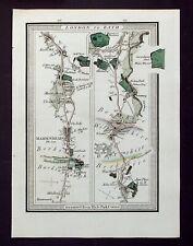 TAPLOW, MAIDENHEAD, KNOWL HILL, RUSCOMBE, SONNING original antique map MOGG 1817
-
$29.99 GBP
 1828 Brazil, Peru & Paraguay by Daniel Lizars Large Hand Coloured Antique Map
-
$145.00 GBP
 MONTGOMERYSHIRE, WALES, C.Saxton, W.Kip, W.Camden original antique map 1637
-
$9.00 GBP
 County map of Huntingdonshire England hand coloured c1860
-
$9.00 GBP
 County map of Lancashire England hand coloured c1860
-
$29.99 GBP
 1828 South Scotland by Daniel Lizars Large Hand Coloured Antique Map
-
$20.00 GBP
 Gloucestershire, 1784 county map, genuine antique 240 years old!
-
$14.99 GBP
 1805 Antique map: Brighton and Eastbourne, Sussex
-
$325.00 GBP
 SOMERSET, Saxton & Kip, Camden original antique map 1637
-
$25.00 GBP
 1806 ORIGINAL ANTIQUE MAP ASIE ASIA - HAND COLOURED COPPER PLATE
-
$195.00 GBP
 WILTSHIRE, SAXTON & KIP, Camden original antique hand col. map 1637
-
$19.95 GBP
 1787 ANTIQUE COPPER PLATE NEW ACCURATE MAP LEICESTER & RUTLAND - JOHN HARRISON
-
$9.00 GBP
 County map of Warwickshire England hand coloured c1860
-
$90.00 GBP
 Hasted, Kent. The Hundred of Faversham - genuine antique map 1793.
-
$40.00 GBP
 1778 ANTIQUE MAP A NEW & ACCURATE CHART OF THE WESTERN OR ATLANTIC OCEAN - BOWEN
-
$145.00 GBP
 NORTH AMERICA INDIAN NATIONS BY CORNELIUS PAAS c1812 GENUINE ANTIQUE MAP
-
$100.00 GBP
 Antique map, Blome, Warwickshire, Description of the Kingdoms of England, 1673
-
$30.00 GBP
 NORTHAMPTONSHIRE COUNTY MAP, BRITANNIA DEPICTA original antique map, Bowen, 1720
-
$9.00 GBP
 County map of Surrey England hand coloured c1860
-
$195.00 GBP
 BRITISH ISLES Britain Anglia Scotia Hibernia, Mercator Hondius antique map 1607
-
$25.00 GBP
 1764 ANTIQUE COPPERPLATE MAP - A NEW & ACCURATE MAP OF EUROPE - JOHN GIBSON
-
$75.00 GBP
 WEST INDIES BY CORNELIUS PAAS c1812 GENUINE ANTIQUE ENGRAVED MAP
-
$64.99 GBP
 1754 Antique map: Breadstreet & Cordwainer Wards, London: Stow's Survey
-
$25.00 GBP
 NOTTINGHAMSHIRE COUNTY MAP, BRITANNIA DEPICTA, original antique map, Bowen, 1720
-
$12.99 GBP
 1805 Antique map: Tunbridge Wells, Kent
-
$18.50 GBP
 OXFORD, TETSWORTH, CHIPPING NORTON, original antique road map, Bowen, 1720
-
$9.00 GBP
 County map of Oxfordshire England hand coloured c1860
-
$9.00 GBP
 County map of Staffordshire England hand coloured c1860
-
$39.99 GBP
 1828 France in Provinces by Daniel Lizars Large Hand Coloured Antique Map
-
$35.00 GBP
 WILTSHIRE, CORSHAM, SOMERSET, BATHFORD, BATH, original antique map, MOGG, 1817
-
$9.00 GBP
 County map of Dorsetshire England hand coloured c1860
-
$25.00 GBP
 IRELAND, BIRR, LOUGHREA, KILDARE, antique road map, Taylor & Skinner, 1783
-
$30.00 GBP
 DORSET, ASKERWELL, BRIDPORT, CHARMOUTH, original antique road map, MOGG, 1817
-
$19.99 GBP
 1839 Scandinavia Orginal Antique Hand Coloured Map by Sidney Hall
-
$40.00 GBP
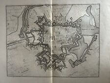 1736 Plan of Ypres, Belgium Original Antique Map by Claude Du Bosc


