 Antiques (UK)
Africa Maps
Asia Maps
Australia/Oceania Maps
Celestial Maps
Central America/Caribbean Maps
Curiosities Maps
Digital Maps
Europe Maps
Map & Globe Mixed Lots
Map & Globe Reproductions
North America Maps
South America Maps
World & Celestial Globes
World Maps

-
$100.00 GBP

 Australian States Original 1873 Map Folio (6) Chapman And Hall +New Zealand
-
$128.50 GBP
 1975 Jekyll Island Georgia Map ORIGINAL LARGE St Simon's Golden Isles Brunswick
-
$72.05 GBP
 دولة الامارات العربية المتحدة 1973 الإمارات الخليج UAE Emirates map خرائط خريطة
-
$250.00 GBP
 23x Iceland Vintage Maps Rare 1970s Icelandic Vintage Fold Out Collection Lot
-
$7.99 GBP
 Vintage Admiralty Charts 1960s-1980’s
-
$174.99 GBP
 1971 George Philip & Son Ltd Old School Roll Down 178 cm Long WORLD MAP On Linen
-
$7.50 GBP
 100's of Admiralty Charts (the pVintage Admiralty and other Charts 1940's-2010's
-
$210.00 GBP
 French Wine Region Map La Cote De Beaune 1972
-
$15.00 GBP
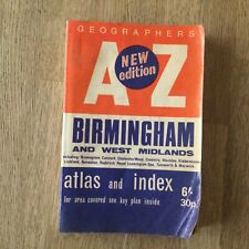 VINTAGE Geographer's A to Z Birmingham 1970s
-
$3.25 GBP
 VINTAGE SEA CHART / NAUTICAL MAP 1961 - The Wash - To Frame?
-
$3.49 GBP
 Vintage Ordnance Survey Cardiff Map - 1" - No. 154, 1970 Edition - B796
-
$3.25 GBP
 VINTAGE SEA CHART / NAUTICAL MAP 1961 - TORQUAY & BRIXHAM Harbours - To Frame?
-
$10.00 GBP
 Vintage Admiralty Chart 2007 Scotland - River Clyde 1979 Edition
-
$499.99 GBP
 Queen's Silver Jubilee Lancashire Map by J. L. Carr NO 126 of ed. of 980 Maps
-
$141.99 GBP
 Herefordshire Historical Map by J L Carr Ltd Edition 363/572 Signed & Framed
-
$40.03 GBP
 1977 Vintage Arabic World Atlas Maps الاطلس الأطلس العربي العربى خرائط 📚
-
$29.95 GBP
 Blaeu Wall Framed Map Gold Foil Nova Totivs Terrarom Sive Novi Orbis Tabvla
-
$6.00 GBP
 EGTON Institute of Geological Sciences Map - 1970 Drift Edition
-
$10.00 GBP
 Vintage 1978 Soviet Russia USSR Leningrad Public Transport Map 90x60cm
-
$9.99 GBP
 VINTAGE STREET MAP OF LOS ANGELES & LONG BEACH. 1978
-
$250.00 GBP
 Royal Geographical Society silver map of the world 1976
-
$12.00 GBP
 OS Pathfinder series 1:25000. 13 paper maps, GB locations. Good condition
-
$12.75 GBP
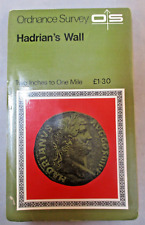 Vintage Retro Ordnance Survey Map - Hadrians Wall - 2 inch to 1 Mile Historical
-
$19.99 GBP
 National Geographic Map - West Indies and Central America - 1970 - Vintage
-
$2.00 GBP
 Large Vintage Daily Telegraph Tourist Map Of Great Britain 1974
-
$7.00 GBP
 Vintage 1978 East London MAP 177 Ordnance Survey One-Inch Map Topography History
-
$14.99 GBP
 National Geographic Traveler's Map of Italy - 1970 - Vintage
-
$150.00 GBP
 Vera Totius Expeditions Nauticae, 1977 'Full Sized copy'; R.H. Power Collection
-
$88.00 GBP
 ASIA Vintage 1972 Linen School Map of Asia
-
$29.99 GBP
 Vintage 1970's Scan-Globe A/S Denmark Miniature Desk Globe
-
$35.00 GBP
 Vintage Map / West Riding Yorkshire / Printed On Steel / 1970's / Robert Morden
-
$49.99 GBP
 Extra Large Ordinance Survey Map Of North Yorkshire Moors 1970
-
$3.25 GBP
 VINTAGE SEA CHART / NAUTICAL MAP 1961 Ireland - Westport Bay - To Frame?
-
$24.99 GBP
 Vintage Admiralty Nautical Navigation Chart Scotland West Coast Sound & Mull
-
$5.00 GBP
 Survey of Cyprus - Administration & Road Map
-
$34.99 GBP
 National Geographic Map - Antarctic Regions - 1932 - Vintage
-
$35.00 GBP
 Large 12" Vintage Chad Valley World Globe Tin Plate Metal Made In England
-
$10.00 GBP
 Vintage Marine Chart - Admiralty 2052 Appr to Harwich
-
$35.99 GBP
 Alpine Countries Alpenlander Austria VTG Road Map Fold Out 1:800.000 Salzburg
-
$93.52 GBP
 Vintage world Map Portuguese School corographic letter from 1973 by J.R.Silva
-
$30.00 GBP
 Original Map Of Moscow From 1974 (2 Side)
-
$3.25 GBP
 VINTAGE SEA CHART / NAUTICAL MAP 1961 - Holland - Flushing Breskens Groningen
-
$3.25 GBP
 VINTAGE SEA CHART / NAUTICAL MAP 1961 - Mersea Quarters- To Frame?
-
$3.25 GBP
 VINTAGE SEA CHART / NAUTICAL MAP 1961 - Salcombe - To Frame?
-
$6.00 GBP
 CLITHEROE British Geological Survey Map - 1975 Solid and Drift Edition
-
$3.25 GBP
 VINTAGE SEA CHART / NAUTICAL MAP 1961 - Holland - Delfzul, Langeoog, Ijmuiden
-
$6.00 GBP
 HUDDERSFIELD British Geological Survey Map - 2003 Solid and Drift Edition
-
$3.25 GBP
 VINTAGE SEA CHART / NAUTICAL MAP 1961 - River Dart - Devon - To Frame?
-
$3.25 GBP
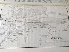 VINTAGE SEA CHART / NAUTICAL MAP 1961 - Honfleur
-
$10.00 GBP
 1971 FIRENZE FOLDOUT MAP ITALY
-
$6.00 GBP
 SHEFFIELD British Geological Survey Map - 1974 Solid and Drift Edition
-
$14.99 GBP
 National Geographic Map - West Indies - 1954 - Vintage
-
$4.00 GBP
 Finland - Esso Map 1976 and Visitors Guide 2003
-
$3.25 GBP
 VINTAGE SEA CHART / NAUTICAL MAP 1961 - Hamble River - To Frame?
-
$3.25 GBP
 VINTAGE SEA CHART / NAUTICAL MAP 1961 Ireland - Teelin & Killybegs Harbours
-
$3.25 GBP
 VINTAGE SEA CHART / NAUTICAL MAP 1961 Milford Haven X 4 Charts
-
$6.00 GBP
 Lichfield Birmingham And The Black Country Map Sheet Number 42 1970
-
$3.25 GBP
 VINTAGE SEA CHART / NAUTICAL MAP 1961 - Lowestoft Harbour & Great Yarmouth Haven
-
$3.25 GBP
 VINTAGE SEA CHART / NAUTICAL MAP 1961 - YEALM RIVER - To Frame?
-
$3.25 GBP
 VINTAGE SEA CHART / NAUTICAL MAP 1961 - COWES & River Medina - To Frame?
-
$3.25 GBP
 VINTAGE SEA CHART / NAUTICAL MAP 1961 - Rivers ALDE & ORE - To Frame?
-
$3.25 GBP
 VINTAGE SEA CHART / NAUTICAL MAP 1961 - Newhaven & Littlehampton - To Frame?
-
$11.99 GBP
 1971 Map - A Travelers Map of France Folding Map
-
$2.99 GBP
 VINTAGE SEA CHART / NAUTICAL MAP 1961 - Ireland - Kinsale - To Frame?
-
$10.49 GBP
 Poole Harbour Map - 78cm x 55cm - 1974
-
$24.99 GBP
 Operational Navigation Chart Map Edition 5 ONC J-6 Saudi Arabia Egypt Yemen Etc
-
$45.00 GBP
 Vintage Admiralty Chart 1446 SCOTLAND - ABERDEEN HARBOUR
-
$3.25 GBP
 VINTAGE SEA CHART / NAUTICAL MAP 1961 - Bembridge - To Frame?
-
$14.99 GBP
 MAP OF BUCKINGHAMSHIRE ROBERT MORDEN 1722 46 x 38cm 1970'S REPRODUCTION
-
$10.00 GBP
 Vintage S’algar San Luis Menorca Map 1970s
-
$3.25 GBP
 VINTAGE SEA CHART / NAUTICAL MAP 1961 - Poole / Brownsea Island - To Frame?
-
$4.99 GBP
 Vintage National Geographic Map - West Indies & Cent America 1970 - 96cm x 67cm
-
$6.00 GBP
 GRANTHAM British Geological Survey Geology Map - 1972 Solid and Drift Edition
-
$3.25 GBP
 VINTAGE SEA CHART / NAUTICAL MAP 1961 - Swansea & Barry - To Frame?
-
$17.99 GBP
 National Geographic Map of The Heavens -Monthly Star Chart Both Hemispheres 1970
-
$29.99 GBP
 Vintage 1970s Danish Scan-Globe A/S Karl F Harig Denmark World Globe
-
$8.99 GBP
 Vintage admiralty marine sea chart 1137 approaches to St Helier Jersey yachting
-
$3.25 GBP
 VINTAGE SEA CHART / NAUTICAL MAP 1961 - TEIGNMOUTH - To Frame?
-
$24.99 GBP
 Vintage Philips Polyglobe Illuminated World Globe Mid Cent.PLEASE READ DESCRIPTI
-
$3.25 GBP
 VINTAGE SEA CHART / NAUTICAL MAP 1961 - Dover Ramsgate Folkestone - To Frame?
-
$29.99 GBP
 Vintage 1972 Danish Scan-Globe A/S 1986 Karl F Harig Denmark World Globe
-
$4.00 GBP
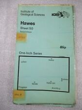 HAWES British Geological Survey Geology Map - 1971 Solid Edition
-
$6.00 GBP
 BARNSLEY British Geological Survey Map - 1976 Solid and Drift Edition
-
$7.50 GBP
 1970 ISLE OF MAN Ordnance Survey Bound Cloth Map - Sheet 87 - 1"-1 Mile
-
$3.25 GBP
 VINTAGE SEA CHART / NAUTICAL MAP 1961 - Portland And Weymouth - To Frame?
-
$6.00 GBP
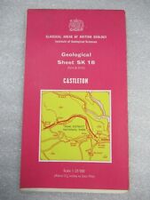 CASTLETON 1975 Geological Sheet SK 18 - Classical Areas of British Geology Map
-
$12.50 GBP
 ADMIRALTY SEA CHART. BARRY & CARDIFF ROADS.No. 1182. SOUTH WALES. 1974-2012
-
$3.25 GBP
 VINTAGE SEA CHART / NAUTICAL MAP 1961 - River Blackwater - To Frame?
-
$3.25 GBP
 VINTAGE SEA CHART / NAUTICAL MAP 1961 Ireland Arklow Ardglass Killough Rosslare
-
$10.00 GBP
 Vintage Stockholm City Map Karta 1970
-
$9.00 GBP
 Vtge Admiralty Sea Map no 830 INDIA, BASSEIN RIVER to PULO PENANG & ISLANDS 1974
-
$3.25 GBP
 VINTAGE SEA CHART / NAUTICAL MAP 1961 Ireland - Portrush & Lough Larne To Frame?
-
$3.25 GBP
 VINTAGE SEA CHART / NAUTICAL MAP 1961 Isle Of Man - Various Locations
-
$3.00 GBP
 Vintage Bartholomew's Quarter-Inch to 1 Mile Map of Derbyshire
-
$1.99 GBP
 EUROPE Sheet Road Map
-
$18.99 GBP
 Admiralty Chart Map Italy De La Pointe De Senetose Au Cap Muro Large Maritime
-
$3.25 GBP
 VINTAGE SEA CHART / NAUTICAL MAP 1961 - Ireland - Glengariff & Bantry Harbours
-
$3.25 GBP
 VINTAGE SEA CHART / NAUTICAL MAP 1961 - France - L’Abervrac’h
-
$120.09 GBP
 USGS Topo Map 7.5 Min Vintage : Devils Nose, CA 1973 BEAUTIFUL Rare California
-
$20.81 GBP
 VINTAGE FOLDING PAPER GEOLOGIC MAP N. DONEGAL IRELAND WALLACE PITCHER 1972 NICE!


