 Antiques (UK)
Africa Maps
Asia Maps
Australia/Oceania Maps
Celestial Maps
Central America/Caribbean Maps
Curiosities Maps
Digital Maps
Europe Maps
Map & Globe Mixed Lots
Map & Globe Reproductions
North America Maps
South America Maps
World & Celestial Globes
World Maps

-
$6.50 GBP

 1902 Map of Italy antique vintage Britannica 10th
-
$6.50 GBP
 1902 Map of the World on Mercators Projection antique vintage Britannica 10th
-
$6.50 GBP
 1902 Map of Scotland antique vintage Britannica 10th
-
$499.99 GBP
 Bacon's Atlas Of The World With Index Gazetteer 1913 VERY RARE
-
$35.00 GBP
 Bacon's New Large Print Map of London and Suburbs - Circa 1914
-
$6.50 GBP
 1902 Map of East India Islands Indonesia Borneo antique vintage Britannica 10th
-
$11.99 GBP
 NORWICH 1910 ANTIQUE CITY PLAN Colour Map - Mounted For Framing
-
$7.99 GBP
 ABERDEEN 1910 ANTIQUE CITY PLAN Colour Map - Mounted For Framing
-
$6.50 GBP
 1902 Map of Oxford Essex Sussex Surrey antique vintage Britannica 10th
-
$6.50 GBP
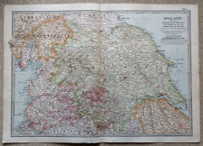 1902 Map of Yorkshire Westmorland Lancashire antique vintage Britannica 10th
-
$7.99 GBP
 CARDIFF 1910 ANTIQUE CITY PLAN Colour Map - Mounted For Framing
-
$7.99 GBP
 GLOUCESTER 1910 ANTIQUE CITY PLAN Colour Map - Mounted For Framing
-
$6.50 GBP
 1902 Map of Nottingham Leicester Norfolk Lincoln antique vintage Britannica 10th
-
$39.13 GBP
 ANTIQUE 1915 Willisburg BROOKLYN Map Greenpoint McCarren Park New York GOWANUS
-
$46.34 GBP
 1916 UNITED STATES Map ORIGINAL LARGE Wisconsin Indiana Pennsylvania Delaware
-
$46.34 GBP
 1915 Bedford Stuyvesant Brooklyn Map Fulton Broadway Rockaway Lewis
-
$6.50 GBP
 1902 Map of Cornwall Devon Dorset Channel Island antique vintage Britannica 10th
-
$7.99 GBP
 SCARBOROUGH 1910 ANTIQUE CITY PLAN Colour Map - Mounted For Framing
-
$11.99 GBP
 BRIGHTON 1910 ANTIQUE CITY PLAN Colour Map - Mounted For Framing
-
$10.00 GBP
 1902 Map of London and Vicinity antique vintage Britannica 10th
-
$11.99 GBP
 CAMBRIDGE 1910 ANTIQUE CITY PLAN Colour Map - Mounted For Framing
-
$12.50 GBP
 Vintage Admiralty Chart 1426 Loch Linnhe - North Part, 1918 edn Updated 1968
-
$6.50 GBP
 1902 Map of India Northern Part Nepal antique vintage Britannica 10th
-
$6.50 GBP
 1902 Map of German Empire Eastern Part antique vintage Britannica 10th
-
$6.50 GBP
 1902 Map of Greece Crete and Samos antique vintage Britannica 10th
-
$6.50 GBP
 1902 Map of Turkey in Asia antique vintage Britannica 10th
-
$10.00 GBP
 1903 Black ASIA SIBERIA CENTRAL ASIA Antique Map
-
$7.00 GBP
 Daily Mail War Map c1914
-
$39.13 GBP
 1916 UNITED STATES Map ORIGINAL Rainfall Colorado Montana Michigan Wisconsin
-
$19.99 GBP
 1902 East Indies Southeast Asia Antique Map by G.W. Bacon over 120 Years Old
-
$95.27 GBP
 Benzigers Advanced Geography for the Use of Catholic Schools 1911
-
$37.53 GBP
 1915 Bushwick Brooklyn Map New York Myrtle Avenue Broadway Bleecker Stockholm
-
$7.99 GBP
 NORTHAMPTON & COVENTRY 1910 ANTIQUE CITY PLAN Colour Map - Mounted For Framing
-
$11.99 GBP
 ISLE of WIGHT 1910 ANTIQUE COUNTY PLAN Colour Map - Mounted For Framing
-
$4.99 GBP
 ANTIQUE 1918 LONG LONDON STREET MAP ROTHERHITHE ACROSS TO SHEPHERDS BUSH
-
$9.99 GBP
 OS Map 24 Lancaster And Fleetwood 1910 Large Sheet Series Two Shillings
-
$19.95 GBP
 Antique National Health Insurance Commission Map of Monmouthshire, Wales d.1914
-
$7.99 GBP
 CARLISLE 1910 ANTIQUE CITY PLAN Colour Map - Mounted For Framing
-
$19.99 GBP
 1902 India Antique Map by G.W. Bacon over 120 Years Old
-
$38.33 GBP
 1915 East WIlliamsburg Brooklyn Map Broadway Triangle Flushing Harrison
-
$23.99 GBP
 Hyde, Haughton, old map Cheshire 1910: 11NW A
-
$6.50 GBP
 1902 Map of Spain Portugal and Andorra antique vintage Britannica 10th
-
$2.99 GBP
 ANTIQUE MAP OF CALIFORNIA & NEVADA, NORTH AMERICA, BY EMERY WALKER, 1910
-
$120.00 GBP
 c1918 Birkenhead & Wallasey Pharus Map & Index, Philip Son & Nephew, Liverpool
-
$11.99 GBP
 EDINBURGH 1910 ANTIQUE CITY PLAN Colour Map - Mounted For Framing
-
$10.00 GBP
 W H Smith Plan of London N W Section J. Bartholomew FRGS circa 1913
-
$45.00 GBP
 George Phillips and Sons, Malvern District Map 1919,VG+
-
$7.99 GBP
 Vintage Ordnance Survey Map of BOURNEMOUTH & SWANAGE. Sheet 141. 1919
-
$6.50 GBP
 1902 Map of Italy Northern Part antique vintage Britannica 10th
-
$69.95 GBP
 Original 1910 OS Sheet Map Bexleyheath Blackfen Upton Halfway St Watling Bromley
-
$79.95 GBP
 Original 1914 OS Coombe Ln Beddington South Croydon Bandonhill Waddon Selsdon Rd
-
$4.95 GBP
 Map 1913: The World On Mercator’s Projection Vintage Antique Original #1
-
$4.95 GBP
 Map 1913: British Isles Showing Railways Europe Vintage Antique #2 3
-
$4.95 GBP
 Map 1913: British Isles Showing Railways England & Wales Vintage Antique #4 5
-
$4.95 GBP
 Map 1913: Spain Portugal Palestine Netherlands Belgium Luxembourg Norway Sweden
-
$4.95 GBP
 Map 1913: Africa West Africa Central Africa South Africa Vintage Antique 22/23
-
$275.00 GBP
 1912 Original Antique LONDON UNDERGROUND RAILWAYS MAP GUIDE (LM44)
-
$25.38 GBP
 1912 ANTIQUE CELESTIAL MAP OF NORTHERN SKY HEAVENS STARS ASTRONOMY
-
$20.00 GBP
 France Sheet 51c Edition 1 ww1 Era Map 1:40,000
-
$11.99 GBP
 SHREWSBURY 1910 ANTIQUE CITY PLAN Colour Map - Mounted For Framing
-
$7.99 GBP
 HULL 1910 ANTIQUE CITY PLAN Colour Map - Mounted For Framing
-
$9.99 GBP
 1915 COLOUR MAP OF THE EUROPEAN WAR THE EASTERN CAMPAIGN BY SIFTON PRAED & CO*
-
$7.99 GBP
 CANTERBURY 1910 ANTIQUE CITY PLAN Colour Map - Mounted For Framing
-
$7.99 GBP
 ROCHESTER & CHATHAM 1910 ANTIQUE CITY PLAN Colour Map - Mounted For Framing
-
$7.99 GBP
 LEEDS & BRADFORD 1910 ANTIQUE CITY PLAN Colour Map - Mounted For Framing
-
$7.99 GBP
 BOURNEMOUTH 1910 ANTIQUE CITY PLAN Colour Map - Mounted For Framing
-
$7.99 GBP
 DERBY & LEICESTER 1910 ANTIQUE CITY PLAN Colour Map - Mounted For Framing
-
$20.00 GBP
 Belgium B Series Sheet 28 N.W. Folding Map 1:20,000 Ordnance Survey 1915 ww1
-
$7.99 GBP
 BATH 1910 ANTIQUE CITY PLAN Colour Map - Mounted For Framing
-
$7.99 GBP
 SALISBURY 1910 ANTIQUE CITY PLAN Colour Map - Mounted For Framing
-
$18.99 GBP
 Old map of Poulton le Fylde, Lancashire in 1913: 51NW repro
-
$18.00 GBP
 TRENCH WARFARE BEAUMONT - HAMEL & SERRIE FRANCE 1916 VINTAGE MOUNTED PRINT
-
$18.99 GBP
 Old map of Blackpool (east), Lancashire in 1913: 51SW repro
-
$7.99 GBP
 WINCHESTER 1910 ANTIQUE CITY PLAN Colour Map - Mounted For Framing
-
$7.99 GBP
 HASTINGS 1910 ANTIQUE CITY PLAN Colour Map - Mounted For Framing
-
$7.99 GBP
 DOVER 1910 ANTIQUE CITY PLAN Colour Map - Mounted For Framing
-
$7.99 GBP
 STRATFORD ON AVON 1910 ANTIQUE CITY PLAN Colour Map - Mounted For Framing
-
$7.99 GBP
 HULL 1910 ANTIQUE CITY PLAN Colour Map - Mounted For Framing
-
$11.99 GBP
 NEWCASTLE 1910 ANTIQUE CITY PLAN Colour Map - Mounted For Framing
-
$16.00 GBP
 Somme. VIII Corps attack 1st July 1916. Beaumont Hamel Serre. Trenches 1932 map
-
$7.99 GBP
 TORQUAY 1910 ANTIQUE CITY PLAN Colour Map - Mounted For Framing
-
$7.99 GBP
 PLYMOUTH 1910 ANTIQUE CITY PLAN Colour Map - Mounted For Framing
-
$7.99 GBP
 ANTIQUE 1910 CHICHESTER CATHEDRAL PLAN Map - Mounted For Framing
-
$18.99 GBP
 Silchester, Pamber Heath, Mortimer West End, Old Map Hampshire 1913: 4SE
-
$7.99 GBP
 WORCESTER 1910 ANTIQUE CITY PLAN Colour Map - Mounted For Framing
-
$7.99 GBP
 YORK 1910 ANTIQUE CITY PLAN Colour Map - Mounted For Framing
-
$8.99 GBP
 Shropshire Vintage Bartholomews Map Shrewsbury Kidderminster C1910 Welshpool Old
-
$7.99 GBP
 EXETER 1910 ANTIQUE CITY PLAN Colour Map - Mounted For Framing
-
$4.50 GBP
 NORTH MIDDLESBROUGH St Hilda's 1913 - Old Ordnance Survey Maps Godfrey Edition
-
$7.99 GBP
 NOTTINGHAM 1910 ANTIQUE CITY PLAN Colour Map - Mounted For Framing
-
$11.50 GBP
 Largo Fife Cloth Sectional Mounted Map 1919 Original Scotland Sifton Praed
-
$18.99 GBP
 Bramhall, Poynton, old map Cheshire 1910: 19SE
-
$11.99 GBP
 PARIS CITY Plan FRANCE - 1910 Mounted Antique Map
-
$18.99 GBP
 Old map of Southport, Lancashire 1912: 75SW repro
-
$7.99 GBP
 ANTIQUE 1910 CHICHESTER CATHEDRAL PLAN Map - Mounted For Framing
-
$23.99 GBP
 Hoylake, West Kirby (N), Saughall Massie (W), old map Cheshire 1913: 12NE A
-
$20.00 GBP
 ww1 Folding Map France Lens 11 Scale 1:100,000 Ordnance Survey Official Use 1915
-
$18.99 GBP
 Old Map of York (SW), Acomb, Dringhouses, Yorkshire -1910 - Repro 174 SW
-
$39.13 GBP
 1915 Map BRONX New York City ORIGINAL Crotona Park Morrisania Charlotte Gardens
-
$340.26 GBP
 Zion National Monument Map Proclamation Woodrow Wilson 1918


