 Antiques (UK)
-
$53.92 GBP

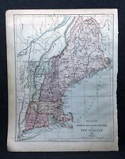
 Original 1864 MASS CONN Rhode isl Antique hand colored JOHNSON's MAP 26.5 X 18"
-
$25.68 GBP
 1879 Map New England USA Victorian Atlas Harpers Geography 1st Edition DWAA9
-
$12.84 GBP
 1879 Map Rhode Island United States Victorian Geography 1st Edition DWAA9
-
$68.21 GBP
 1876 North Eastern States antique map ~ 27.3" x 19.6" hand colored NY MD PA ME+
-
$20.06 GBP
 1901 Tunison New York NYC & Long Island antique map ~ 23" x 14.6" - nice color
-
$12.04 GBP
 1884 New England States USA Harper and Brothers Copyright 1875 Map Ephemera
-
$401.24 GBP
 1840 United States antique map by Greenleaf - 14.2" x 12" scarce 1st edition
-
$60.19 GBP
 1862 Johnson Massachusetts Rhode Island CT antique map 26" x 17.8" nice color
-
$60.19 GBP
 New York NH VT CT MA RI 1860 hand-color Mitchell antique map 23.5" x 15.2"
-
$140.43 GBP
 1840 Massachusetts RI CT map by Greenleaf ~ 14.25" x 11.9" scarce 1st edition
-
$92.28 GBP
 1849 Massachusetts, RH & Boston by Mitchell antique map ~17.4" x 13.8"
-
$20.06 GBP
 1901 Tunison Massachusetts Rhode Island antique map ~ 23" x 14.6" - nice color
-
$76.23 GBP
 1856 Black's New York VT NH RI MA CT 23.8" x 17.2" - beautiful antique color
-
$140.43 GBP
 Vintage 1946 New England Electric System Map Electric Properties & Service Area


