 Antiques (UK)
-
$103.42 GBP

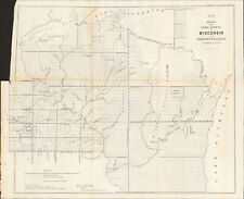
 1840 Wisconsin Green Bay Map ORIGINAL Astor Lake Michigan Survey RARE
-
$160.49 GBP
 1867 Kansas Colorado Montana & Dacota Hand Colored Map 13 x 15 Mitchell Antique
-
$19.99 GBP
 1902 Eastern United States Railways and Physical Antique Map by John Bartholomew
-
$19.99 GBP
 1902 Western United States Railways and Physical Antique Map by John Bartholomew
-
$6.99 GBP
 Antique Map Of The Eastern United States Dated 1901 The Mississippi States
-
$80.00 GBP
 Antique Map "Royal Relief Atlas - North America" Phillips Bevan, 1885
-
$89.99 GBP
 1925 Indexed Antique Map of Boston, Massachusetts by Walker Lithograph Co.
-
$10.42 GBP
 Vintage 1940s COLORADO Highway Road Map - Chevron RPM Gasoline Service Station
-
$15.00 GBP
 Vintage 1958 Rand McNally Imperial Map of Canada 5R58 PMX102 1950s/60s
-
$9.00 GBP
 Vintage Map Atlantic Provinces 1972 New Brunswick, Nova Scotia,Prince Edward Isl
-
$14.99 GBP
 Edwardian Historical Maps of the United States (1902) Century Atlas of the World
-
$31.30 GBP
 1878 Maine Mitchell antique map 15.1" x 12.1" - nice color
-
$15.00 GBP
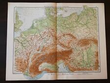 VINTAGE MAP-PAGE 35-36 FROM ANDREE WORLD ATLAS -CENTRAL EUROPE PHYSICAL MAP-1914
-
$220.68 GBP
 DUNLEVIE c1856 Map Counties Of Gaspe & Bonaventure Quebec Canada SCARCE! #2
-
$120.36 GBP
 1903 Rand McNally Co. Map of Alaska and the Yukon Gold Fields Canada California
-
$100.31 GBP
 Vtg 1784 Map of United States NJ State Historic Society Abel Buell Reproduction
-
$140.43 GBP
 1875 Map Yellowstone Montana Captain William Ludlow US Army Corps Engineers
-
$36.11 GBP
 1878 United States map 22.8" x 15.1" nice color - Island of New Foundland inset
-
$47.35 GBP
 1862 Johnson Minnesota & Dakota antique map 17.2" x 14" nice color
-
$55.37 GBP
 1878 California Mitchell antique map 22.9" x 15.1" - San Francisco inset
-
$25.68 GBP
 1879 Map Maine United States New England Victorian Geography 1st Edition DWAA9
-
$76.23 GBP
 1862 Johnson Dakota Nebraska Kansas Colorado antique map 17.4" x14.2" nice color
-
$96.30 GBP
 1892 Death Valley Expedition Map, Biological Survey, Tulare Lake, Las Vegas, etc
-
$100.31 GBP
 1877 F. V. Hayden Parts of Western Wyoming and Southeastern Idaho Map
-
$79.44 GBP
 1878 Colorado Montana Dakota & Wyoming Mitchell antique map 22.9" x 15.1"
-
$100.31 GBP
 1883 General Sherman Route Map Fort Ellis Montana to Fort Hope British Columbia
-
$52.16 GBP
 1862 Johnson New York with many insets antique map 26.1" x 17.8" nice color
-
$13.64 GBP
 Original Physical & Economic Map of the Americas in 1910 by Meyers. German
-
$220.68 GBP
 DUNLEVIE c1856 Map Counties Of Gaspe & Bonaventure Quebec Canada SCARCE! #1
-
$220.68 GBP
 MATTHEWS c1856 Map Of Upper Canada Ontario Indian Land Agency Divisions Scarce!
-
$120.37 GBP
 Original Circa 1850 Map Of Oregon Boundary Lithograph By A. Hoen & Co.
-
$220.68 GBP
 DEVINE c1856 Dr Salters Map Of Lake Huron Ontario Indian Lands etc. No. 7 Scarce
-
$119.57 GBP
 1862 Johnson Washington & Oregon antique map 17.2" x 14" nice color
-
$47.35 GBP
 1878 New York Mitchell antique map 23" x 15.1" nice color & city insets
-
$220.68 GBP
 1862 Johnson Texas antique map 25.6" x 18.6" nice color - Galveston, Sabine Lake
-
$31.30 GBP
 1878 Oregon Washington MT ID Mitchell antique map 15.1" x 12.3" - nice color
-
$44.14 GBP
 1878 Washington DC & Baltimore Mitchell antique map 15.1" x 12.3" - nice color
-
$32.10 GBP
 1856 Arkansas Survey Antique Map - Lithograph - Ackerman Broadway NY 18" x 17.3"
-
$25.68 GBP
 1879 Map United States Physical Groups Victorian Geography 1st Edition DWAA9
-
$25.68 GBP
 1879 Map Massachusetts Boston US Victorian Atlas Geography 1st Edition DWAA9
-
$71.42 GBP
 1878 Boston Mitchell antique map / plan 23" x 15.1" - nice color - harbor inset
-
$25.68 GBP
 1879 North Central States Group US Victorian Atlas Geography 1st Edition DWAA9
-
$55.37 GBP
 1878 Kansas & Nebraska Mitchell antique map 22.9" x 15.1" - nice color
-
$104.31 GBP
 1884 ANTIQUE MAP Indian Removal CHEROKEE NATION 32" Arkansas Kansas Missouri
-
$300.93 GBP
 1862 Johnson California Southwest Territory antique map 26.1" x 18.7" nice color
-
$25.68 GBP
 1879 Map New England USA Victorian Atlas Harpers Geography 1st Edition DWAA9
-
$36.11 GBP
 1862 Johnson's New York Map Johnson & Ward Illustrated Family Atlas Antique
-
$119.57 GBP
 1878 Texas antique map 22.8" x 15.1" nice color - Galveston Indian Territory NM
-
$204.63 GBP
 1860 Washington & Oregon Mitchell antique map 15.4" x 12.6" rare 1st edition
-
$84.26 GBP
 1860 Wisconsin & Michigan Mitchell antique map 15.3" x 12.7" rare 1st edition
-
$36.11 GBP
 1862 Johnson Iowa & Nebraska antique map 17.6" x 14.2" nice color
-
$151.67 GBP
 1860 Minnesota & Dacotah Mitchell antique map 15.5" x 12.7" rare 1st edition
-
$8.02 GBP
 1958 McNally Map - South Dakota - Pierre Black Hills Rapid City Mt. Rushmore
-
$60.19 GBP
 1856 Wisconsin & MN Survey Antique Map Lithograph - Ackerman NY ~ 21.5" x 18.7"
-
$40.12 GBP
 Vintage 1946 Los Angeles Hollywood Tour Map - Shell Oil Service Station
-
$60.19 GBP
 1862 Johnson Virginia PA DE MD antique map 26.6" x 18.1" nice color - Richmond
-
$31.30 GBP
 1878 Western Hemisphere Mitchell antique map 15.1" x 12.1" - nice color
-
$36.11 GBP
 1878 Georgia Alabama Mitchell antique map 22.7" x 15.1" Atlanta Savannah insets
-
$12.84 GBP
 Eastern USA - Original 1909 Physical Map by John Bartholomew. Antique
-
$44.14 GBP
 1862 Johnson Kentucky & Tennessee antique map 24.7" x 17.9" nice color
-
$60.19 GBP
 1849 Lithograph of 1st Printed Chart of Coast of New England & New Netherlands
-
$12.84 GBP
 Map Of Original 13 Colonies 1871 Victorian Lithograph History Swinton DWAA12
-
$13.64 GBP
 Africa - Original 1928 German Physical Map by Meyers. Vintage
-
$28.09 GBP
 1856 Design for New D.C. Jail - Antique Lithograph - Duval ~ 22.2" x 18"
-
$12.84 GBP
 Map Sherman's Army Virginia Operations 1871 Victorian Lithograph History DWAA12
-
$11.12 GBP
 1920 Color Maps Physical Features of Ireland and Scotland Map
-
$36.11 GBP
 1862 Johnson's Missouri and Kansas Map Johnson & Ward Antique
-
$9.52 GBP
 1920 Color Maps by John Bartholomew of Physical Europe Map
-
$8.02 GBP
 1942 Pecos River Basin Texas New Mexico - Percipitation Distribution Map Roswell
-
$13.64 GBP
 USA - Original 1903 Physical Map by Dodd Mead & Company. Antique
-
$60.18 GBP
 1885 ANTIQUE MAP 21.75" Eskimo Tribes NORTH EAST AMERICA CANADA Nunavut Dr. Boas
-
$44.14 GBP
 1878 North & South Carolina Mitchell antique map 15.1" x 12.3" - nice color
-
$20.51 GBP
 TWO United States Maps East/West Genuine 1906 Date City Port Rail Canal Physical
-
$12.84 GBP
 Map War Of 1812 Indian Wars 1871 Victorian Lithograph History Swinton DWAA12
-
$52.16 GBP
 Johnson's North And South Carolina 1862 Map Johnson and Ward Illustrated Atlas
-
$401.24 GBP
 1845 North America map by A.K. Johnston 25.8" x 21.2" Antique Republic of Texas
-
$16.05 GBP
 Authentic 1910 Plate Map ~ US PHYSICAL Geography UNITED STATES ~ Extremely Rare
-
$60.19 GBP
 1860 US Canada Mexico C. America Mitchell antique map 15.3" x 12.5" hand color
-
$164.51 GBP
 1860 Boston city plan Mitchell antique map 15" x 12.5" vibrant hand color
-
$39.32 GBP
 1862 Johnson state of New Jersey antique map 16.6" x 14" nice color
-
$15.24 GBP
 Original 1899 Map NORTH POLE Arctic Explorers Nansen Johansen Franklin McClure
-
$31.30 GBP
 1878 Virginia & West, MD DE & NJ Mitchell antique map 15.1" x 12" - nice color
-
$11.12 GBP
 1920 Color Maps Political United States and Physical South America Map
-
$13.64 GBP
 The America's - Original 1924 German Physical Map by Meyers. Vintage
-
$72.22 GBP
 1860s Map, Harper's Ferry, Sale of Government Property, 'John Brown's Fort'
-
$36.11 GBP
 1878 Kentucky & Tennessee Mitchell antique map 15.1" x 12" - nice color
-
$5.58 GBP
 Vintage 1962 Colorful Colorado State Highway Department Road Map Travel Guide
-
$13.64 GBP
 The America's - Original 1928 Physical Map by Meyers. German Language Map
-
$9.52 GBP
 1920 Color Maps Physical Features of Switzerland and the Alps Map
-
$52.16 GBP
 1856 Louisiana Antique Survey Map - Lithograph - Duval - 18.3" x 17" - Congress
-
$228.70 GBP
 1857 UTAH MAP: Sketch of the Country between South Pass & the Great Salt Lake
-
$25.68 GBP
 1879 Map West Pacific NW & Southwest Group Victorian Geography 1st Edition DWAA9
-
$160.49 GBP
 1845 Canada map by A.K. Johnston ~ 25.8" x 21.2" Antique Pastel Huge
-
$60.19 GBP
 1862 Johnson Massachusetts Rhode Island CT antique map 26" x 17.8" nice color
-
$19.26 GBP
 Map Territorial Growth Of United States 1871 Victorian Lithograph History DWAA12
-
$18.34 GBP
 Manitoba, BC, Canada & NW Territories Map; Genuine 1907 (Dated) City Topog Rails
-
$38.11 GBP
 1848 ORIGINAL MAP UNITED STATES TEXAS FLORIDA CANADA CUBA MEXICO HAWAII NEW YORK
-
$60.19 GBP
 New York NH VT CT MA RI 1860 hand-color Mitchell antique map 23.5" x 15.2"
-
$192.59 GBP
 CIVIL WAR 1862-63 "Map of the Battle-Grounds in the Vicinity of Richmond, VA."
-
$25.68 GBP
 1879 Map Texas & Southern Plains States US Victorian Geography 1st Edition DWAA9


