 Antiques (UK)
-
$29.99 GBP

 Original Antique Victorian Map of Dover - Published 1891
-
$28.70 GBP
 antique Londinium Londinum Elizabethan London map Agas Wallis 1563 poster print
-
$18.90 GBP
 antique early map Thames river London estuary Sheppey Isle Merian 1667 art print
-
$18.90 GBP
 River Thames antique Victorian excursions guide map Eton to Nore 1849 art poster
-
$14.99 GBP
 Large George Philip wall map County Kent 1961 fabric school London geographical
-
$19.00 GBP
 Framed Art Print 80s map mounted Suffolk Ipswich Speed 1600s Large
-
$20.50 GBP
 River Thames Old London Bridge Elizabethan view map Merian 1638 art poster print
-
$17.99 GBP
 Old Map of Dover, Kent in the 1600's - town plan, repro, vintage, historical
-
$12.00 GBP
 Old Tudor Poster map Kent, Canterbury Rochester: Speed 1600's 15.5" x 12 Reprint
-
$11.99 GBP
 Large Print of a London Map First Published in 1746. Kent Street. e3
-
$4.99 GBP
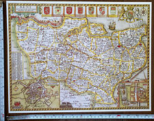
 Old Antique Tudor map Kent inc Canterbury Rochester England Speed 1600's Reprint
-
$19.00 GBP
 Framed Art Print 80s map mounted Kent Canterbury Rochester Speed 1600s Large
-
$20.50 GBP
 Antique Victorian Bennet's map river Thames Up down the River art print poster
-
$15.00 GBP
 Repro Antique Framed 11"x8.5" Map of Kent, England c.1612. Wall Art, Picture.
-
$15.99 GBP
 Pigot & Co County Colour Map Kent 1840 Reproduction
-
$10.00 GBP
 Vintage Copy Antique 19th Century Map of Kent by Wrightsons Foilgraphics London
-
$5.99 GBP
 Old Antique Victorian Picture map Isle of Thanet, England c1830's Moule: Reprint
-
$16.99 GBP
 Kent 1786 - repro old map of Thomas Kitchin - 58x41cm - 20x16ins
-
$10.00 GBP
 Reproduction of Moule's Map of Kent
-
$270.00 GBP
 London circular map 14 Miles round St. Pauls from original by Pigot c1830
-
$4.50 GBP
 Decorative Print County Map Of Kent By Thomas Moule 1830, Dover, Rochester
-
$455.00 GBP
London map 14 Miles round St Pauls from original Pigot c1830 A0+ size
-
$386.00 GBP
 London map 14 Miles round St Pauls from original Pigot c1830 A1+ size


