 Antiques (UK)
-
$29.68 GBP

 Vintage 1925 Topographic Map - Kinsley, Kansas - 19.75" x 16.25"
-
$29.68 GBP
 Vintage 1941 Topographic Map - Caldwell, Kansas - 19.75" x 16.5"
-
$29.68 GBP
 Vintage 1933 Topographic Map - Lakin, Kansas - 19.75" x 16.5"
-
$27.28 GBP
 Antique 1921 Topographic Map - Larned, Kansas - 19.75" x 16.5"
-
$4.81 GBP
 1897 Map of United States & Mexico Original antique print
-
$4.81 GBP
 1897 Map East part of United States Original antique print
-
$4.81 GBP
 1897 Map Western part of United States Original antique print USA
-
$8.02 GBP
 Vintage Map "Soil Map for Kansas-Parsons Sheet" 1903
-
$104.31 GBP
 1884 ANTIQUE MAP Indian Removal CHEROKEE NATION 32" Arkansas Kansas Missouri
-
$29.68 GBP
 Vintage 1925 Topographic Map - Ellis, Kansas - 19.75" x 16.5"
-
$7.70 GBP
 1855 VTG Antique Pages Indian Oregon Utah New Mexico Kansas Washington Territory
-
$19.98 GBP
 1903 Antique Map Kansas Russell Bunker Hill 21 X 18 #9967
-
$48.00 GBP
 1934 LARGE MAP ~ UNITED STATES ~ KANSAS NEBRASKA & OKLAHOMA ~
-
$29.68 GBP
 Vintage 1939 Topographic Map - Larned, Kansas - 19.75" x 16.5"
-
$28.08 GBP
 Vintage 1930 Topographic Map - Ashland, Kansas - 19.75" x 16.5"
-
$29.68 GBP
 Vintage 1941 Topographic Map - Ellsworth, Kansas - 20" x 16.5"
-
$26.47 GBP
 Antique 1922 Topographic Map - Beloit, Kansas - 19.75" x 16.5"
-
$16.05 GBP
 Original Vintage Map Showing MIssouri-Kansas-Texas Lines, 1926
-
$29.68 GBP
 Vintage 1949 Topographic Map - Eureka, Kansas - 20.5" x 17"
-
$13.63 GBP
 1960’s Army Map Leavenworth, Kansas - Sheet 7062 IV Series V778 $6 shipping
-
$29.68 GBP
 Vintage 1925 Topographic Map - Anthony, Kansas - 19.5" x 16.25"
-
$29.68 GBP
 Vintage 1938 Topographic Map - Syracuse, Kansas - 19.75" x 16.5"
-
$28.88 GBP
 Vintage 1925 Topographic Map - Hutchinson, Kansas - 19.75" x 16.5"
-
$9.63 GBP
 Antique 1904 MAP Kansas Americana Co 12 X 10 Topeka
-
$27.28 GBP
 Vintage 1949 Topographic Map - Concordia, Kansas - 20.5" x 17"
-
$28.88 GBP
 Vintage 1945 Topographic Map - Coldwater, Kansas - 20.75" x 17"
-
$16.05 GBP
 Original Vintage Map of the Kansas City, Mexico & Orient Railway & Conn, ~ 1910
-
$29.68 GBP
 Antique 1924 Topographic Map - Phillipsburg, Kansas - 19.5" x 16.25"
-
$28.88 GBP
 Antique 1921 Topographic Map - Washington, Kansas - 20" x 16.5"
-
$36.10 GBP
 Antique 1910 Topographic Map - Dodge, Kansas - 20" x 16.5"
-
$29.68 GBP
 Vintage 1944 Topographic Map - Russell, Kansas - 20.75" x 17"
-
$28.88 GBP
 Antique 1922 Topographic Map - Cheney, Kansas - 19.75" x 16.5
-
$28.88 GBP
 Vintage 1949 Topographic Map - Fredonia, Kansas - 20.5" x 17"
-
$28.88 GBP
 Antique 1921 Topographic Map - Marysville, Kansas - 19.75" x 16.5"
-
$28.88 GBP
 Vintage 1945 Topographic Map - Pratt, Kansas - 20.75" x 17"
-
$29.68 GBP
 Vintage 1937 Topograpic Map - Minneapolis, Kansas - 19.75" x 16.5"
-
$15.21 GBP
 Vintage 1947 State Map Print Suitable For Framing 2 Sided Kansas Iowa
-
$28.88 GBP
 Antique 1924 Topographic Map - Mankato, Kansas - 19.75" x 16.5"
-
$29.68 GBP
 Vintage 1937 Topographic Map - Lyons, Kansas - 19.75" x 16.5"
-
$29.68 GBP
 Antique 1915 Topographic Map - Lakin, Kansas - 19.75" x 16.5"
-
$28.88 GBP
 Antique 1921 Topographic Map - Spearville, Kansas - 20" x 16.5"
-
$28.88 GBP
 Antique 1921 Topographic Map - Meade, Kansas - 19.75" x 16.5"
-
$29.68 GBP
 Vintage 1927 Topographic Map - Wellington, Kansas - 20" x 16.5"
-
$29.68 GBP
 Vintage 1938 Topographic Map - Clay City, Kansas - 19.75" x 16.5"
-
$28.08 GBP
 Antique 1924 Topographic Map - Ness, Kansas - 19.75" x 16.5"
-
$24.07 GBP
 1950 Army map Wolcott Kansas Sheet 7062 III NE w/ Aerial Photo
-
$25.68 GBP
 1879 Map West Central States Group Victorian Atlas Geography 1st Edition DWAA9
-
$27.28 GBP
 Antique 1922 Topographic Map - Norton, Kansas - 19.75" x 16.5"
-
$10.27 GBP
 Antique 1906 Color Map Kansas 11" X 16" #4144
-
$24.07 GBP
 1950 Army map Oak Mills Kansas Sheet 6962 I NE w/ Aerial Photo
-
$32.09 GBP
 1950 Army map Junction City Kansas Sheet 6662 III SE w/ Aerial Photo Fort Riley
-
$27.28 GBP
 Antique 1922 Topographic Map - Smith Center, Kansas - 19.75" x 16.5"
-
$16.05 GBP
 Original Vintage Map of the Kansas City, Mexico & Orient Railway & Conn. ~ 1910
-
$28.88 GBP
 Antique 1921 Topographic Map - Garden City, Kansas - 20" x 16.5"
-
$26.47 GBP
 Antique 1922 Topographic Map - Hill City, Kansas - 19.75" x 16.25"
-
$28.08 GBP
 1950 Army map Wind Creek Kansas Sheet 6662 III NE w/ Aerial Photo Fort Riley
-
$16.05 GBP
 Original Vintage Map of the Kansas City Southern Railway - 1910
-
$28.08 GBP
 1950 Army map Swede Creek Kansas Sheet 6662 II SE w/ Aerial Photo
-
$23.99 GBP
 1910 Antique Map Western Kansas Hamburg Larned Colby Plainville 37X38 #4230
-
$32.02 GBP
 1911 Antique Color Map Shawnee County Kansas Topeka Rossville Elmont 34X28 #0500
-
$16.05 GBP
 Original Vintage Map of the Kansas City Southern Railway 1915
-
$60.19 GBP
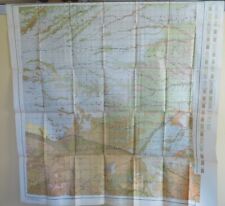
 original 1906 USGS map of Garnett, Lane, Blue Mound, Geneva, KS
-
$32.09 GBP
 1940's Army map Ferrelview Kansas City Missouri Sheet 7062 I SW w/ Aerial Photo
-
$32.09 GBP
 1950 Army map Ogden Kansas Sheet 6662 II SW w/ Aerial Photo Fort Riley Funston
-
$32.09 GBP
 1950 Army map Keats Kansas Sheet 6662 II NW w/ Aerial Photo Fort Riley
-
$16.05 GBP
 Original Vintage Map of the Kansas City Southern Railway 1917
-
$20.06 GBP
 US Department Of The Interior Geological Survey, Kansas Lake Mc Bride Quad 1939
-
$60.19 GBP
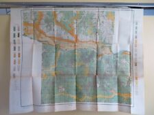
 original 1902 USGS map of Parsons, KS & Oswego, Chetopa, Mound Valley
-
$44.14 GBP
 1900 USGS map of Fort Scott, KS Liberal, MO
-
$12.04 GBP
 1900's Map of Kansas
-
$32.10 GBP
 SESQUICENTENNIAL HISTORICAL MAP OF LAWRENCE KANSAS UNIVERSITY KU 1854-2004 BH
-
$60.19 GBP
 original 1900 map of Mound City, KS & Pleasanton, La Cygne, Osawatomie, Prescott
-
$60.15 GBP
 KANSAS Old Farm Plot MAP Signed Survey Jackson Township Osborn County w/Letter


