 Antiques (UK)
-
$19.99 GBP

 1903 large colour fold out map titled " illinois - northern part "
-
$19.99 GBP
 1903 large colour fold out map titled " illinois - southern part "
-
$15.94 GBP
 Kentucky Geological Survey ~ Rosiclare Quadrangle ~ 1954 Illinois-Kentucky
-
$75.72 GBP
 Chicago Antique 1895 Original Edgebrook SUB Map In Chicago TOTALLY AMAZING REPRO
-
$16.98 GBP
 1891 ILLINOIS MAP ANTIQUE FULL COLOR RAILROADS RIVERS MOUNTAINS LAKE MICHIGAN
-
$17.53 GBP
 USGS Planimetric Topo Map OTTAWA Illinois USA 1985 41088-A1-PL-100
-
$11.95 GBP
 USGS Planimetric Map St Louis Missouri Illinois 1985
-
$15.93 GBP
 Vintage 1940's White Rose Gasoline Illinois Rand McNally & Co. Road Map
-
$21.92 GBP
 Rand-McNally city map: NORTH LAKE COUNTY Illinois © 1997 - index -
-
$79.69 GBP
 1886 US MAP Chicago Rock Island & Pacific Railway Map & Timetable CRAM 41"x20"
-
$11.95 GBP
 General Highway Map, Rock Island County Illinois, Vintage 1955, Rev 1984, Color
-
$18.73 GBP
 USGS Topographic Map AURORA Illinois 1985 - bad - 100K -
-
$14.87 GBP
 USGS Planimetric Map DANVILLE - Illinois - 1984 - old - 100K -
-
$79.70 GBP
 Antique 1902 Booklet Railroad Map Of INDIANA - Shows ALL Railroads in 1902 REPRO
-
$11.95 GBP
 Vintage 1964? Illinois Tollway Map Chicago 20.5”x18”
-
$17.49 GBP
 USGS Topographic Map PINCKNEYVILLE Illinois 1985/1988 38089-A1-TM-100
-
$23.91 GBP
 1971 Soil Survey Book, Douglas County, Illinois With Fold-Out Maps
-
$11.95 GBP
 Vintage Map Of Whiteside, Upper Rock Island County Illinois 1983, Road Index
-
$66.14 GBP
 Antique 1910 Rand McNally & Co.’s “New Street Number Guide Map Of Chicago”
-
$51.81 GBP
 Original 1852 Map of Missouri, Illinois, Indiana, Ohio, Kentucky & Tennessee
-
$15.93 GBP
 Moline Illinois 1963 Vintage Ward Precinct Map Rock Island County Quad Cities
-
$19.92 GBP
 Original 1929 USGS Topo Map SMITHLAND Kentucky Calvert City Ohio River Illiniois
-
$35.87 GBP
 Geology Folded Map Galena Sheet Zinc Lead District Illinois Black Jack Mine 1914
-
$18.69 GBP
 USGS Topographic Map CARLYLE LAKE Illinois 1985 - 100K -
-
$18.32 GBP
 Original 1932 USGS Topo Map LaCenter Bandana Kentucky Ohio River Joppa Illinois
-
$31.84 GBP
 Antique Map 1914 ST CLAIR County EAST ST LOUIS Illinois Topographic 36" X 36"
-
$15.29 GBP
 USGS Planimetric Map DANVILLE - Illinois Indiana - 1984 - 100K -
-
$23.83 GBP
 Antique 1903 Map Johnson County Illinois Buncombe Vienna 22"X22" #21037
-
$11.95 GBP
 Soil Survey of Tazewell County Illinois USDA Fold Out Maps Conservation
-
$21.92 GBP
 USGS Topographic Map PARIS Iliinois Indiana USA 1986 1990 39087-E1-TM-100
-
$5.17 GBP
 NATIONAL GEOGRAPHIC MAP STATE OF ILLINOIS 1931 VINTAGE
-
$18.69 GBP
 USGS Topographic Map ST. LOUIS - Missouri Illinois - 1985 - 100K -
-
$23.90 GBP
 1979 Book, Soil Survey of Kane County, Illinois With Fold-Out Maps
-
$63.76 GBP
 1903 Complete Rand McNally & Co Pocket Map & Shipper’s Guide to Illinois
-
$1.99 GBP
 Guide to the Geologic Map of Illinois - 1961 Educational Series 7
-
$79.66 GBP
 Illinois State Geological survey oil maps 1909-1911, Raymond S. Blatchley 1913
-
$23.91 GBP
 1970 Book, Soil Survey of Lake County, Illinois With Fold-Out Maps
-
$18.29 GBP
 USGS Topographic Map KANKAKEE Illinois Indiana 1991 41087-A1-TM-100
-
$17.49 GBP
 USGS Topographic Map QUINCY Illinois Missouri 1986/1990 39091-E1-TM-100
-
$18.69 GBP
 USGS Topographic Map CAPE GIRARDEAU - Missouri Illinois Kentucky - 1986 - 100K -
-
$23.30 GBP
 Antique Map 1902 Clinton County Illinois Trenton Breese Aviston Carlyle #13173
-
$19.03 GBP
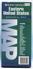 Rand-McNally regional state map: EASTERN UNITED STATES © 1993 -BAD-
-
$18.29 GBP
 USGS Topographic Map OLNEY Illinois 1986 1988 38088-E1-TM-100
-
$10.35 GBP
 USGS Index to Topographic Maps of Illinois April 1979 Geological Survey
-
$17.14 GBP
 USGS Planimetric Map ROCK ISLAND COUNTY - Illinois - 1986 - 100K -
-
$18.29 GBP
 USGS Topographic Map OTTAWA Illinois USA 1991 41088-A1-TM-100
-
$18.29 GBP
 USGS Topographic Map LITCHFIELD Illinois 39089-A1-TM-100
-
$18.69 GBP
 USGS Topographic Map PRINCETON Indiana Illinois 1986 - 100K -
-
$18.93 GBP
 USGS Topographic Map MOUNT VERNON Illinois Indiana 1982 100K 38088-A1-TM-100
-
$47.82 GBP
 Antique Rand McNally ILLINOIS Indexed Pocket Map and Auto Road Guide 1924
-
$17.33 GBP
 USGS Topographic Map ROLLA Missouri Illinois 1:250,000 - 1989 - 1x2°
-
$15.49 GBP
 USGS Topographic Map TERRE HAUTE Indiana Illinois - 1986 - 100K -
-
$17.10 GBP
 USGS Topographic Map CARBONDALE - Illinois Missouri - 1986 - 100K -
-
$17.33 GBP
 USGS Topographic Map KEWANEE Illinois -1985- 100K -
-
$20.71 GBP
 Rand-McNally regional state map: EASTERN UNITED STATES © 1993
-
$18.73 GBP
 USGS Topographic Map EFFINGHAM Illinois 1986 - 100K -
-
$18.69 GBP
 USGS Topographic Map MEXICO - USA Missouri Illinois - 1986 - 100K -
-
$17.33 GBP
 USGS Topographic Map LINCOLN ILLINOIS 1989 - 100K - 30X60 minute series
-
$31.80 GBP
 Antique 1903 Map Winnebago County Illinois Rockford Pecatonica 27"X27" #21039
-
$18.73 GBP
 USGS Topographic Map CHAMPAIGN Illinois 1985 - 100K -
-
$19.85 GBP
 Antique Map 1902 Clay County Illinois Lousiville Xenia Okaloosa Clay City #13175
-
$19.93 GBP
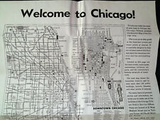 1960's Chicago Tribune Advertising Map of Chicago
-
$20.71 GBP
 Rand-McNally state map: ILLINOIS - c.1995 - paper - highway -
-
$19.01 GBP
 USGS Topographic Map PADUCAH Kentucky Illinois Missouri Indiana - 1987 - 250K -
-
$23.91 GBP
 1979 Book, Soil Survey of Kankakee County, Illinois, With Fold Out Maps
-
$18.77 GBP
 USGS Topographic Map ALEDO Illinois-Iowa 1989 - 100K -
-
$7.17 GBP
 Rare National Geographic Folding Map of Illinois Copyright 1931 Free Ship! #5B
-
$7.93 GBP
 1972 ILLINOIS PHILLIPS 66 Gasoline Company Folded Road Map
-
$3.99 GBP
 USGS Topographic Map CAPE GIRARDEAU - Missouri Illinois Kentucky - 1986 - 100K -
-
$13.55 GBP
 1931 National Geographic Map Illinois
-
$35.87 GBP
 Folded Map Mineral Industries Illinois Chicago Decatur Springfield Joliet 1927
-
$31.80 GBP
 Antique 1903 Map McLean County Illinois Bloomington Normal 46"X35" #21040
-
$59.62 GBP
 Antique 1903 Map Sangamon County Illinois Springfield Shelbytown 45"X34" #21036
-
$8.37 GBP
 Rand-McNally City Road Map: CHICAGO & VICINITY, Illinois ©1997 with Index
-
$10.35 GBP
 Rand McNally Chicago & Vicinity Illinois Map
-
$10.35 GBP
 1998 Illinois Historic Route 66
-
$31.88 GBP
 Mississippi River, Revetment of Banks Below Cairo, Illinois, 1912 - With Map
-
$10.35 GBP
 1991-92 Illinois Official Highway Map
-
$47.82 GBP
 ILLINOIS 1941 RAILROAD AND AUTO ROAD MAP, RAND McNLLY POCKET MAPS
-
$10.35 GBP
 2003-2004 Illinois Official Highway Map
-
$19.10 GBP
 Illinois White County Map c1901 Q7#54
-
$25.47 GBP
 Illinois White County Phillips Township c1901 Double Page Q7#49
-
$25.47 GBP
 Illinois White County Gray Township c1901 Double Page Q7#45
-
$25.47 GBP
 Illinois White County Hawthorne Township c1901 Double Page Q7#46


