 Antiques (UK)
-
$31.20 GBP

 1956 Maryland Map Washington DC Baltimore Annapolis Wilmington Easton Cambridge
-
$100.30 GBP
 Vintage New York Map Delaware and Hudson River Canal w/Railroads Mines 1828 1898
-
$16.05 GBP
 Original Vintage Map of the Delaware, Lackawanna & Western Railroad ~ 1910
-
$16.05 GBP
 Original Vintage Map of the Delaware & Hudson Railroad System ~ 1910
-
$49.00 GBP
 VINTAGE ADMIRALTY CHART. No.266. CHESAPEAKE BAY to BARNEGAT INLET. 1923 Edition.
-
$49.00 GBP
 VINTAGE ADMIRALTY CHART. No.2563. DELAWARE RIVER APPROACHES. 1961 Edition.
-
$14.44 GBP
 1928 ORIGINAL VINTAGE MAP OF MARYLAND AND DELAWARE / WASHINGTON D.C.
-
$14.40 GBP
 1930s Vintage Map of Maryland Antique Maryland & Delaware Map Wall Art Decor
-
$8.02 GBP
 Original 1925 Map MARYLAND DELAWARE DISTRICT OF COLUMBIA Washington Baltimore
-
$29.99 GBP
 VINTAGE ADMIRALTY CHART CAPE BRETON TO DELAWARE BAY
-
$36.87 GBP
 1932 Colorful Pictorial Map ~ PENNSYLVANIA - NEW JERSEY by BERTA & ELMER HADER
-
$10.43 GBP
 1943 Vintage Map - The Thirteen Colonies - New York City Boston Charleston
-
$40.12 GBP
 Vintage Original ca 1860s Johnson's Atlas Map of Maryland & Delaware Inset of DC
-
$16.05 GBP
 Original Vintage Map of the Delaware & Hudson Railroad System ~ 1910
-
$16.05 GBP
 Original Vintage Map of the Delaware, Lackawanna & Western RR & Connections 1917
-
$16.05 GBP
 Original Vintage Map of the Delaware, Lackawanna & Western Railroad - 1910
-
$12.83 GBP
 Vintage MARYLAND Map Topographic Original Antique Delaware Washington DC
-
$16.60 GBP
 1938 Colorful Pictorial Map ~ DELAWARE by Norman Reeves for 1939 World's Fair
-
$8.83 GBP
 Advertising/Service Card and Map, New York, Buffalo, Statler Garage Delaware
-
$22.43 GBP
 New Castle County Delaware 1962 Maintenance Map ~ Original Vintage ~ 19" x 24" b
-
$16.60 GBP
 1938 Colorful Pictorial Map ~ DELAWARE by Norman Reeves ~ 1939 World's Fair
-
$36.07 GBP
 Wilmington South Delaware 1961 Original Vintage USGS Topo Map
-
$24.03 GBP
 New Castle County Delaware 1962 Maintenance Map ~ Original Vintage ~ 19" x 24" a
-
$52.15 GBP
 USGS 15' topographic map, Wilmington, DE & NJ; 1906 edition, reprinted 1951
-
$9.59 GBP
 Vintage MARYLAND Map Wall Art Topographic Original 1920s Antique Delaware
-
$8.79 GBP
 Vintage MARYLAND Map of Delaware Wall Art Decor 1940s Original Ellicott City
-
$21.12 GBP
 Old 1931 Pictorial Map ~ DELAWARE by P.S. JOHST ~ Free S&H
-
$24.07 GBP
 Vintage S&MM 1978 Framed 12X18 Industrial Sales Map#5 South Atlantic States
-
$16.05 GBP
 Original Vintage Map of the Delaware & Hudson Railroad System ~ 1910
-
$16.05 GBP
 Original Vintage Map of the Delaware & Hudson Railroad System, 1926
-
$16.05 GBP
 Original Vintage Map of The Delaware, Lackawanna & Western R.R., 1904
-
$16.05 GBP
 Original Vintage Map of The Delaware & Hudson Railroad System, 1904
-
$14.44 GBP
 1950s DELAWARE Picture Map Vintage Animated Delaware State Map BW 2333
-
$5.61 GBP
 map of n jersey pennsylvania delaware and maryland by s g goodrich
-
$19.89 GBP
 1945 Two-Sided Color Railroad Map DE/MD/MA/RI Hammond 9.25x12.25"
-
$36.87 GBP
 Vintage 1938 Colorful Pictorial Map ~ DELAWARE by Ruth Taylor ~ Free S&H
-
$22.43 GBP
 Kent County Delaware 1962 Maintenance Map ~ Original Vintage ~ 19" x 24" b
-
$24.03 GBP
 Kent County Delaware 1962 Maintenance Map ~ Original Vintage ~ 19" x 24" a
-
$16.05 GBP
 Original Vintage Map of the Delaware, Lackawanna & Western Railroad ~ 1910
-
$16.05 GBP
 Original Vintage Map of the Delaware & Hudson Railroad System - 1910
-
$16.60 GBP
 1959 Picture / Pictorial Map Geography of DELAWARE by PS JOHST - VERNON QUINN
-
$10.42 GBP
 USGS Index to Topographic Maps of Maryland April 1979 Geological Survey
-
$14.40 GBP
 Vintage Original 1959 Turnpikes of Eastern US United States 14" x 8.5" Map
-
$8.02 GBP
 Map of Maryland, Deleware and District of Columbia 1925
-
$16.60 GBP
 Vintage 1950 Atlas Map ~ MARYLAND - DELAWARE ~ Old & Authentic ~ Free S&H
-
$160.49 GBP
 Delaware City Quadrangle - Delaware - New Jersey - Map
-
$32.06 GBP
 Wilmington North Delaware 1975 Original Vintage USGS Topo Map
-
$38.93 GBP
 1867 S. Augustus Mitchell ATLAS MAP New Jersey Maryland Delaware 15" handcolored
-
$17.37 GBP
 Alexis USA Universal GPS Grid Road Map: PENNYSYLVANIA - PENN - PA -
-
$19.16 GBP
 Rand-McNally regional state map: EASTERN UNITED STATES © 1993 -BAD-
-
$12.24 GBP
 1946 Antique DELAWARE State Picture Map Animated Map of Delaware 7857
-
$28.05 GBP
 Frederica Delaware 1957 Original Vintage USGS Topo Map
-
$20.86 GBP
 Rand-McNally regional state map: EASTERN UNITED STATES © 1993
-
$22.28 GBP
 Rand-McNally regional map: PHILADELPHIA & Vicinity Pennsylvania © 1997 -Index-
-
$10.02 GBP
 DELAWARE, United States - 1950s State Map
-
$10.39 GBP
 Delaware Vintage Pictorial Map (Small/Index Card size)
-
$12.04 GBP
 1939 Marcus Hook Quadrangle Topographic Original PA DE NJ Vintage Map Nice
-
$20.67 GBP
 Rand-McNally regional map: PHILADELPHIA & VICINITY © 1993 Delaware Valley - Love
-
$16.05 GBP
 Vintage U.S. Coast & Geodetic Survey Map Cape Henlopen & Delaware Breakwater '38
-
$682.10 GBP
 U S Geological Survey State Transportation Zone edition map set Railroad 81 pcs.
-
$13.24 GBP
 1986 Trucker’s Wilmapco Region Original Vintage Map For DE, MD, NJ, PA
-
$32.06 GBP
 Cedar Creek Delaware 1944 Original Vintage USGS Topo Map
-
$9.63 GBP
 vintage 1939 atlas map of Maine & Maryland Delaware 11x14 ready to frame
-
$6.20 GBP
 Vintage Atlas State Map Color Page Maine or Maryland Delaware 9inx12in
-
$120.36 GBP
 Plat Book of Delaware County Iowa 1954 (E10)
-
$24.07 GBP
 LITTLE CREEK DELAWARE ORIGINAL 1956 USGS QUADRANGLE 27X22 MAP EXCELLENT COND.
-
$144.40 GBP
 1942 DELAWARE CO PA SWARTHMORE COLLEGE FRATERNITIES SENIOR & JUNIOR HS ATLAS MAP
-
$48.15 GBP
 MARYLAND, DELAWARE 1941 RAILROAD AND AUTO ROAD MAP, RAND McNLLY POCKET MAPS
-
$140.39 GBP
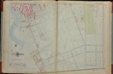
 1901 WILMINGTON DELAWARE CLAYTON ST-CHRISTIANA RIVER & ELM ST-CITYLINE ATLAS MAP
-
$140.39 GBP
 1901 WILMINGTON DELAWARE CHRISTIANA RIVER - CHRISTIANA AVE & CITY LINE ATLAS MAP
-
$140.39 GBP
 1901 WILMINGTON DEL. BRANDYWINE RIVER-CITYLINE AND MARKET ST-RAILROAD ATLAS MAP
-
$140.39 GBP
 1901 WILMINGTON DELAWARE FAIRGROUNDS-CITYLINE & DEL. RIVER-COMMERCE ST ATLAS MAP
-
$140.39 GBP
 1901 WILMINGTON DELAWARE DUPONT ST TO ADAMS ST AND FIFTH ST TO ELM ST ATLAS MAP
-
$140.39 GBP
 1901 WILMINGTON DELAWARE WEST ST TO KIRKWOOD ST AND 16th ST TO 10th ST ATLAS MAP
-
$140.39 GBP
 1901 WILMINGTON DELAWARE KIRKWOOD ST TO DURE ST AND 16th ST TO 10th ST ATLAS MAP
-
$140.39 GBP
 1901 WILMINGTON DELAWARE - INDEX - BAIST ATLAS MAP
-
$140.39 GBP
 1901 WILMINGTON DELAWARE ADAMS ST-KING ST & FIFTH ST-CHRISTIANA RIVER ATLAS MAP
-
$80.21 GBP
 1901 WILMINGTON DELAWARE - TITLE PAGE - BAIST ATLAS MAP
-
$140.39 GBP
 1901 WILMINGTON DELAWARE CHRISTIANA RIVER - KING ST & FIFTH ST - BAIST ATLAS MAP
-
$140.39 GBP
 1901 WILMINGTON DELAWARE POPLAR ST-BRANDYWINE RIVER & TENTH - FIFTH ST ATLAS MAP
-
$140.39 GBP
 1901 WILMINGTON DELAWARE BROOME ST-JEFFERSON ST AND TENTH ST-FIFTH ST ATLAS MAP
-
$140.39 GBP
 1901 WILMINGTON DELAWARE JEFFERSON ST-POPLAR ST AND TENTH ST-FIFTH ST ATLAS MAP
-
$140.39 GBP
 1901 WILMINGTON DELAWARE JESSUP RD - 36th ST AND CITY LINE - MARKET ST ATLAS MAP
-
$140.39 GBP
 1901 WILMINGTON DELAWARE MT SALEM LANE-FRANKLIN ST & CITY LINE-13th ST ATLAS MAP
-
$140.39 GBP
 1901 WILMINGTON DELAWARE CLEVELAND ST-BROOME ST & 12th ST-LANCASTER AV ATLAS MAP
-
$140.39 GBP
 1901 WILMINGTON DELAWARE BRANDYWINE CEMETARY-10thST & FRANKLIN-WEST ST ATLAS MAP
-
$17.45 GBP
 Alexis USA Universal GPS Grid Road Map: WEST VIRGINIA - DELAWARE - MARYLAND


