 Antiques (UK)
-
$200.00 GBP

 17th Century Map Of Cornwall By Robert Morden
-
$35.00 GBP
 100% ORIGINAL CORNWALL FOX HUNTING MAP BY HOBSON C1860/S VGC COLOURED
-
$6.50 GBP
 1902 Map of Cornwall Devon Dorset Channel Island antique vintage Britannica 10th
-
$75.00 GBP
 14 Antique English County Maps Bundle, Hand Coloured 19thC, B&W, Hand Coloured
-
$3.25 GBP
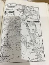
 VINTAGE SEA CHART / NAUTICAL MAP 1961 - The Wash - To Frame?
-
$30.00 GBP
 Vintage map of Cornwall, by Christopher sexton, dated 1575.
-
$45.00 GBP
 John Speed MAP “ The Kingdom Of England” -1646 & Cornwall 1610
-
$3.25 GBP
 VINTAGE SEA CHART / NAUTICAL MAP 1961 - TORQUAY & BRIXHAM Harbours - To Frame?
-
$14.00 GBP
 Devon & Cornwall Vintage Maps & Guides Inc. 1950 Bartholomews Exmoor & Dartmoor
-
$5.50 GBP
 3 Vintage OS Cloth Maps, Cornwall-Lands End,Truro & Falmouth, Newquay & Padstow
-
$9.99 GBP
 VINTAGE 1930 LANDS ENDS CORNWALL AREA PLAN Colour Map - Mounted For Framing
-
$3.25 GBP
 VINTAGE SEA CHART / NAUTICAL MAP 1961 Ireland - Westport Bay - To Frame?
-
$75.00 GBP
 Antique map of Cornwall by Richard Blome 1715
-
$39.13 GBP
 1889 Switzerland Map ORIGINAL Zurich Geneva Bern Cantons Townships Railroads
-
$49.00 GBP
 ANTIQUE ADMIRALTY CHART. No.1178. TREVOSE HEAD to BULL POINT. 1920 Edition.
-
$49.00 GBP
 ANTIQUE ADMIRALTY CHART. No.1564. WHITSAND BAY, CORNWALL. 1890 Edition.
-
$85.00 GBP
 Antique Map of South West England by Petrus Bertius 1618
-
$3.25 GBP
 VINTAGE SEA CHART / NAUTICAL MAP 1961 - Mersea Quarters- To Frame?
-
$105.00 GBP
 Antique Map of Cornwall by John Cary 1813
-
$3.25 GBP
 VINTAGE SEA CHART / NAUTICAL MAP 1961 - Salcombe - To Frame?
-
$3.25 GBP
 VINTAGE SEA CHART / NAUTICAL MAP 1961 - Holland - Flushing Breskens Groningen
-
$18.99 GBP
 Perranworthal, Gwennap, Ponsanooth, Perranwell, old map Cornwall 1908: 64 SW
-
$24.99 GBP
 DEVON CORNWALL PLYMOUTH LOOE BY EMANUEL BOWEN c1720 GENUINE ANTIQUE MAP
-
$3.25 GBP
 VINTAGE SEA CHART / NAUTICAL MAP 1961 - River Dart - Devon - To Frame?
-
$75.00 GBP
 Emanuel Bowen : A Map of Cornwall. 1720
-
$3.25 GBP
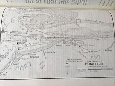 VINTAGE SEA CHART / NAUTICAL MAP 1961 - Honfleur
-
$3.25 GBP
 VINTAGE SEA CHART / NAUTICAL MAP 1961 - Holland - Delfzul, Langeoog, Ijmuiden
-
$8.50 GBP
 1900s Cornwall Bartholomew's Reduced Survey Bedford Hertford Sheet 25
-
$59.00 GBP
 ANTIQUE ADMIRALTY CHART. No.442. LIZARD HEAD to START POINT. 1913 Edition.
-
$245.00 GBP
 SOUTH WEST ENGLAND, WALES, 'Regni Angliae', original antique map, De Wit, c.1680
-
$49.00 GBP
 VINTAGE ADMIRALTY CHART. No. 1168. NORTH COASTS of DEVON, CORNWALL. 1954 Edn.
-
$450.00 GBP
 100% ORIGINAL LARGE CORNWALL MAP BY J BLAEU C1646 HAND COLOURED VGC
-
$18.99 GBP
 Calstock, old map Cornwall 1907: 30SW
-
$65.00 GBP
 Antique map of Cornwall by Alexander Hogg and Thomas Conder 1784
-
$3.25 GBP
 VINTAGE SEA CHART / NAUTICAL MAP 1961 - Hamble River - To Frame?
-
$3.25 GBP
 VINTAGE SEA CHART / NAUTICAL MAP 1961 Ireland - Teelin & Killybegs Harbours
-
$3.25 GBP
 VINTAGE SEA CHART / NAUTICAL MAP 1961 Milford Haven X 4 Charts
-
$9.99 GBP
 VINTAGE 1930 LIZARD POINT CORNWALL AREA PLAN Colour Map - Mounted For Framing
-
$49.99 GBP
 Old Ordnance Survey Map of the Neighbourhood of Lizard Scale One Inch to a Mile
-
$31.13 GBP
 1897 England and Wales Map Cornwall Dorsey Cardiff Portsmouth Hastings Bristol
-
$3.25 GBP
 VINTAGE SEA CHART / NAUTICAL MAP 1961 - Lowestoft Harbour & Great Yarmouth Haven
-
$75.00 GBP
 Devon Cornwall coast profile Salcombe Plymouth Fowey Lizard. MOUNT/PAGE 1758 map
-
$3.25 GBP
 VINTAGE SEA CHART / NAUTICAL MAP 1961 - Rivers ALDE & ORE - To Frame?
-
$15.00 GBP
 Lovely Rare Vintage Bartholomew's New Reduced Survey Cornwall Map Sheet 37 A786
-
$4.00 GBP
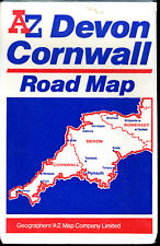 A-to-Z Map - Devon & Cornwall
-
$18.00 GBP
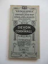 1923 DEVON & CORNWALL Cloth Backed Folding Road Map 'GEOGRAPHIA' No.8 4/6Net
-
$3.25 GBP
 VINTAGE SEA CHART / NAUTICAL MAP 1961 - YEALM RIVER - To Frame?
-
$3.95 GBP
 Fine, Ordnance Survey One-inch map - Sheet 189, Land's End. Cloth Edition 1946
-
$18.99 GBP
 Tywardreath, Par Green, St Blazeys , Polkerris, old map Cornwall 1908 51 NE
-
$2.99 GBP
 VINTAGE SEA CHART / NAUTICAL MAP 1961 - Ireland - Kinsale - To Frame?
-
$3.25 GBP
 VINTAGE SEA CHART / NAUTICAL MAP 1961 - COWES & River Medina - To Frame?
-
$7.50 GBP
 BUDE, Cornwall, rare WW2 Naval Map 1943
-
$14.95 GBP
 1898 North Devon, East Cornwall, Barnstaple & Bude Bay large map. 125 years old.
-
$3.25 GBP
 VINTAGE SEA CHART / NAUTICAL MAP 1961 - Newhaven & Littlehampton - To Frame?
-
$18.99 GBP
 Landulph, Cargreen, old map Cornwall 1907: 38SW
-
$18.99 GBP
 St Austell , St Mewan, old map Cornwall 1938: 50NE
-
$3.25 GBP
 VINTAGE SEA CHART / NAUTICAL MAP 1961 - Swansea & Barry - To Frame?
-
$9.99 GBP
 Vintage WW2 Truro St Austell Cornwall l940 Linen Backed OS Sheet 143
-
$3.25 GBP
 VINTAGE SEA CHART / NAUTICAL MAP 1961 - Bembridge - To Frame?
-
$3.25 GBP
 VINTAGE SEA CHART / NAUTICAL MAP 1961 - TEIGNMOUTH - To Frame?
-
$3.25 GBP
 VINTAGE SEA CHART / NAUTICAL MAP 1961 - Poole / Brownsea Island - To Frame?
-
$125.00 GBP
 1693 Greenvile Collins Sea Chart Lands End Cornwall Scilly Islands Antique Map
-
$18.99 GBP
 Higher Boscaswell, Trewellard, Carnyorth, Botallack, old map Cornwall 1908: 67SW
-
$18.99 GBP
 St Dennis, Nanpean, Treviscoe, Whitemoor, Cleers, old map Cornwall 1907 41 SW
-
$18.99 GBP
 St Neot (northeast), West Draynes, old map Cornwall 1907: 27SE
-
$15.99 GBP
 Old map Environs of Truro, Cornwall - 1898
-
$3.25 GBP
 VINTAGE SEA CHART / NAUTICAL MAP 1961 - Portland And Weymouth - To Frame?
-
$19.99 GBP
 1955 Antique Map; Admiralty Chart 2649 English Channel Western Portion
-
$3.25 GBP
 VINTAGE SEA CHART / NAUTICAL MAP 1961 - Dover Ramsgate Folkestone - To Frame?
-
$22.00 GBP
 TOURING MAP OF DEVON AND CORNWALL. South West England. WARD LOCK 1951 old
-
$3.25 GBP
 VINTAGE SEA CHART / NAUTICAL MAP 1961 Ireland - Portrush & Lough Larne To Frame?
-
$3.25 GBP
 VINTAGE SEA CHART / NAUTICAL MAP 1961 Isle Of Man - Various Locations
-
$18.99 GBP
 Polgooth, Sticker, New Mills, old map Cornwall 1907: 50SE
-
$79.00 GBP
 EXPERIMENTAL RADAR ADMIRALTY CHART. No.2649. ENGLISH CHANNEL. 1952 Edn.
-
$18.99 GBP
 Pentewan, St Ewe (northeast), old map Cornwall 1907: 59NE
-
$16.00 GBP
 GEORGE COLE c1835: Cornwall
-
$3.25 GBP
 VINTAGE SEA CHART / NAUTICAL MAP 1961 - River Blackwater - To Frame?
-
$3.25 GBP
 VINTAGE SEA CHART / NAUTICAL MAP 1961 Ireland Arklow Ardglass Killough Rosslare
-
$3.49 GBP
 ST.GERMANS or LYNHER RIVER; SALTASH, Cornwall WW2 Naval Military Map 1944
-
$18.99 GBP
 Old map of Torpoint, Devonport 1919 - Cornwall, repro 46-SW
-
$3.25 GBP
 VINTAGE SEA CHART / NAUTICAL MAP 1961 - Colne River Brightlingsea - To Frame?
-
$18.99 GBP
 Perranuthnoe, St Hilary, Goldsithney, old map Cornwall 1908 75 NW
-
$345.00 GBP
 CORNWALL, Saxton & Kip, Camden original antique map 1637
-
$3.25 GBP
 VINTAGE SEA CHART / NAUTICAL MAP 1961 - Ireland - Glengariff & Bantry Harbours
-
$18.99 GBP
 Manaccan, Helford, old map Cornwall 1908: 77SW
-
$3.25 GBP
 VINTAGE SEA CHART / NAUTICAL MAP 1961 - Leith Kirkcaldy Granton Grangemouth
-
$12.99 GBP
 Bacon's Large Print Map of South West England (c1900) Devon & Cornwall, Linen
-
$3.25 GBP
 VINTAGE SEA CHART / NAUTICAL MAP 1961 - France - L’Abervrac’h
-
$800.00 GBP
 Antique Map "The Spanish Armada entering the English Channel" John Pine, 1739
-
$3.25 GBP
 VINTAGE SEA CHART / NAUTICAL MAP 1961 - France - Four Channel
-
$3.25 GBP
 VINTAGE SEA CHART / NAUTICAL MAP 1961 - St Malo France
-
$3.25 GBP
 VINTAGE SEA CHART / NAUTICAL MAP 1961 - Ireland Kilmakilloge Ardgroom & Sneem
-
$3.25 GBP
 VINTAGE SEA CHART / NAUTICAL MAP 1961 - France - Morbihan
-
$3.25 GBP
 VINTAGE SEA CHART / NAUTICAL MAP 1961 - France - Douarnenez & Audierne
-
$25.00 GBP
 Antique map of Cornwall by Thomas Moules 1842
-
$3.25 GBP
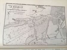 VINTAGE SEA CHART / NAUTICAL MAP 1961 - France - La Rochelle
-
$5.00 GBP
 1924 LAND'S END and LIZARD Cornwall - Ordnance Survey Contoured Cloth Map #146
-
$165.00 GBP
 Antique map of Cornwall by Robert Morden 1722
-
$17.50 GBP
 Thomas Moule C1835 Antique Map. Cornwall
-
$31.13 GBP
 OLD 1899 Southern England Wales Map London Cornwall STEAMSHIPS RAILWAYS PORTS


