 Antiques (UK)
-
$98.78 GBP

 1634 Nicolas Tassin Antique Map Bordeaux River Garonne Nouvelle-Aquitaine France
-
$40.24 GBP
 1873 Henry Taunt River Thames Map, Pangbour, Purley Hall, Whitchurch-on-Thames
-
$73.17 GBP
 1873 Henry Taunt River Thames Map, Oxford and Cambridge Boat Race Course, London
-
$51.22 GBP
 1873 Henry Taunt River Thames Map, Hampton Court Thames Ditton Surbiton Kingston
-
$25.00 GBP
 Rare antique road map YORKSHIRE, TOPCLIFFE, RIVER SWALE, Mostyn Armstrong, 1776
-
$29.99 GBP
 1794 Antique Map; Canals, Rivers, Roads etc around Manchester after Mutlow
-
$24.99 GBP
 1795 Antique Map; Plan of the Huddersfield to Ashton Canal after Mutlow
-
$24.99 GBP
 1795 Antique Map; Bridgewater Canal, Manchester to Runcorn after Mutlow
-
$29.99 GBP
 1833 Antique map: Environs of Windsor Extending 14 to 18 miles - George Cruchley
-
$35.00 GBP
 Surrey antique map River Mole, 1840. Very nice map.
-
$12.99 GBP
 COLERAINE VINTAGE MAP PORTNA, CARNROE LOCK, LOUGH BEG, RIVER BANN, LOUGH NEAGH
-
$19.99 GBP
 1887 Antique map: The Thames from its source to Windsor by Stanford
-
$6.50 GBP
 Map of the Estuary of the Forth Scotland c1895 antique chromolithograph
-
$40.24 GBP
 1873 Henry Taunt River Thames Map, Burcot, Shillingford, Warborough, Dorchester
-
$40.24 GBP
 1873 Henry Taunt River Thames Map, Cleeve Goring Streatley Basildon Oxfordshire
-
$40.24 GBP
 1873 Henry Taunt River Thames Map, Shillingford Bridge, Benson, Wallingford
-
$17.50 GBP
 Original antique map, BELGIUM, BRUGES, ESCAUT / SCHELDT RIVER, Duvotenay, 1859
-
$40.24 GBP
 1873 Henry Taunt River Thames Map, Mapledurham, Purley, Norcot Reading Caversham
-
$27.44 GBP
 1873 Henry Taunt River Thames Map, Richmond, Twickenham Park Isleworth Brentford
-
$34.76 GBP
 1873 Henry Taunt River Thames Map, Cholsey, North Stoke, Little Stoke, Moulsford
-
$40.24 GBP
 1873 Henry Taunt River Thames Map, Boveney, Dedworth, Windsor Racecourse, Clewer
-
$40.24 GBP
 1873 Henry Taunt River Thames Map, Abingdon, Culham, Sutton Courtenay, Appleford
-
$10.98 GBP
 1719 Mallet Antique Map "Fort Tekcki" Terki, Tumenka river (Terek) Russia
-
$10.32 GBP
 ORIGINL 1855 HAND-COLORD Colton Atlas Map:BRAZIL,GUYANA,RIVERS,COASTAL,Mts,TOWNS
-
$18.29 GBP
 1873 Henry Taunt River Thames Map, Oxford to London
-
$51.22 GBP
 1873 Henry Taunt River Thames Map, Henley Remenham Aston Medmenham Mill End
-
$51.22 GBP
 1873 Henry Taunt River Thames Map, Hurely Harleyford Bisham Marlow Cookham Dean
-
$51.22 GBP
 1873 Henry Taunt River Thames Map, Teddington, Twickenham, Richmond, Petersham
-
$28.92 GBP
 1835 M J Thiers Large Antique Map of Rhine & Danube Rivers Southern Germany
-
$28.91 GBP
 1835 M J Thiers Large Antique Map of Danube River Hochstadt Germany, Napoleon
-
$24.54 GBP
 1835 M Thiers Large Antique Map The Course of River Rhine during Napoleon Wars
-
$32.93 GBP
 1683 Manesson Mallet Antique Map "Cercle du Bas-Rhin" River Rhine Germany
-
$13.55 GBP
 Oldenburg & the Weser River Basin - Original 1888 Map by Meyers. Germany
-
$51.22 GBP
 1873 Henry Taunt River Thames Map, Eton, Windsor, Frogmore, Datchet, Berkshire
-
$88.00 GBP
 1881 MAP MONMOUTHSHIRE RIVER WYE NEWPORT ABERGAVENNY PONTYPOOL
-
$19.92 GBP
 Antique German Map of Coblenz Germany on the Rhine River
-
$51.22 GBP
 1873 Henry Taunt River Thames Map, Boulters Lock, Taplow, Maidenhead, Bray
-
$25.49 GBP
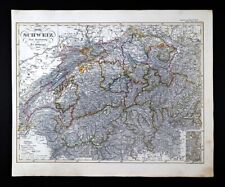 1844 Stieler & Stulpnagel Map Switzerland Geneva Zurich Lucerne Basel Bern Alps
-
$40.24 GBP
 1873 Henry Taunt River Thames Map, Lower Caversham, Sonning Eye Sonning Shiplake
-
$47.81 GBP
 1845 Stieler Map Rhein River Rheinland Germany Frankfurt Strassburg Black Forest
-
$15.94 GBP
 1885 RARE ORIGINAL MAP LOWER SAXONY GERMANY ESTUARY OF ELBE river map NEUHAUS
-
$192.86 GBP
 Rhine river old map Totius Fluminis Rheni Holland German. Frederic de Wit 1680
-
$127.51 GBP
 ALSACE RHINE RIVER FRANCE GERMANY 1710 JB HOMANN LARGE ANTIQUE MAP 18TH CENTURY
-
$98.42 GBP
 John Speed 1607 Map: 12x9" BRITAIN AS IT WAS DIVIDED - Matted and Framed 18x15"
-
$32.67 GBP
 1893 Antique Map France , Provinces Rivers Railroad Lines
-
$55.78 GBP
 The North German Confederation and Prussia 1860 Original Map
-
$47.81 GBP
 Prussia The Lower Course & Estuary Of The River Oder 1860 Original Map


