 Antiques (UK)
-
$3.89 GBP

 Ordnance Survey Archaeological Map of Monastic Britain - South Sheet with Index
-
$6.50 GBP
 Manchester Map Ordnance Survey. 1953. No. 101.
-
$40.00 GBP
 VINTAGE ADMIRALTY MAP. No.2649. ENGLISH CHANNEL, WESTERN PORTION 1955
-
$3.95 GBP
![1950s Wonderful Britain map, Places to visit, South Wales, 26x20cm [26760]](https://i.ebayimg.com/thumbs/images/g/f9YAAOSwp~9lNj-S/s-l225.jpg) 1950s Wonderful Britain map, Places to visit, South Wales, 26x20cm [26760]
1950s Wonderful Britain map, Places to visit, South Wales, 26x20cm [26760]
-
$9.99 GBP
 Vintage Admiralty Nautical Navigation Sea Chart Dover Harbour No. 1698 (1952)
-
$5.50 GBP
 Sussex 1950s Vintage BMC County Road Map And Gazetteer No 6
-
$3.89 GBP
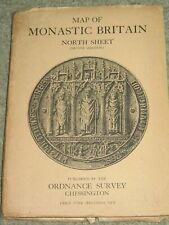 Ordnance Survey Archaeological Map of Monastic Britain - North Sheet
-
$35.00 GBP
 1952 SURVEY OF CYPRUS ADMINISTRATION MAP
-
$5.00 GBP
 Vintage Map of Birmingham
-
$1.99 GBP
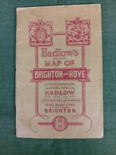
 Hadlow's Map of Brighton & Hove 1950s
-
$10.00 GBP
 Vintage Admiralty Chart 3750 England - River Crouch 1957 Edition
-
$3.49 GBP
 Vintage Bartholomew's half-inch contoured Cloth map No.32 Wharfdale
-
$4.90 GBP
 Hadlows Map Of Brighton And Hove. Good Condition.
-
$31.85 GBP
 Geological Map Of The British Islands 4th Edition Sir William Pugh 32” x 25”
-
$49.00 GBP
 VINTAGE ADMIRALTY CHART. No. 1168. NORTH COASTS of DEVON, CORNWALL. 1954 Edn.
-
$49.99 GBP
 Vintage sky and the outer hebrides RAF air information map 1952
-
$5.00 GBP
 Barnett's Havering Map - Street Map and Fold-Out Map 1950s - Romford Hornchurch+
-
$9.99 GBP
 Vintage Admiralty Sea Chart The Solent Nab Tower To Spithead No.L(D5)2050 (1955)
-
$9.99 GBP
 Vintage Admiralty Nautical Chart Sheerness and Approaches No. 3683 (1954)
-
$22.00 GBP
 Job lot of 7 vintage Ordinance Survey Maps, 1956-78, London, Scotland, Ashington
-
$14.00 GBP
 Devon & Cornwall Vintage Maps & Guides Inc. 1950 Bartholomews Exmoor & Dartmoor
-
$9.99 GBP
 Vintage Admiralty Nautical Sea Chart The Downs South East No. L(D5) 1828 (1958)
-
$5.00 GBP
 c1950 OLIVER'S ROAD GUIDE and MAP For MOTORISTS Routes & Distance From LIVERPOOL
-
$4.99 GBP
 OLD LARGE 38" x 30" NATIONAL GEOGRAPHIC MAP 1950? very good condition
-
$5.75 GBP
 Vintage AA Map of France, Belgium, Switzerland & Adjoining Territories Folding
-
$5.00 GBP
 c1950 OLIVER'S ROAD GUIDE and MAP For MOTORISTS Routes & Distance From LIVERPOOL
-
$8.00 GBP
 Browne and Nolan's Map of Dublin and Suburbs c.1950
-
$7.99 GBP
 Dolgelley Vintage Map North West Wales Dated 1953 Ordnance Survey 116 Large Maps
-
$39.00 GBP
 ATHENS, PIRAIEVS, POROS. GREECE. ADMIRALTY SEA CHART. No.1657. 1963 Edition.
-
$20.00 GBP
 1950 Vintage Folding Guide Map Ipswich Suffolk England 10.5" x 8"
-
$49.00 GBP
 VINTAGE ADMIRALTY CHART. No.2041. PORT of SOUTHAMPTON. 1957 Edition..
-
$20.00 GBP
 1952 Vintage Map National Parks Great Britain Concise Oxford Atlas 14.5" x 10 "
-
$12.50 GBP
 1951 Galway & Mayo Ireland Bartholomew's Map Quarter Inch to Mile
-
$149.97 GBP
 Esso Pictorial Map Of Denmark C.Bering Politikens Forlag Printed 1950s
-
$190.00 GBP
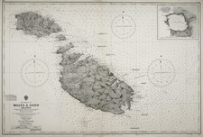 Nautical Chart "Malta & Gozo Islands" British Admiralty, 1954
-
$19.99 GBP
 Rare Vintage, Daily Telegraph Map Antarctica, 1950's, Polar collectable scott et
-
$9.99 GBP
 Vintage Admiralty Nautical Navigation Chart Edinburgh Channels No. 1605 (1956)
-
$3.49 GBP
![1950s Wonderful Britain map, Places to visit, Ayr & Argyll, 26x20cm [26638]](https://i.ebayimg.com/thumbs/images/g/jeYAAOSwNBJjwTxL/s-l225.jpg) 1950s Wonderful Britain map, Places to visit, Ayr & Argyll, 26x20cm [26638]
1950s Wonderful Britain map, Places to visit, Ayr & Argyll, 26x20cm [26638]
-
$499.95 GBP
 BEA BRITISH EUROPEAN AIRWAYS ORIGINAL VINTAGE ROUTE MAP AIRLINE POSTER 1958
-
$49.00 GBP
 VINTAGE ADMIRALTY CHART. No.1827. RIVER STOUR to RAMSGATE HARBOUR. 1959 Edition
-
$11.75 GBP
 Vintage Retro Ordnance Survey Map - Buckingham - 1 inch - No 146 - 1952
-
$7.99 GBP
 1952 HISTORICAL MAP SCOTLAND DEPICTING ARMS OF SCOTTISH FAMILY CLANS AND YEARS.
-
$19.99 GBP
 1956 Antique Map; Admiralty Chart # 1907, Cloch Point to Little Cumbrae, Striven
-
$6.99 GBP
 Vintage Bartholomew Map of Skye & Wester Ross (1956) 1/2 Inch, SCOTLAND, No. 54
-
$3.49 GBP
![1950s Wonderful Britain map, Places to visit, Aberdeen Dundee, 26x20cm [26640]](https://i.ebayimg.com/thumbs/images/g/iRUAAOSwnxBjwT9B/s-l225.jpg) 1950s Wonderful Britain map, Places to visit, Aberdeen Dundee, 26x20cm [26640]
1950s Wonderful Britain map, Places to visit, Aberdeen Dundee, 26x20cm [26640]
-
$79.00 GBP
 EXPERIMENTAL RADAR ADMIRALTY CHART. No.2649. ENGLISH CHANNEL. 1952 Edn.
-
$7.99 GBP
 Vintage Map Bala And Welshpool 1953 Large Map Ordnance Survey 117 Fold out
-
$18.99 GBP
 Admiralty Map of Portsmouth Harbour (#2631), Vintage 1959. 103cm x 70cm
-
$49.00 GBP
 VINTAGE ADMIRALTY CHART. No.1826. BURROW HEAD to LIVERPOOL . 1953 Edition.
-
$1.99 GBP
 County Road Map Of Hampshire By Geographer`s Map Co Ltd 1950s
-
$24.99 GBP
 Vintage Aberdeen Town Plan by Bartholomew (1958) Folding Map, Scotland, Scottish
-
$9.40 GBP
 Ordnance Survey Map - Chatham & Maidstone - 1 inch - No 172 - 1961? - Vintage
-
$12.50 GBP
 1951 Galway & Mayo Ireland Bartholomew's Map Quarter Inch to Mile
-
$20.00 GBP
 VINTAGE ADMIRALTY CHART Newport Weston Super/M River Usk Chepstow Bristol 1954
-
$9.99 GBP
 1954 Firth of Forth Scotland Map Bartholomew's OS Contoured Cloth No 46 Vintage
-
$19.99 GBP
 1958 Antique Map; Admiralty Chart # 2164 Firth Of Clyde To Large Channel
-
$49.00 GBP
 VINTAGE ADMIRALTY CHART. No.1460. VENEZIA, VENICE. 1958 Edition
-
$4.50 GBP
 Hereford ‘Seventh Series’ One Inch Ordnance Survey Map 1952 Sheet 142
-
$4.49 GBP
![1950s Ordnance Survey Cloth Map Snowdon, 1 Inch to mile **[25978]](https://i.ebayimg.com/thumbs/images/g/-KMAAOSwEkljU-xS/s-l225.jpg) 1950s Ordnance Survey Cloth Map Snowdon, 1 Inch to mile **[25978]
1950s Ordnance Survey Cloth Map Snowdon, 1 Inch to mile **[25978]
-
$26.00 GBP
 VINTAGE ADMIRALTY CHART. No.1859. KING ROAD, PORT OF BRISTOL. 1960 Edition.
-
$11.96 GBP
 Post WAR VTG 1950's JAPANESE/English~Bilingual 'MAP OF TOKYO'~29 1/2" x 40 1/2"~
-
$25.00 GBP
 1951 Vintage Folding Map Hampshire & Dorset John Bartholomew 10" x 6.5"
-
$11.50 GBP
 Vintage Ordnance Survey Map Winchester - 1" - No 168 - 7th Series - 1959
-
$48.50 GBP
 PICTORIAL MAP OF ESSEX c.1950, MINT CONDITION, by WAYFARER MAPS , WESTON, HERTS.
-
$49.00 GBP
 VINTAGE ADMIRALTY CHART. No.1796. BARRA HEAD to SKYE, & The SMALL ISLES.
-
$2.99 GBP
 2 VINTAGE BACON'S REVERSIBLE MOTORING MAP
-
$4.50 GBP
 Lancaster & Kendal ‘Seventh Series’ One Inch Ordnance Survey Map 1957 Sheet 89
-
$29.99 GBP
 1954 Antique Map; Admiralty Chart 1168 Plans of North Coasts of Devon & Cornwall
-
$24.99 GBP
 WORLD REFUGEE YEAR 1959-60 MAP by John Bartholomew, never bound in or used.
-
$39.99 GBP
 Admiralty Chart No.2615 - Portland to Christchurch - 1954 Edition
-
$14.00 GBP
 Vintage Historical Map of Scotland By L.G Bullock John Bartholomew & Sons LTD
-
$11.50 GBP
 Vintage Europe Road Atlas. Fold Out Maps Kummerly & Frey
-
$14.00 GBP
 5 X Vintage Dunlop UK Maps. 3 Large Folding Paper Maps & 2 Motorway Map Books.
-
$5.00 GBP
 The Up to-date Road Map of Essex Including New Arterial and By Pass Roads Cloth
-
$49.00 GBP
 VINTAGE ADMIRALTY CHART. No.1447. PORT OF DUBLIN. IRELAND 1951 Edition
-
$7.95 GBP
 North Wales Vintage Bartholomew's Map, Revised Half-Inch Contoured, Sheet 27
-
$14.00 GBP
 Admiralty Map: River Thames entrance, Edinburgh channels (#1605). Vintage 1956.
-
$8.00 GBP
 Vintage Ward Lock's Oban Skye Fort William - Maps Plans Illustrations
-
$19.99 GBP
 Vintage map Mountain Huts of the Eastern Alps D.A.V & O.A.V 1957
-
$15.00 GBP
 Set of 9 Vintage Bartholomew's revised half inch contoured maps
-
$17.99 GBP
 Admiralty Map of World surface currents (#5310), Vintage 1954. 70cm x 53cm.
-
$5.99 GBP
 Vintage Bartholomew Map of Mid Wales (1955) Welsh 1/2 Inch Paper Map, No. 22
-
$14.69 GBP
 The Autocar Map Users Companion For England And Wales
-
$4.50 GBP
 Bartholomew's Revised Half Inch Contoured Map on paper Sheet 5 New Forest 1955
-
$49.00 GBP
 ANTIQUE ADMIRALTY CHART. No.2234. SEA OF AZOV, BLACK SEA. 1920 Edition
-
$49.00 GBP
 VINTAGE ADMIRALTY CHART. No.442. LIZARD Pt. to STRAIGHT Pt.. 1956 Edition.
-
$15.00 GBP
 Original OS Map; 1:10,560; Sheet SK 94 SW; 1956; Barkston, Lincolnshire
-
$4.50 GBP
 Keswick ‘Seventh Series’ One Inch Ordnance Survey Map 1958 Sheet 82
-
$3.95 GBP
![1950s Wonderful Britain map, Places to visit, Liverpool, 26x20cm [26757]](https://i.ebayimg.com/thumbs/images/g/ysEAAOSwW89lNj4x/s-l225.jpg) 1950s Wonderful Britain map, Places to visit, Liverpool, 26x20cm [26757]
1950s Wonderful Britain map, Places to visit, Liverpool, 26x20cm [26757]
-
$5.99 GBP
 1950s Firth of Tay St ANDREWS VINTAGE MAP Bartholomew's Contoured Cloth back 49
-
$49.00 GBP
 VINTAGE ADMIRALTY CHART. No.1795. THE LITTLE MINCH. 1958 Edition.
-
$30.00 GBP
 Printed Vintage Map Denbigh&Flintshire Montgomery 43x36 Cm Glazed Herman Moll
-
$9.99 GBP
 Collection of Five Cloth Ordnance Survey Maps, Sheets 29, 93, 99, 102 & 104
-
$48.50 GBP
 NEW ZEALAND SHIPPING CO. LTD WORLD SERVICES & CONNECTING ROUTES. BARTHOLOMEW MAP
-
$19.99 GBP
 Orig 1956 DEWSBURY AREA Ordnance Survey Map (detailed every building shown)
-
$1.00 GBP
 Vintage Michelin map No. 90 for Corse ( Corcisca ) Dated 1949
-
$3.95 GBP
![1950s Wonderful Britain map, Places to visit, Northants, 26x20cm [26758]](https://i.ebayimg.com/thumbs/images/g/I90AAOSwFq5lNj6v/s-l225.jpg) 1950s Wonderful Britain map, Places to visit, Northants, 26x20cm [26758]
1950s Wonderful Britain map, Places to visit, Northants, 26x20cm [26758]
-
$19.99 GBP
 10 x Ordnance Survey 1:1250 Plans of the City of Salisbury (1950s and 60s)
-
$95.00 GBP
 Vintage Map : FINLAND - Porkkalanselkä to Söderskär 1959 - Large : 70x102cm
-
$32.00 GBP
VINTAGE ADMIRALTY CHART. No.1859. KING ROAD, PORT OF BRISTOL. 1960 Edition.


