Antiques (UK)
Antiques (US)
Antiquitäten (DE)
Antiquariato (IT)
Antiques (UK)
Antiquités (FR)
Antiques (CA)
Antiques (AU)
Antiques (UK)
/
Maps, Atlases & Globes
/
Europe Maps
/
1910-1919 Date Range, Cumberland County Europe Maps
NOTE: When you buy through our links, we may earn a commission.
Learn more*
Best Match
Newest
Ending
Lowest Price
Highest Price
Best Match
Newest
Ending
Lowest Price
Highest Price
S
M
L
XL
Share
Share
Twitter
Facebook
Email
Share
Pinterest
Facebook
Twitter
Email
$6.50 GBP
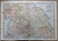
1902 Map of Yorkshire Westmorland Lancashire antique vintage Britannica 10th
Share
Pinterest
Facebook
Twitter
Email
$5.50 GBP
Bartholomew's Reduced Ordnance Survey Cumberland Map Circa 1918 Dissected Cloth
Share
Pinterest
Facebook
Twitter
Email
$44.00 GBP
1912 MAP ~ ENGLAND NORTH ~ CUMBERLAND NORTHUMBERLAND DURHAM YORK ETC
MORE
Cartographer/Publisher
John Bartholomew (2)
County
Cumberland
Date Range
1910-1919
Format
Atlas Map (1)
Folding Map (2)
Original/Reproduction
Antique Original (3)
Type
Ordnance Survey Map (1)
Political Map (1)
 Antiques (UK)