 Antiques (UK)
-
$40.00 GBP

 1911 Vintage Folding Map Plan of The Isle of Man John Bartholomew 14" x 11"
-
$40.00 GBP
 1921 Antique Folding Map Harrogate Knaresborough Wharfdale England 14.5" x 10.5"
-
$25.00 GBP
 1930 Vintage Folding D/S Map Land's End & The Lizard John Bartholomew 7.5" x 5"
-
$25.00 GBP
 1921 Antique Folding Map Ripon Fountains Nidderdale England 14" x 10.25"
-
$14.99 GBP
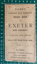 1900 Gall & Inglis / Cary: Eland's Cycling & Touring Road Map, Exeter & District
-
$9.99 GBP
 1900 Gall & Inglis / Cary: Dumfries District Map, Scotland
-
$14.99 GBP
 1910 Gall & Inglis / Cary: Easton's Touring & Motoring Map of Peebles & District
-
$11.99 GBP
 BRITISH ISLES Physical Charts - Antique Map 1902 by Bartholomew
-
$12.89 GBP
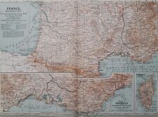 1903 South of France antique map. Marseille, Monpellier, Bordeaux & Corsica.
-
$14.95 GBP
 1920 ANTIQUE MAP - EXCURSIONSKARTE VON KANDERSTEG UND UMGEBUNG SWITZERLAND
-
$14.95 GBP
 1920 ANTIQUE MAP CLOTH TOURISTEN WANDERKARTE DOLOMITEN WESTLICHES BLATT AUSTRIA
-
$9.95 GBP
 1920 ANTIQUE MAP - RHATIKON FERWALL UND SILVRETTA GRUPPE AUSTRIA SWITZERLAND
-
$12.89 GBP
 1903 Northern France antique map. Paris, Reims, Chartres, Dijon & Orléans.
-
$20.00 GBP
 1930 Vintage Folding D/S Map Southampton & Bournemouth John Bartholomew
-
$19.99 GBP
 1902 British Isles Physical Map with Rainfall & Temperatures By John Bartholomew
-
$25.00 GBP
 1921 Antique Folding Map of Yorkshire England 9.5" x 8.75"
-
$19.99 GBP
 Antique Colour Map British Isles Physical GB U.K. 1904 Harmsworth Atlas 17
-
$19.99 GBP
 Edwardian Map of Greece, Crete and Samos (1902) ex Century Atlas of the World
-
$19.99 GBP
 Edwardian Map of Ireland & Dublin (1902) ex Century Atlas of the World - Irish
-
$19.99 GBP
 Edwardian Europe, European Map (1902) ex Century Atlas of the World, France, UK
-
$14.99 GBP
 Antique 1904 colour Map The Alps Physical Harmsworth Universal ATLAS
-
$19.99 GBP
 Edwardian Map of Denmark & Iceland, Faroe (1902) ex Century Atlas of the World
-
$19.99 GBP
 Edwardian Vicinity of London, England Map (1902) ex Century Atlas of the World
-
$14.99 GBP
 Edwardian Map of Poland 1667, 1772, 1793, 1795 (1902) Century Atlas of the World
-
$19.99 GBP
 Edwardian Map of Northern France & Paris (1902) ex Century Atlas of the World
-
$19.99 GBP
 Edwardian Map of Switzerland & Lichtenstein (1902) ex Century Atlas of the World
-
$14.99 GBP
 Edwardian Southern England and Wales Map (1902) ex Century Atlas of the World
-
$19.99 GBP
 Edwardian Map of The German Empire, East (1902) ex Century Atlas of the World
-
$100.06 GBP
 Vintage MAP of EAST COAST HARBORS of NEWFOUNDLAND,1908,3 Old Survey Maps,43"x29"
-
$28.00 GBP
 World War I WWI Great War Map of Pazardzhik Peshtera Area Bulgaria 1907 FREE POS
-
$28.00 GBP
 World War I WWI Great War Map of Samokov and Ihtiman Area Bulgaria 1901 FREE POS
-
$14.41 GBP
 1901 ANTIQUE PHYSICAL MAP OF EUROPE MOUNTAINS RIVERS
-
$19.99 GBP
 Edwardian Map of Netherlands, Belgium, Lux (1902) ex Century Atlas of the World
-
$19.99 GBP
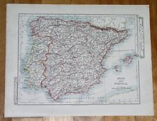
 Edwardian Map of Spain, Portugal & Andorra (1902) ex Century Atlas of the World
-
$19.99 GBP
 Edwardian Map of Russia, South & West Part (1902) ex Century Atlas of the World
-
$19.99 GBP
 Edwardian Map of Southern France & Corsica (1902) ex Century Atlas of the World
-
$31.22 GBP
 1900s Imperial Russian Climate color map of Russia
-
$19.99 GBP
 Edwardian Map of Italy, Northern Part (1902) ex Century Atlas of the World
-
$14.41 GBP
 1904 ORIGINAL ANTIQUE PHYSICAL MAP OF EUROPE / MOUNTAINS RIVERS
-
$12.81 GBP
 Europe - Original 1903 Dated Physical Map by Dodd Mead & Company. Antique
-
$19.99 GBP
 Edwardian Map of Italy, Central & Sicily (1902) ex Century Atlas of the World
-
$19.99 GBP
 Edwardian Map of Turkey & Balkans, Romania (1902) ex Century Atlas of the World
-
$27.99 GBP
 JUMAA I BALA old antique linen folded MAP OF TURKEY war office 1909 wall art
-
$19.99 GBP
 Edwardian Map of North Central France (1902) ex Century Atlas of the World
-
$20.81 GBP
 1910s Imperial Russian Antique map Hemispheres of Earth
-
$19.99 GBP
 Edwardian Map of Norway & Sweden, Stockholm (1902) ex Century Atlas of the World
-
$19.99 GBP
 Edwardian Northern England and Wales Map (1902) ex Century Atlas of the World
-
$19.99 GBP
 Edwardian Map of The German Empire, SW Part (1902) ex Century Atlas of the World
-
$19.99 GBP
 Edwardian Scotland & Shetland Islands Map (1902) ex Century Atlas of the World
-
$19.99 GBP
 Edwardian Map of Austria Hungary, Vienna (1902) ex Century Atlas of the World
-
$19.99 GBP
 Edwardian Map of The German Empire, North (1902) ex Century Atlas of the World
-
$15.16 GBP
 1907 ORIGINAL ANTIQUE PHYSICAL MAP OF FRANCE / CLIMATE AGRICULTURE
-
$19.99 GBP
 Edwardian Central Europe Map (1902) ex Century Atlas of the World, France German
-
$19.99 GBP
 Edwardian Map of Russia, Poland & Finland (1902) ex Century Atlas of the World
-
$19.99 GBP
 Edwardian Map of Austria Hungary Budapest (1902) ex Century Atlas of the World
-
$38.00 GBP
 1908 MAP ~ EUROPE ~ PHYSICAL ~ FROM GERMAN DIERCKE ATLAS
-
$15.16 GBP
 1907 ORIGINAL ANTIQUE FRENCH PHYSICAL MAP EUROPE MOUNTAINS RIVERS VER
-
$15.16 GBP
 1906 ORIGINAL ANTIQUE PHYSICAL MAP OF FRANCE / BELGIUM
-
$16.01 GBP
 Mähren Und Schlesien Map Wagner Böhmen Prag 1905 30+22’ Kytka
-
$14.41 GBP
 1900 ORIGINAL ANTIQUE MAP PHYSICAL EUROPE POLAND RUSSIA GERMANY AUSTRIA HUNGARY
-
$15.17 GBP
 Old Map Murray's Handy Classical Map of Gallia with Index abb
-
$18.50 GBP
 ANTIQUE FOLDING COLOUR MAP GREECE GRAECIA 1908
-
$18.50 GBP
 ANTIQUE FOLDING COLOUR MAP THE BRITISH ISLES UK GB PHYSICAL AND GEOLOGICAL1908
-
$18.80 GBP
 1908 ANTIQUE PHYSICAL MAP / VIEWS OF THE ALPS MOUNTAINS SWITZERLAND ITALY FRANCE
-
$32.00 GBP
 1903 MAP BRITISH ISLANDS PHYSICAL LAND HEIGHTS CAMBRIAN WELSH MOUNTAINS PENNINE
-
$44.00 GBP
 1901 VICTORIAN MAP ~ BRITISH ISLES PHYSICAL HEIGHTS & DEPTHS LAND SEA
-
$65.00 GBP
 Antique map framed and glazed La Plata - St AatenbChile Und Patagonien
-
$14.41 GBP
 1907 ANTIQUE MAP OF SPAIN AND PORTUGAL BALEARIC ISLANDS MAJORCA ENGLAND PHYSICAL
-
$32.00 GBP
 1903 MAP ~ SWITZERLAND ~ THE ALPS PHYSICAL PEAKS HEIGHTS ~ BERN ZURICH
-
$20.57 GBP
 1908 ANTIQUE PHYSICAL MAP OF UNITED KINGDOM GREAT BRITAIN ENGLANSCOTLAND IRELAND
-
$38.00 GBP
 1904 VICTORIAN MAP ~ EUROPE (PHYSICAL)
-
$38.00 GBP
 1904 ANTIQUE MAP ~ EUROPE PHYSICAL LAND HEIGHTS BRITISH ISLES FRANCE SCANDINAVIA
-
$44.00 GBP
 1901 VICTORIAN MAP ~ EUROPE PHYSICAL LAND & SEA HEIGHT DEPTHS
-
$44.00 GBP
 1902 MAP ~ EUROPE PHYSICAL ~ LAND HEIGHTS MOUNTAIN RANGES
-
$48.00 GBP
 1900 VICTORIAN MAP ~ EUROPE PHYSICAL LAND HEIGHTS SEA DEPTHS
-
$38.00 GBP
 1903 MAP ~ EUROPE PHYSICAL LAND HEIGHTS SECTIONAL CURRENTS ISOTHERMS
-
$14.01 GBP
 1900 Meyers Map North Italy Rome Florence Venice Milan Pisa Genoa Verona Alps
-
$44.00 GBP
 1909 VICTORIAN MAP ~ BRITISH ISLES PHYSICAL ~ LAND & SEA HEIGHT DEPTHS
-
$48.00 GBP
 1900 VICTORIAN MAP ~ BRITISH ISLES PHYSICAL SHOWING HEIGHTS & DEPTHS
-
$12.01 GBP
 1901 Tunison Spain Portugal Switzerland antique map ~ 14.6" x 11.6" nice color
-
$44.00 GBP
 1904 ANTIQUE MAP ~ EUROPE PHYSICAL ~ LAND HEIGHTS SEA DEPTHS SPAIN BRITISH ISLES
-
$20.01 GBP
 1901 Tunison Germany Austria Hungary antique map ~ 22.8" x 14.6" nice color
-
$48.00 GBP
 1901 VICTORIAN MAP ~ BRITISH ISLES PHYSICAL LAND HEIGHTS MOUNTAINS ~ RAILWAY
-
$15.17 GBP
 Old Map Murray's Handy Classical Map of Germany Germania with Index abb
-
$20.01 GBP
 1901 Tunison Europe & South America antique map ~ 22.8" x 14.6" nice color
-
$20.01 GBP
 1901 Tunison England Ireland Scotland antique map ~ 23" x 14.6" nice color
-
$16.01 GBP
 1901 Tunison Italy & France antique map ~ 14.6" x 11.3" nice color
-
$12.01 GBP
 1900 Times Map - Physical Alps Switzerland Austria Italy Geneva Vienna Innsbruck
-
$28.01 GBP
 1901 Andrees Map Netherlands Belgium Holland Amsterdam Brussels Antwerp Ghent
-
$24.01 GBP
 1901 Andrees Map Saxony Germany Leipzig Dresden Chemnitz Pirna Bautzen Zwickau
-
$16.00 GBP
 1900 Times Map Switzerland Geneva Zurich Lucern Lake Constance Swiss Alps Italy
-
$11.61 GBP
 1905 MAP Baedeker - AUSTRIA Alps Panoramic Views & Attersee Gmunden Bad Ischl
-
$4.00 GBP
 Antique Maps - Konigssee Beretchesgaden Bavaria Gemany - 1909
-
$9.61 GBP
 1905 BAEDEKER MAP - Belgium Ypres City Town Plan 4" x 6" (10 x 15 cm)
-
$24.01 GBP
 Map Austria Wanderkarte Krems 4665 Militärgeographisches Institut Wien
-
$12.00 GBP
 1900 Meyers Map Salzburg Austria Alps Germany Berchtesgaden Hallein Hallstatt
-
$11.61 GBP
 1905 MAP Baedeker - AUSTRIA Vienna Wien & Environs
-
$22.41 GBP
 Antique map of europe 1453-1558 lithography, 31cm x 24 cm
-
$25.52 GBP
 HOLLAND - 1905 PHYSICAL MAP incl. Railways Roads 11.5 x 12" (29 x 30 cm)
-
$14.81 GBP
 1905 BAEDEKER MAP - BELGIUM Entire Coastal Area 6" x 8" (15,5 x 21 cm)


