 Antiques (UK)
-
$100.31 GBP

 Vtg 1784 Map of United States NJ State Historic Society Abel Buell Reproduction
-
$20.06 GBP
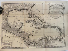
 1708 Antique Map North American Reproduction British American Colonies Vtg
-
$220.68 GBP
 1780 Bonne Map of Southwest America and New Spain
-
$9.63 GBP
 Map Revolutionary War South Colonies 1871 Victorian Woodcut Print History DWAA12
-
$245.00 GBP
 Map "Carte de la Nouvelle Angleterre, Nouvelle York et Pensilvanie" Bellin,c1750
-
$35.00 GBP
 1760 J. van der Schley, Ancient Mexico City, foreign topography, map
-
$99.99 GBP
 1783 NEW & ACCURATE MAP OF NORTH AMERICA INC NOOTKA SOUND & ASIA by BOWEN *
-
$790.00 GBP
 Antique Map "Totius Americae Septentrionalis et Meridionalis" J. B. Homann, 1740
-
$120.37 GBP
 1787 Rigobert Bonne Mappemonde Occidental Western Hemisphere Antique Map
-
$6.99 GBP
 Old Antique Picture Poster wall map North, South America: 1720 1700's Reprint
-
$150.00 GBP
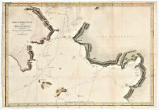 Antique Map "Chart of Norton Sound and of Bherings Strait" James Cook, 1784
-
$160.49 GBP
 2 America Island Maps by Jean Baptist Anville Circa 1730 Hispaniola Mexican Gulf
-
$150.00 GBP
 1773 Bellin, map, Hudson Bay, Canada, James Bay, Labrador
-
$12.84 GBP
 Map Sherman's Army Virginia Operations 1871 Victorian Lithograph History DWAA12
-
$772.38 GBP
 1755 (1768) De Vaugondy Large 2nd edition Antique Map of Colonial United States
-
$3611.12 GBP
 Henry Mouzon “An Accurate Map of North and South Carolina…” 1775 - Bottom half
-
$38.11 GBP
 1848 ORIGINAL MAP UNITED STATES TEXAS FLORIDA CANADA CUBA MEXICO HAWAII NEW YORK
-
$140.43 GBP
 1767 America's Lakes, Rivers & Mountains antique map by Clouet ~ 22.8" x 16.8"
-
$1520.68 GBP
 Antique 1755 Map ~ British & French Dominions North America ~ Mitchell / Throop
-
$140.43 GBP
 1767 America's Islands, Capes & Seaports antique map by Clouet ~ 22.8" x 17.1"


