 Antiques (UK)
Africa Maps
Asia Maps
Australia/Oceania Maps
Celestial Maps
Central America/Caribbean Maps
Curiosities Maps
Digital Maps
Europe Maps
Map & Globe Mixed Lots
Map & Globe Reproductions
North America Maps
South America Maps
World & Celestial Globes
World Maps

-
$199.99 GBP

 RARE Antique Map , W Pinnock , 1833 , NEW PLAN OF LONDON , Large A2 SIZE
-
$99.00 GBP
 1845 Antique Map of Persia by A. Findlay mounted on cardboard with COA
-
$249.99 GBP
 1728 VERY RARE Herman Moll Map , Genuine Antique, The Persian Empire
-
$325.00 GBP
 Taylor and Skinner Survey and Maps of Scotland 1776
-
$7.99 GBP
 Vintage Admiralty Charts 1960s-1980’s
-
$14.99 GBP
 Bacon's Large Scale Plan of Bristol (c1900) Map, Cloth Mounted
-
$4200.00 GBP
 rare 1922 War Office map HONG KONG linen Geographical Section General Staff
-
$9.99 GBP
 Vintage Admiralty Nautical Navigation Sea Chart Dover Harbour No. 1698 (1952)
-
$19.99 GBP
 The Geographia Plan Of Glasgow Alexander Gross Map
-
$3.95 GBP
 RIVER SEINE ESTUARY, France D-Day Invasion OVERLORD Planning - WW2 Map 1943
-
$49.99 GBP
 Rare Essex Pt Map (1777) Strethall, Heydon, Langley - John Chapman & Peter Andre
-
$15.00 GBP
 Vintage 1962 Geological Survey Map Surrey Aldershot Guildford Woking Farnborough
-
$9.99 GBP
 National Geographic Map - The Earth's Moon 1969
-
$17.99 GBP
 Antique/Vintage Map of Libyan Desert Routes of the L.R.D.G 1940-1941 - 1945pub
-
$40.00 GBP
 MALDIVE ISLANDS, Sheet 1, INDIAN OCEAN, 1918 BRITISH ADMIRALTY SEA CHART. No.66a
-
$39.00 GBP
 VINTAGE ADMIRALTY CHART. No.760. MADAGASCAR. 1933 Edition
-
$9.99 GBP
 Military Ordnance Midlands Military Edition War Revision 1940 . Free UK Postage
-
$7.50 GBP
 100's of Admiralty Charts (the pVintage Admiralty and other Charts 1940's-2010's
-
$5.00 GBP
 Ordinance survey maps x 6, old reprints 'The Godfrey Edition' 1899-1902
-
$12.75 GBP
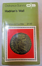 Vintage Retro Ordnance Survey Map - Hadrians Wall - 2 inch to 1 Mile Historical
-
$3.25 GBP
 VINTAGE SEA CHART / NAUTICAL MAP 1961 - The Wash - To Frame?
-
$9.99 GBP
 Vintage decorative sheet map of Devonshire John Speede 1610 Devon
-
$9.95 GBP
 PORTSMOUTH HARBOUR, GOSPORT, PORTSEA Hampshire - Rare Vintage WW2 Naval Map 1943
-
$7.99 GBP
 Antique 1881 Victorian City Map of BRISTOLBy G W Bacon 21 x 13”
-
$10.00 GBP
 1903 Black ASIA SIBERIA CENTRAL ASIA Antique Map
-
$14.99 GBP
 MAP OF KENT CIRCA 1700'S 48 x 36cm 1970'S REPRODUCTION
-
$10.00 GBP
 VTG BARTHOLOMEW’S AUTOMOBILE AA CLOTH MAP - SHEET 21-SALISBURY-SOUTHAMPTON c1925
-
$27.45 GBP
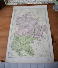
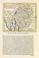 Westmoreland map By Seller & Grose Original engraved hand colour 1777
-
$34.99 GBP
 Large Antique Map of Hispar-Biafo Glacial Regions - Karakoram Himalaya - 1950
-
$249.99 GBP
 1728 VERY RARE Herman Moll Map , Genuine Antique, Greece Asia Middle East
-
$4.99 GBP
 Ordnance Survey Map Landranger Series 128 Derby & Burton upon Trent Area
-
$39.99 GBP
 Admiralty Chart - No.2007 - DUMBARTON to GLASGOW, RIVER CLYDE - 1934 Edn.
-
$25.00 GBP
 OS Map 1875: Bethnal Green: Middlesex Sheet V11
-
$19.99 GBP
 Vintage Admiralty Nautical Navigation Chart Scotland Firth Clyde & Approaches
-
$7.99 GBP
 Antique 1881 Victorian City Map of TUNBRIDGE WELLS By G W Bacon 21 x 13”
-
$12.00 GBP
 1836. IRVINE AYRSHIRE. 6" TO THE MILE BURGH MAP. WITH REPORT ON THE BURGH
-
$14.00 GBP
 ORIGINAL VINTAGE JAPANESE MAP OF AICHI PREFECTURE & NAGOYA (78x53cm)
-
$35.00 GBP
 c1830 Environs of London Moule Antique Map Engraved W Hughes, Published G Virtue
-
$17.99 GBP
 Antique/Vintage Map of Routes in Southern Iran, J.V. Harrison - 1942
-
$249.99 GBP
 1728 VERY RARE Herman Moll Map , Genuine Antique, Cyrus The Great Persia
-
$18.00 GBP
 Ordnance Survey 1964 GEOLOGICAL SURVEY Vintage Cloth Map SHEET 2
-
$7.00 GBP
 Daily Mail War Map c1914
-
$7.99 GBP
 Vintage Ordnance Survey Map of BOURNEMOUTH & SWANAGE. Sheet 141. 1919
-
$10.00 GBP
 Vintage Admiralty Chart 2007 Scotland - River Clyde 1979 Edition
-
$19.95 GBP
 Antique National Health Insurance Commission Map of Monmouthshire, Wales d.1914
-
$19.99 GBP
 1956 Antique Map; Admiralty Chart # 1907, Cloch Point to Little Cumbrae, Striven
-
$6.50 GBP
 Western Super Mare Ordnance Survey Linen Map Special Sheet 1928 Ellis Martin Cov
-
$5.00 GBP
 Vintage Map of Birmingham
-
$29.00 GBP
 Antique Map of Scotland "L'Ecosse" after Pierre Vander Aa Etching Limited Print
-
$25.00 GBP
 Antique Map LONDON & Vicinity, Benjamin Smith Original 1902
-
$2.99 GBP
 ANTIQUE MAP OF CALIFORNIA & NEVADA, NORTH AMERICA, BY EMERY WALKER, 1910
-
$7.00 GBP
 OS maps 7th series + 1 New Popular 1 inch maps, 8 maps, good to fair condition
-
$10.99 GBP
 Antique Map of United Kingdom Surface Working of Minerals relating to planning
-
$45.00 GBP
 John Speed MAP “ The Kingdom Of England” -1646 & Cornwall 1610
-
$2.00 GBP
 Avis Rent A Car - 1975 - Foldable Metro Street Map Seattle Tacoma Washington
-
$18.99 GBP
 Old Map of Codsall ( E ), Bushbury ( W), Staffordshire in 1884- Repro 56 SW
-
$22.99 GBP
 Antique Map of Palestine & Egypt - 1893 Henry Kiepert
-
$3.49 GBP
 Ordnance Survey (OS) Map 1:25,000 Pathfinder Sheet SK 21/31 Ashby-de-la-Zouch
-
$12.00 GBP
 Vintage Ireland Map Bacons Geographical Establishment 50cm x 34cm (M)
-
$12.00 GBP
 OS Pathfinder series 1:25000. 13 paper maps, GB locations. Good condition
-
$8.50 GBP
 1900s South Devon Bartholomew's Reduced Survey 2 miles to 1 inch Sheet 36
-
$3.99 GBP
 LAS VEGAS MAP
-
$8.50 GBP
 1900s Dorset Bartholomew's Reduced Survey 2 miles to 1 inch Sheet 34
-
$12.00 GBP
 Vintage Bedfordshire Map Bacons Geographical Establishment 50cm x 34cm (M)
-
$19.95 GBP
 Map of Roman Britain - NEW A2 Print
-
$12.50 GBP
 Vintage Admiralty Chart 1426 Loch Linnhe - North Part, 1918 edn Updated 1968
-
$14.99 GBP
 National Geographic Traveler's Map of Italy - 1970 - Vintage
-
$34.00 GBP
 Saxton Map of C16th Norfolk. Framed Vintage Reproduction
-
$8.00 GBP
 Original Ordnance Survey Map, Surrey Sheet XXIII, NE Worplesdon. Edition 1920
-
$185.00 GBP
 1934 Cecily Peele Map of Oxford and Her Worthies - Hand Painted In Colour 1948
-
$24.99 GBP
 Vintage Admiralty Nautical Navigation Chart Loch Crinan Forth Lorne No:2326 1966
-
$9.99 GBP
 Antique/Vintage Map of Coastal Scenery of the United Kingdom - 1944
-
$34.99 GBP
 National Geographic Map - Antarctic Regions - 1932 - Vintage
-
$14.99 GBP
 1830 Original Pigot & Co. Map: Hertfordshire
-
$7.99 GBP
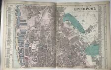 Antique 1881 Victorian City Map of LIVERPOOL By G W Bacon 21 x 13” inch
-
$19.99 GBP
 1958 Antique Map; Admiralty Chart # 2164 Firth Of Clyde To Large Channel
-
$23.99 GBP
 Hyde, Haughton, old map Cheshire 1910: 11NW A
-
$25.99 GBP
 Scotland - Comparative View of the Lengths of Principal Rivers - Thomson 1831
-
$3.00 GBP
 OS maps 7th series, 1 inch maps,3 maps, 1953-1966, good to fair condition
-
$9.99 GBP
 Vintage Admiralty Sea Chart The Solent Nab Tower To Spithead No.L(D5)2050 (1955)
-
$15.99 GBP
 Old map Environs of Rugby, Warwickshire - 1898
-
$9.99 GBP
 Antique/Vintage County Map of Cumberland & Lake District - John Heywood, 1868
-
$20.99 GBP
 East End London, Mile end, St Katherine's Dock, old Map London 1888 #D17 Repro
-
$5.00 GBP
 Survey of Cyprus - Administration & Road Map
-
$12.00 GBP
 1701 ROBERT MORDEN MAP OF NORTHAMPTONSHIRE - Antique Framed Map Rob MORDEN
-
$15.99 GBP
 Old map Environs of Chester, Cheshire - 1898
-
$25.00 GBP
 S. AMERICA, PATAGONIA, GEORGIA, SOUTH SHETLANDS, original antique map, SDUK 1844
-
$70.00 GBP
 British Isles map Mercator Hondius Jansson edition Original Anglia 1634
-
$79.95 GBP
 Original 1900 East London Centre Hand Coloured City Map River Thames Bishopsgate
-
$95.00 GBP
 Antique Map LONDON & Environs, John Russell, David Hughson Original 1808
-
$9.99 GBP
 Vintage Coloured Map Of Kent -c1895 Showing Ashford/ Maidstone/Canterbury/Dover
-
$6.99 GBP
 BUCKINGHAMSHIRE 1610 Map by John Speed - Uncoloured
-
$18.99 GBP
 Daventry, old map Northants 1900: 43NW repro
-
$45.00 GBP
 c1760 French Map By Bellin - Great Yarmouth Norfolk Plan De La Ville Et Environs
-
$15.99 GBP
 Old map Environs of Wakefield, West Yorkshire 1898
-
$69.95 GBP
 Original 1910 OS Sheet Map Bexleyheath Blackfen Upton Halfway St Watling Bromley
-
$13.99 GBP
 Antique Map England & Wales C1870's Map Of UK Europe World Atlas
-
$19.99 GBP
 National Geographic Map - West Indies and Central America - 1970 - Vintage
-
$249.99 GBP
 1728 VERY RARE Herman Moll Map , Genuine Antique, Voyage Of Aeneas Greece
-
$49.00 GBP
 VINTAGE ADMIRALTY CHART. No.599. CAPE VERDE, R. GAMBIA, WEST AFRICA, 1916 Edn


