 Antiques (UK)
Africa Maps
Asia Maps
Australia/Oceania Maps
Celestial Maps
Central America/Caribbean Maps
Curiosities Maps
Digital Maps
Europe Maps
Map & Globe Mixed Lots
Map & Globe Reproductions
North America Maps
South America Maps
World & Celestial Globes
World Maps

-
$145.00 GBP

 VINTAGE GEOGRAPHIA 1950s SCHOOL EDUCATIONAL GLASGOW STREET PLAN WALL MAP PRE M8!
-
$249.99 GBP
 1728 VERY RARE Herman Moll Map , Genuine Antique, The Persian Empire
-
$199.99 GBP
 1728 VERY RARE Herman Moll Map , Genuine Antique, Voyage Of Aeneas Greece
-
$199.99 GBP
 RARE Antique Map , W Pinnock , 1833 , NEW PLAN OF LONDON , Large A2 SIZE
-
$249.99 GBP
 1971 George Philip & Son Ltd Old School Roll Down Large WORLD MAP On Linen
-
$120.00 GBP
 Antique Map "British India" John Tallis / J. Rapkin, 1851
-
$245.00 GBP
 Map "Carte de la Nouvelle Angleterre, Nouvelle York et Pensilvanie" Bellin,c1750
-
$55.00 GBP
 c1760 French Map By Bellin - Great Yarmouth Norfolk Plan De La Ville Et Environs
-
$7.50 GBP
 1907 Map of the World showing land surface features antique vintage
-
$12.95 GBP
 National Geographic Magazine Vintage Large Wall Map of Western Europe Dec 1950
-
$4.99 GBP
 c1900 Bazaar Exchange & Mart Tourists Route Map of England & Wales - Cycling
-
$115.00 GBP
 Antique Map "The North Part of Italy" Herman Moll, c.1711
-
$8.95 GBP
 Map Of Turkey Syria Iraq , Israel & Lebanon 1996 TA Bartholomew Times Physical
-
$20.00 GBP
 WALL MAP OF CYPRUS (in English) size 100x70cm - NEW EDITION 2024
-
$199.99 GBP
 1728 VERY RARE Herman Moll Map , Genuine Antique, Expedition Greece Turkey
-
$319.99 GBP
 1568 REAL RARITY , Genuine Latin Map Of Middle East & Garden Of Eden ,Vincentius
-
$125.00 GBP
 Antique Map "Scotia" (Scotland) Abraham Ortelius, 1655 Ca
-
$46.99 GBP
 Philips Special Map of the Nile, Advance on Khartum & Environs of Omdurman c1898
-
$32.00 GBP
 Antique Map of Scotland "L'Ecosse" after Pierre Vander Aa Etching Limited Print
-
$84.95 GBP
 Robert Morden Antique Map East Riding Yorkshire York Beverley Hand Colour 1695
-
$13.99 GBP
 Antique Map North Polar Regions With Results Of Latest Explorations Dated C1870
-
$6.99 GBP
 Antique Map Physical Map Of Asia Map Of The World Dated 1901 Atlas Globe Art
-
$29.99 GBP
 1815 Antique Map; Hindoostan / Hindūstān, India
-
$49.99 GBP
 1804 Antique Map; Scotland by J. Kirkwood & Sons
-
$100.00 GBP
 Antique Map "Hungary" John Tallis, 1851
-
$9.99 GBP
 1900 Gall & Inglis / Cary: Dumfries District Map, Scotland
-
$125.00 GBP
 Antique "Map of the Island of St. Christopher's" (Saint Kitts and Nevis) 1794
-
$99.99 GBP
 1695 COLOUR MAP OF DARBYSHIRE BY ROBERT MORDEN DERBYSHIRE DERBY BAKEWELL PEAKS *
-
$249.99 GBP
 1728 VERY RARE Herman Moll Map , Genuine Antique, Greece Asia Middle East
-
$249.99 GBP
 1728 VERY RARE Herman Moll Map , Genuine Antique, Justin’s Map Of The World
-
$23.65 GBP
 1938 ORIGINAL VINTAGE MAP OF INDONESIA BORNEO SINGAPORE PHILIPPINES MALAYSIA
-
$249.99 GBP
 1728 VERY RARE Herman Moll Map , Genuine Antique, Cyrus The Great Persia
-
$79.99 GBP
 1715 COLOUR MAP OF COUNTY PALATINE OF CHESTER BY RICHARD BLOME COAT OF ARMS *
-
$59.99 GBP
 1807 COLOUR WORLD MAPS x15 by BARLOW TURKEY AFRICA IRELAND WORLD HEMISPHERES *
-
$40.00 GBP
 1960 Vintage Folding Map South East Devon England John Bartholomew 14" x 12"
-
$3.99 GBP
 Bartholomew's Revised Half-Inch Contoured Maps Sheet 23 Hereford
-
$4.99 GBP
 Old Antique Victorian colour map of Aberystwyth Wales 1800's 1834 Wood: Reprint
-
$29.99 GBP
 1784 COLOUR MAP GLOUCESTERSHIRE HAMPSHIRE ISLE OF MAN CHANNEL ISLES BY CONDER *
-
$19.99 GBP
 1902 India Physical & Orographical Map by John Bartholomew
-
$19.99 GBP
 1870 Physical Map of North America by Edward Weller Original Antique Map
-
$40.00 GBP
 Job Lot Bundle x17 Vintage National Geographic Physical Wall Maps 1940's 1950's
-
$235.00 GBP
 Antique Map "A New Map of the Isle of Wight" George Brannon, 1824
-
$45.00 GBP
 Antique Map "Iceland-Greenland- Faroe Islands" Edward Weller, 1863
-
$12.99 GBP
 1720 Antique Road Map: Grantham to Tuxford, Owen & Bowen Shts 15/16
-
$150.00 GBP
 Antique Map "Carte de la Syrie" (Holy Land) Henri Liebaux, 1729
-
$300.00 GBP
 Map "Transsylvaniae Tabula" (Romania) Sebastian Munster, 1572
-
$10.00 GBP
 Bundle of 2 VINTAGE 1970's / 1980's Maps of Scotland and Aberdeen
-
$19.99 GBP
 Edwardian Maps of Palestine & Israel, Canaan (1902) Century Atlas of the World
-
$75.00 GBP
 Original Antique Map Jersey Channel Islands 1849 9.25" x 7"
-
$6.99 GBP
 Antique Map Of The Eastern United States Dated 1901 The Mississippi States
-
$99.99 GBP
 1848 BETTS NEW MAP OF IRELAND by RAILWAY COMMISSIONERS STEAM TRAIN DUBLIN RAIL
-
$9.99 GBP
 1915 COLOUR MAP OF THE EUROPEAN WAR THE EASTERN CAMPAIGN BY SIFTON PRAED & CO*
-
$19.99 GBP
 1850 Antique Map; Ireland by John Dower / William Orr
-
$149.99 GBP
 1785 MAP OF THE WORLD INCLUDING THE DISCOVERIES MADE BY CAPT COOK HAWAII ARCTIC*
-
$2.99 GBP
 The Dagenham Corridor Map - London Country Parks Leaflets
-
$9.99 GBP
 Military Ordnance Midlands Military Edition War Revision 1940 . Free UK Postage
-
$79.99 GBP
 1695 COLOUR MAP OF SUFFOLK BY MORDEN IPSWICH BURY ST EDMUNDS SOUTHWOLD *
-
$35.00 GBP
 1760 J. van der Schley, Ancient Mexico City, foreign topography, map
-
$115.00 GBP
 Antique Print "Vue & Description du Palais du Grand Mogol" (Kota-India) 1719
-
$20.00 GBP
 1930 Vintage Folding Map Dunkeld & Pitlochry Scotland John Bartholomew 8" x 6"
-
$125.00 GBP
 Map "Tartariae sive Magni Chami Regni Tipus" (Russia-California) Ortelius, 1655
-
$8.99 GBP
 Antique Map Physical Map Of Asia C1900 Map Of The World Atlas Globe Print
-
$7.19 GBP
 WWII 1944 American Red Cross Map Of Paris & Map Of London
-
$50.00 GBP
 1722 Map of Northamptonshire by Robert Morden - Hand Coloured in a Gilt Frame
-
$145.00 GBP
 Antique Map "Hispaniae Descriptio" (Spain-Portugal) S.Munster, 1550
-
$25.00 GBP
 Old Folding Map Northern & Central Italy & Corsica 1913 10.5" x 10.25"
-
$110.00 GBP
 Antique Map "Descriptio regni Daniae" (Denmark) S.Munster, 1550
-
$90.00 GBP
 Antique Map "England and Wales" R. Phillips, 1807
-
$800.00 GBP
 Antique Map "Magnae Britanniae et Hiberniae Tabula" (United Kingdom)Hondius,1631
-
$6.99 GBP
 Antique Map Physical Map Of South America 1901 Map Of The World Atlas Globe
-
$5.00 GBP
 Historic Antique Old Vintage Picture MAP 1500's 1522 The World Reprint 16th cent
-
$250.00 GBP
 Map "Das Koenigreich Sardinien Nro 455" (Sardinia) Von Reilly-Busching, 1790
-
$70.00 GBP
 Antique Map "Insulae S. Thomae" (Sao Tome Island) R. De Renneville, 1725
-
$350.00 GBP
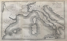
 1761-80 ITALIA ANTIQUA Christoph Cellarius Sardinia Corsica Mediterraneum Colour
-
$79.99 GBP
 1695 HAND COLOURED MAP OF SUFFOLK BY ROBERT MORDEN IPSWICH BURY ST EDMUNDS *
-
$18.11 GBP
 1937 ORIGINAL VINTAGE MAP OF VIETNAM LAOS THAILAND SIAM MALAYSIA SINGAPORE
-
$40.00 GBP
 1960 Vintage Folding Map Weymouth District England John Bartholomew 13" x 11.5"
-
$285.00 GBP
 Antique Watercolour "Lake of Geneva" James Horsburgh, 1850
-
$40.00 GBP
 1885 Antique map of Dublin Bay Ireland - Virtue & Co Ltd 13" x 10.5"
-
$55.00 GBP
 Antique Map "Carte des Royaumes de Congo, Angola et Benguela" J. N. Bellin, 1757
-
$29.99 GBP
 1828 Antique Map; Hindoostan / Hindūstān, India by L. Hebert
-
$10.00 GBP
 1880s Antique Map of ENVIRONS MANCHESTER Bacon Atlas of the British Isles
-
$225.00 GBP
 Antique Map "Penha D'Aguia" (Madeira, Portugal) J. F. Eckersberg, 1858
-
$149.99 GBP
 1620 MERCATOR MAP OF YORKSHIRE LINCS STAFFS LEICS & NORFOLK INSCRIBED in DUTCH *
-
$24.00 GBP
 World Map Exhibiting Chief Physical Features by Hall Longman & Co 1854
-
$15.00 GBP
 MAP OF FRANCE WINE REGIONS ORIGINAL GENUINE large 1852 GOOD CONDITION TO FRAME
-
$150.00 GBP
 Antique Map "Geography. Map of the World" Andrew Bell, 1797
-
$14.99 GBP
 1855 Antique map: The Expedition of Hannibal into Italy by R. Scott
-
$120.00 GBP
 Antique Map "Regno di Danimarca colle Isole Faroer ed Islanda" (Iceland)
-
$249.99 GBP
 1796 COLOUR CHART OF TURON BAY COCHIN CHINA TO MOUTH OF PEI HO RIVER PEKING
-
$9.95 GBP
 1890 / 1933 ANTIQUE MAP - MONTREUX SWITZERLAND
-
$800.00 GBP
 Antique Map "The Spanish Armada entering the English Channel" John Pine, 1739
-
$80.00 GBP
 Antique Map "Russia in Asia" John Tallis, 1851
-
$215.00 GBP
 Map "Kaart der Koningkryken Siam, Tonkin, Pegu, Ava, Arakan" Schley-Bellin, 1755
-
$285.00 GBP
 Map "Italiae Antiquae et Novae pars Septentrionalis-Australis" J.A. Cramer, 1825
-
$39.99 GBP
 1890 NEW LARGE SCALE MAP OF SOUTH AFRICA by BACON COLOUR FOLD-OUT MAP AFRICA ^
-
$199.99 GBP
 1750 PARTIE OCCIDENTALE DE L'EMPIRE DE RUSSIE PAR DE VAUGONDY COLOUR MAP RUSSIA
-
$145.00 GBP
 Antique "Map of the Original Thirteen Colonies" S. Augustus Mitchell, 1879
-
$24.99 GBP
 1854 Ethnographical & Physical Charts of The World Map By John Bartholomew
-
$249.99 GBP
 1728 VERY RARE Herman Moll Map , Genuine Antique, Ancient Greek Trojan War


