 Antiques (UK)
Africa Maps
Asia Maps
Australia/Oceania Maps
Celestial Maps
Central America/Caribbean Maps
Curiosities Maps
Digital Maps
Europe Maps
Map & Globe Mixed Lots
Map & Globe Reproductions
North America Maps
South America Maps
World & Celestial Globes
World Maps

-
$9.99 GBP

 New Reduced Survey Map of Glasgow & Clyde John Bartholomew Tourist 4 Mile inch
-
$8.99 GBP
 New Reduced Ordnance Survey Map The Environs Of London John Bartholomew 2 Mile
-
$25.00 GBP
 1904 Antique Folding Guide Map Aberystwyth to Barmouth Wales 9" x 6.5"
-
$9.99 GBP
 1910s Derby Environs of J Bartholomew W H Smith Map OS Cloth Vintage
-
$10.00 GBP
 Vintage Ordnance Survey Map - White Edition : 55- Scotland
-
$19.99 GBP
 ORDNANCE SURVEY WALL CHART / MAP BLACKBURN & BURNLEY #95 1" : 1 MILE 1961
-
$12.99 GBP
 1920 Ordnance Survey Ipswich Vintage Map CLOTH PANELS
-
$6.50 GBP
 Western Super Mare Ordnance Survey Linen Map Special Sheet 1928 Ellis Martin Cov
-
$9.99 GBP
 Vintage Coloured Map Of Kent -c1895 Showing Ashford/ Maidstone/Canterbury/Dover
-
$8.50 GBP
 1900s South Devon Bartholomew's Reduced Survey 2 miles to 1 inch Sheet 36
-
$19.99 GBP
 ORDNANCE SURVEY WALL CHART/ MAP ISLE OF MAN MANX #87 1" : 1 MILE vintage 1963
-
$20.00 GBP
 1913 Ordinance Survey Killarney District Ireland Road Map
-
$19.99 GBP
 ORDNANCE SURVEY WALL CHART/ MAP GLASGOW SCOTLAND #60 1": 1 MILE vintage 1965
-
$4.99 GBP
 Ordnance Survey Map Landranger Series 128 Derby & Burton upon Trent Area
-
$24.99 GBP
 Large OS surveyor's map 1910 Sheffield Park, Fletching Sussex - 25 miles to inch
-
$14.95 GBP
 100% ORIGINAL LARGE BRIGHTON SUSSEX HASTINGS MAP BY ORDNANCE SURVEY C1922 VGC
-
$15.00 GBP
 Lovely Rare Ordnance Survey Map of Lincoln and District Sheet 47 1912 A912
-
$85.00 GBP
 Wimbledon, London c1920 Bacon’s Large Scale Plan 4 inches to 1 mile
-
$15.00 GBP
 Lovely Very Rare Ordnance Survey Brighton Map Sheet 88 1903 A744
-
$10.00 GBP
 VTG BARTHOLOMEW’S AUTOMOBILE AA CLOTH MAP - SHEET 21-SALISBURY-SOUTHAMPTON c1925
-
$3.99 GBP
 VINTAGE OS MAP OF TENBY - 1974
-
$19.99 GBP
 ORDNANCE SURVEY WALL CHART/ MAP EDINBURGH #62 1": 1 MILE vintage 1965
-
$4.99 GBP
 WW2 Revision 1940 Vintage Paper Sheet Map Tunbridge Wells Kent Sheet 125
-
$30.00 GBP
 Ordnance Survey Landranger Maps 9, 10, 11, 12, 15, 19, 20, 24, 25, 33, 34, 41
-
$8.50 GBP
 1900s South Devon Bartholomew's Reduced Survey 2 miles to 1 inch Sheet 36
-
$23.99 GBP
 Middleton, Cromford, Wirksworth, Old Map Derbyshire 1900: 34-SW A
-
$18.00 GBP
 Ordnance Survey 1933 THE COTSWOLDS Vintage Cloth Map
-
$35.00 GBP
 Ordnance Survey Map Fifth Edition 2/6d Linen Backed. x5 VGC
-
$25.00 GBP
 1902 Antique Folding Guide Map Tremadoc Bay Pwllheli Portmadoc Wales 13." x 8"
-
$24.99 GBP
 Large OS surveyor's map 1910 Sheffield Park, railway, Sussex - 25 miles to inch
-
$32.14 GBP
 Beautiful 1905 Color TOPOGRAPHIC MAP OF THE JUNEAU GOLD BELT, ALASKA, 19” X 55”
-
$20.00 GBP
 1904 Antique Folding Guide Map Vale of Llangollen Wales 9.75" x 6.25"
-
$3.99 GBP
 OS 1" Map 7th series HEREFORD 142 1952
-
$20.00 GBP
 Job Lot of Vintage Ordnance Survey Maps x33 Bartholomews Geographic OS
-
$9.95 GBP
 VINTAGE ONE INCH ORDINANCE SURVEY SCOTTISH 6 MAP BUNDLE 1950'S 1960'S
-
$12.95 GBP
 100% ORIGINAL LARGE NEWCASTLE CARLISLE TYNE MAP BY ORDNANCE SURVEY C1922 VGC
-
$8.50 GBP
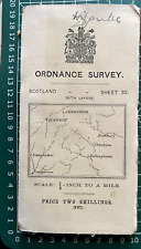
 OS SCOTLAND Sheet 11, 1/4inch:1mile . 1st edition c1903, revised 1907.
-
$6.99 GBP
 Rare Ordnance Survey Map TM46 Leiston 1983 Sizewell, Westleton Dunwich, Minsmere
-
$19.99 GBP
 1886 Channel Islands & Isle Of Man Antique Hand Coloured Map by G.W. Bacon
-
$25.00 GBP
 1904 Antique Folding Guide Map Bala Lake & Environs Wales 13" x 6.5"
-
$4.50 GBP
 Ordnance Survey one inch special map of Worcester & Malvern District. 1924.
-
$4.99 GBP
 WW2 Revision 1940 Vintage Cloth Sheet Map Weald Of Kent Sheet 126 Ord. Survey
-
$1.50 GBP
 BRECON ORDNANCE SURVEY. Sheet 141 ONE -INCH MAP PUBLISHED in 1971 VGC !
-
$19.99 GBP
 ORDNANCE SURVEY WALL CHART / MAP LONDON NE #161 1" : 1 MILE Vintage 1960
-
$1.50 GBP
 LLANDOVERY Sheet 140 ONE -INCH MAP ORDNANCE SURVEY VGC !
-
$5.50 GBP
 OS SCOTLAND Sheet 8, 1/4inch:1mile. 1st edition c1905, rev 1914
-
$1.50 GBP
 DARTMOOR WALKS - ORDNANCE SURVEY, PATHFINDER GUIDE PUBLISHED by JARROLD VGC !
-
$19.99 GBP
 ORDNANCE SURVEY WALL CHART / MAP LONDON SE #171 1" : 1 MILE Vintage 1964
-
$69.95 GBP
 Original 1899 OS Map Sheet Chalfont St Peter Park Gerrards Cross Bulstrode Park
-
$20.00 GBP
 RARE Victorian Map of Worcestershire Area (STANFORD's Ordnance Survey - Cloth)
-
$29.99 GBP
 Job Lot Collection Of Vintage Cloth Ordnance Survey Maps 1920s / 1930s
-
$1.50 GBP
 St. DAVID'S & HAVERFORDWEST AREA 1 1/4 to 1 Mile ORDNANCE SURVEY VGC !
-
$8.00 GBP
 Four Sheet Maps Of Ireland - North, South, East And West, Ordnance Survey
-
$1.50 GBP
 WALES TOURIST MAP ONE -INCH MAP PUBLISHED in 1973 VGC !
-
$14.99 GBP
 ORDNANCE SURVEY CLOTH TOURIST MAP OF THE LAKE DISTRICT 1" TO 1 MILE 1920
-
$10.99 GBP
 Ordnance Survey Thames London Cloth Map 1927 scale 1 inch to 1 mile
-
$23.99 GBP
 Salcombe, South Pool, East Portlemouth, Old Map Devon 1907: 136SE A
-
$18.99 GBP
 St Neot (northeast), West Draynes, old map Cornwall 1907: 27SE
-
$7.99 GBP
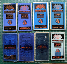 c.1950 Bartholomew Half-Inch Map Collection x 8
-
$3000.00 GBP
 Extremely Rare War Office WW1 Cloth Map of Amiens surrounding areas of France
-
$9.99 GBP
 1914 Ordnance Survey Map. Sheet 32 Hawick; Jedburgh etc. 1/2 "=mile
-
$19.99 GBP
 ORDNANCE SURVEY WALL CHART / MAP DORCHESTER #178 1" : 1 MILE Vintage 1960
-
$69.95 GBP
 Original 1925 OS Map Sheet Little Gaddesden Great Berkhampstead Nettleden Hudnal
-
$4.50 GBP
 NORTH MIDDLESBROUGH St Hilda's 1913 - Old Ordnance Survey Maps Godfrey Edition
-
$15.00 GBP
 Large Vintage LEEDS Geographia Cloth Backed Map
-
$8.99 GBP
 Antique Map Dated 1955 On Cloth Barrow In Furness Ordnance Survey National Grid
-
$15.99 GBP
 Rhum Skye Photos Cuillins & ORDNANCE SURVEY MAP 1957 Wall Decor
-
$69.95 GBP
 Original 1899 OS Map Sheet Theydon Bois Garnon Epping Forest GER Debden Green
-
$3.00 GBP
 1943 Ordnance Survey Map 181 Chichester WWII Non-Original Cover
-
$4.99 GBP
 WW2 Revision 1940 Vintage Paper Sheet Map South East London Sevenoaks Sheet 115
-
$12.99 GBP
 Vintage BARTHOLOMEW Scotland Scottish Island SHETLAND 62 MAP
-
$18.99 GBP
 Old Map Kent OS - Dartford E - Greenhithe - Stone - Swanscombe - 9 NE 1910
-
$40.00 GBP
 33 Vintage Bartholomew's Half-inch Maps Cloth & Paper 1945-1961 Bundle
-
$4.99 GBP
 Old Map Reprint Sheet 44 Oakham England, Folded one inch to mile scale
-
$6.00 GBP
 Original Ordnance Survey Map, Surrey Sheet XXVlII, SE. Thursey. Edition 1920
-
$7.59 GBP
 ORDNANCE SURVEY CLOTH ANTIQUE UK MAP 1926 PEEBLES AND GALASHIELS
-
$23.99 GBP
 Middlesbrough , old map Yorkshire 1920: 6 SW antiqued
-
$23.99 GBP
 Plymouth (SE), Plymstock, Elburton, Staddiscombe, Old Map Devon 1907: 124SW A
-
$39.00 GBP
 Ordnance Survey map 1936 Peak District special FIRST edition 3 shillings OS
-
$10.00 GBP
 Vintage Cloth Map 1923 - Ordnance Survey 62SW - Blackmore Stondon Massey Hatch +
-
$1.99 GBP
 VINTAGE ORDNANCE SURVEY OS MAP OF TENBY - VINTAGE 1975
-
$8.99 GBP
 Shetland Islands ORDNANCE SURVEY MAP 1961 Wall Decor
-
$5.00 GBP
 Bartholomew's New Reduced Survey cloth map NORTH WALES - circa 1902 - 1920
-
$7.99 GBP
 VINTAGE ORDNANCE SURVEY 1" MAP of Berwick Upon Tweed (1960) Northumberland Sh 73
-
$69.95 GBP
 Original 1921 OS Map Sheet Romford Dagenham Beacontree Chadwell Heath Rush Green
-
$23.99 GBP
 Farndon (S), Crewe, old map Cheshire 1913: 53SE
-
$15.00 GBP
 8 x VINTAGE ORDNANCE SURVEY NATIONAL GRID PAPER Map MAPS 1:25,000
-
$20.00 GBP
 ANTIQUE LINEN ORDNANCE SURVEY MAP SHEET 98 NE KENDAL - LAKE DISTRICT DATED 1865
-
$9.00 GBP
 O/S Map, Newport, Ryde, Isle Of Wight, 1954 Applied Map Reading Exam.
-
$180.00 GBP
 SUSSEX CHICESTER-BRIGHTON-WILLIAM MUDGE c1813 GENUINE ORDNANCE SURVEY CLOTH MAP
-
$9.50 GBP
 OS Map 6 Inch to 1 mile 1923 Dronfield Woodhouse Holmesfield Derbyshire
-
$18.99 GBP
 Tywardreath, Par Green, St Blazeys , Polkerris, old map Cornwall 1908 51 NE
-
$18.99 GBP
 Old map - Edenbridge OS Kent 49 SW- 1908
-
$9.99 GBP
 Vintage WW2 Kettering and Huntington 1940 Linen Backed OS Sheet 74
-
$18.99 GBP
 Higher Boscaswell, Trewellard, Carnyorth, Botallack, old map Cornwall 1908: 67SW
-
$6.99 GBP
 Ordnance Survey OS District Map 1/2" Snowdon 1961
-
$4.50 GBP
 OXFORD 1898 - Old Ordnance Survey Maps Godfrey Edition
-
$17.50 GBP
 Vintage Inverness Sheet 13 1908 Ordnance Survey Map
-
$32.14 GBP
 Beautiful 1905 Color GEOLOGIC MAP OF THE JUNEAU GOLD BELT, ALASKA, 19” X 55”
-
$25.00 GBP
 1933 Vintage Folding Guide Map The Western Highlands Scotland 13" x 11.25"


