
-
$40.00 GBP

 1882 Map of the Nguru mountain district Tanzania coast antique vintage
-
$90.00 GBP
 * Rare * Copperplate Engraved Map of Essex By John Seller Hand Coloured 1695
-
$24.99 GBP
 1795 Lancashire Original Antique Map by John Stockdale
-
$60.00 GBP
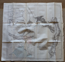 1882 Map of Sources Irawadi River Pundit Journey Tibet Assam antique vintage
-
$15.00 GBP
 Vintage Bacon's Cycling Road Map Of The Environs London N.E.
-
$6.00 GBP
 CLITHEROE British Geological Survey Map - 1975 Solid and Drift Edition
-
$120.00 GBP
 c1918 Birkenhead & Wallasey Pharus Map & Index, Philip Son & Nephew, Liverpool
-
$15.00 GBP
 1909 MAP CARLISLE NEWCASTLE NORTH VINTAGE ORDNANCE SURVEY, ANTIQUE FOLDING MAP
-
$7.00 GBP
 Vintage 1978 East London MAP 177 Ordnance Survey One-Inch Map Topography History
-
$12.00 GBP
 Stanford's 1930s Map of Canals & Rivers Navigable by Small Craft
-
$18.00 GBP
 Antique Daily Mail Bird's Eye Map of the British Front 1914-18 WWI
-
$4.99 GBP
 ANTIQUE 1918 LONG LONDON STREET MAP ROTHERHITHE ACROSS TO SHEPHERDS BUSH
-
$5.00 GBP
 VINTAGE MAP - 'NORTHERN IRELAND MAP FOLDER FOR TOURISTS AND SPORTSMEN'.
-
$24.99 GBP
 1795 West Yorkshire Original Antique Map by John Stockdale
-
$80.21 GBP
 Antique 1900s Maine Map Kennebec River City Of Bath Maine Lincoln County Map
-
$50.00 GBP
 Cheshire Map of Chester by Rob Morden c1695 Copperplate Engraving Hand Painted
-
$7.50 GBP
 VINTAGE / ANTIQUE ORDNANCE SURVEY OF IRELAND MOVILLE 1 INCH TO 1 MILE DATED 1907
-
$9.29 GBP
 Historical Map of Scotland by LG Bullock Bartholomew Folded Map
-
$27.00 GBP
 4x Cloth London Ordnance Survey Vintage Road Maps
-
$45.00 GBP
 George Phillips and Sons, Malvern District Map 1919,VG+
-
$28.00 GBP
 c 1920s Cartes Taride Map Grande Carte Routiere Bretagne No 5 Section Ouest Map
-
$15.00 GBP
 Vintage Bacon's Cycling Road County Map Of The Lincoln
-
$19.99 GBP
 Vintage Ordnance Survey Map, Aldershot Command c1925 Military, 1" - 1 Mile
-
$13.99 GBP
 Antique Print Eastern Division Of The United States C1877 Map USA Map Of World
-
$6.95 GBP
 THE DAILY TELEGRAPH MAP OF EUROPE 1960's GEOGRAPHIA RARE LARGE 101cm X 76cm N595
-
$7.50 GBP
 Antique Road Map Complete - 35 Miles Round To London - Geographers' Map Co. LTD
-
$11.99 GBP
 Vintage Bartholomew's pocket plan of Glasgow & suburbs Scotland map index guide
-
$19.95 GBP
 Map of Palaestina Palestine. Vintage Original Colour Print PHA 1872 Phillips
-
$450.00 GBP
 JOHNSTON'S ROAD MAPS OF ENGLAND & WALES. FULL SET & CASED *** VERY RARE ***
-
$205.20 GBP
 Vintage Antique Pocket Map Ohio 1829
-
$40.00 GBP
 1882 Map of the Mozambique coast antique vintage
-
$56.17 GBP
 HEC Robinson 71 x 96 cm Color Relief Wall Map - 1941 EAST INDIES Spratly Isles
-
$125.00 GBP
 DORSET SOMERSET BY WILLIAM MUDGE c1811 GENUINE 1st EDITION ORDNANCE SURVEY MAP
-
$9.99 GBP
 REID'S PLAN NEWCASTLE UPON TYNE SCALE 4" TO 1 MILE
-
$4.50 GBP
 MONKWEARMOUTH & SOUTHWICK 1895 - Old Ordnance Survey Maps Godfrey Edition
-
$17.00 GBP
 Philips Authentic Map of England Mounted on Cloth. Pocketbook Hardcover
-
$5.00 GBP
 Navigation Instruction map 5062 Bristol Channel 1967
-
$20.00 GBP
 ANTIQUE FOLDING LINEN ORDNANCE MAP OF DROITWICH BROMSGROVE & REDDITCH
-
$25.00 GBP
 c 1920s Vintage Carte Taride, Cycling Automobiles Bretagne Map No 9
-
$150.00 GBP
 1690 Carel Allard France/Luxembourg Rare Antique Hand-coloured Copper Engraving
-
$7.00 GBP
 Vintage Cloth Map 1924 - Edward Stanford Ltd 73SW Battlesbridge Rawreth Wickford
-
$5.00 GBP
 Bartholomew's SUSSEX Half-Inch Sheet 32 - 1933 Vintage Cloth Map
-
$2.75 GBP
 Grantham Long Bennington with ROAD MAP of LINCOLNSHIRE fold out street map b/w
-
$15.00 GBP
 Vintage Bacon's New Cycling Road Map Of Reading And District
-
$6.00 GBP
 Vintage Ordnance Survey One-Inch Tourist Map Ben Nevis & Glen Coe on Cloth 1961
-
$4.25 GBP
 THE CROSSING OF THE RIVER SEINE 21 ARMY GROUP 25-27 AUG 1944, WW2 OVERLORD Map
-
$8.00 GBP
 Geographia Road Map of England & Wales
-
$4.95 GBP
 BRITISH and CANADIAN OPERATIONS 28 JULY - 4 AUGUST 1944, WW2 OVERLORD Map
-
$4.50 GBP
 NORTH MIDDLESBROUGH St Hilda's 1913 - Old Ordnance Survey Maps Godfrey Edition
-
$9.95 GBP
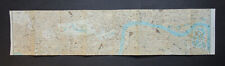
 Vintage London 1652 Tissue Paper Map 33cm X 33cm Stained Crinkled Torn Folded
-
$135.00 GBP
 WILTSHIRE BY WILLIAM MUDGE c1817 GENUINE 1st EDITION ORDNANCE SURVEY MAP
-
$4.99 GBP
 THE ADVANCE OF THE ALLIED ARMIES INTO GERMANY, 1 April to 1 May 1945, WW2 Maps
-
$15.00 GBP
 Vintage Bacon's Cycling And Motoring Map Of Norwich District Waistcoat Folding
-
$7.30 GBP
 Vintage Bacon's Cycling Road Map 50 Miles Around Birmingham
-
$25.00 GBP
 NER OS MAP NORTH SHIELDS PARCEL DELIVERIES 1920/1 EDITION ON LINEN
-
$9.99 GBP
 VINTAGE RELIEF MAP SWITZERLAND SUISSE KUMMERLY c.1920s/30's ?
-
$4.50 GBP
 CHESTERFIELD 1914 - Old Ordnance Survey Maps Godfrey Edition
-
$20.00 GBP
 France Sheet 51c Edition 1 ww1 Era Map 1:40,000
-
$6.00 GBP
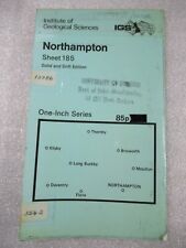 NORTHAMPTON British Geological Survey Geology Map - 1966 Solid and Drift Edition
-
$120.00 GBP
 1854 Large Map of Crimea Sebastopol Linen Backed Colour Crimean War J Arrowsmith
-
$6.00 GBP
 GLOSSOP British Geological Survey Map - 1981 Solid and Drift Edition
-
$4.50 GBP
 Britain a map for tourists A British Travel Publication
-
$15.00 GBP
 1912 Vintage Ordnance Survey White Edition Cloth Map Hastings & Bexhill Sussex
-
$7.50 GBP
 THE INITIAL DEVELOPMENT OF THE BRIDGEHEAD 13-18 JUNE 1944, WW2 Map of OVERLORD
-
$120.00 GBP
 Map "Massif de Gavarnie et du Mont Perdu" (Gavarnie-France) Franz Schrader, 1932
-
$12.00 GBP
 ORDNANCE SURVEY 1" TO 1 MILE TOURIST MAP OF THE NEW FOREST c1930
-
$4.00 GBP
 A-to-Z Map - 35 Miles Around London
-
$5.00 GBP
 Vintage Pinner & Hatch End Fold-Out Map 1940s Lock & Vince Surveyors - Excellent
-
$7.99 GBP
 1952 HISTORICAL MAP SCOTLAND DEPICTING ARMS OF SCOTTISH FAMILY CLANS AND YEARS.
-
$9.99 GBP
 1915 COLOUR MAP OF THE EUROPEAN WAR THE EASTERN CAMPAIGN BY SIFTON PRAED & CO*
-
$4.50 GBP
 HACKNEY 1870 - Old Ordnance Survey Maps Godfrey Edition
-
$6.59 GBP
![1930s Vintage Motoring and Touring Paper Map LL Devon [23413]](https://i.ebayimg.com/thumbs/images/g/gd4AAOSwHIllhsXZ/s-l225.jpg) 1930s Vintage Motoring and Touring Paper Map LL Devon [23413]
1930s Vintage Motoring and Touring Paper Map LL Devon [23413]
-
$3.50 GBP
 Bacons County Map Gloucester For Cyclists & Tourists c 1910 11
-
$7.99 GBP
 VINTAGE ABERDEEN TOWN PLAN BARTHOLOMEW'S FOLDING MAP - 41/2" TO MILE DATED 1962
-
$12.95 GBP
 1838 ANTIQUE MAP OF THE WORLD AS KNOWN TO THE ANCIENTS - ROLLIN'S HISTORY
-
$10.00 GBP
 Vintage Ordnance Survey Quarter Inch map 1946 England, North Central
-
$20.00 GBP
 VINTAGE ORDNANCE SURVEY MAP SHEET 106 OXFORD AND HENLEY WHITE EDITION DATED 1912
-
$7.95 GBP
 GEOGRAPHIA 2":1 Mile FOOTPATH MAP OF COUNTRY AROUND EASTBOURNE - 1938
-
$4.00 GBP
 Historical Map of Wales and Monmouth L Bullock John Bartholomew ⭐️MAKE AN OFFER
-
$5.00 GBP
 VINTAGE LINEN WARD LOCK MOTORING MAP SHEET 19 - LONDON & SUSEX COAST
-
$4.00 GBP
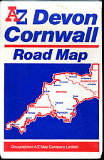 A-to-Z Map - Devon & Cornwall
-
$145.00 GBP
 c1900 Panoramic Map Brighton Sussex Lewes South Downs Pictorial Antique Johnson
-
$14.99 GBP
 1910 Gall & Inglis / Cary: Easton's Touring & Motoring Map of Peebles & District
-
$10.00 GBP
 Bacon's Cycling And Motoring Map Of Scarborough District
-
$3.99 GBP
 THE ALLIED ARMIES CLOSE TO THE RHINE. BATTLE POST ARDENNES March 1945, WW2 Map
-
$3.49 GBP
 1958 Issue ONTARIO Official PROVINCE ROAD MAP Department Highways CANADA Frost
-
$12.50 GBP
 1949 Antrim & Donegal Ireland Bartholomew's Map Quarter Inch to Mile
-
$5.00 GBP
 Vintage Shell Cartoguide Map Of Northern France 1962-63
-
$4.50 GBP
 CHESTER 1898 Old Ordnance Survey Maps Godfrey Edition
-
$9.95 GBP
 LINKING UP UTAH OMAHA GOLD BEACHES & OPERATIONS, WW2 OVERLORD Map 7-12 June 1944
-
$7.50 GBP
 Antiquated Parchment Replica of JOHN SPEED MAP OF LANCASHIRE 1610 The Old Map Co
-
$20.00 GBP
 LIVERPOOL Wigan Southport Wirral St Helens Chorley 3 x OS MAPS 1840 1902 & 1924
-
$4.95 GBP
 THE OPERATIONS OF SECOND BRITISH ARMY WEST OF THE ORNE 10-18 JULY 1944, WW2 Map
-
$4.49 GBP
![1940s Ordnance Survey Cloth Map Ludlow SOME MOLD, 1 Inch to mile **[25989]](https://i.ebayimg.com/thumbs/images/g/EVAAAOSwPvRjU~p0/s-l225.jpg) 1940s Ordnance Survey Cloth Map Ludlow SOME MOLD, 1 Inch to mile **[25989]
1940s Ordnance Survey Cloth Map Ludlow SOME MOLD, 1 Inch to mile **[25989]
-
$11.99 GBP
 SAN FRANCISCO City Street Plan - 1909 Mounted Antique Map - United States USA
-
$8.50 GBP
 Beijing Tourist Map - China Cartographic Publishing House - English Edition 1986
-
$4.99 GBP
 OLD LARGE 38" x 30" NATIONAL GEOGRAPHIC MAP 1950? very good condition
-
$6.00 GBP
 YORK British Geological Survey Map - 1983 Solid and Drift Edition
-
$28.09 GBP
 Antique German ski lecgaler alpen map antique vintage 1921 Ski of the Alps
-
$49.99 GBP
 1795 Chester City Plan Original Antique Map by John Stockdale


