 Antiques (UK)
Africa Maps
Asia Maps
Australia/Oceania Maps
Celestial Maps
Central America/Caribbean Maps
Curiosities Maps
Digital Maps
Europe Maps
Map & Globe Mixed Lots
Map & Globe Reproductions
North America Maps
South America Maps
World & Celestial Globes
World Maps

-
$175.00 GBP

 1794 Country Around Manchester Large Folding Map by Stockdale 84 cm x 81 cm
-
$25.00 GBP
 1930 Vintage D/S Folding Map of Bristol & Cathedral John Bartholomew 10" x 6"
-
$200.00 GBP
 Antique 1801? FOLDING MAP ON A CLOTH A NEW MAP OF MIDDLESEX JOHN CARY
-
$24.99 GBP
 Vintage/Europe/Map/Blackie/Fullarton/Cartography/Victorian/Art
-
$15.00 GBP
 Vintage Bacon's Cycling Road Map Of The Environs London N.E.
-
$9.99 GBP
 Map of Routes 9th QR Lancers South Africa 1889-1902 Boer War military campaign
-
$19.99 GBP
 Ubersichtskarte von Mitteleuropa: K51 Koln 1926 Linen Backed Folding Map / VGC
-
$15.00 GBP
 Dunlop Touring Maps Of Great Britain And Ireland No.10 Eastern Counties
-
$15.00 GBP
 Vintage Bacon's Cycling Road County Map Of The Lincoln
-
$15.00 GBP
 Vintage Geographia Cyclists Map Of Essex
-
$15.00 GBP
 Vintage Bacon's Cycling And Motoring Map Of Norwich District Waistcoat Folding
-
$3.99 GBP
 VINTAGE OS MAP OF TENBY - 1974
-
$3000.00 GBP
 Extremely Rare War Office WW1 Cloth Map of Amiens surrounding areas of France
-
$40.00 GBP
 1919 Original Old Folding Muirhead Street Maps x 4 of London each 9.5" x 6.5"
-
$350.00 GBP
 1793 Plan Manchester & Salford Large Folding Map by Charles Laurent 106 cm x 91
-
$24.99 GBP
 Vintage/Sidney Hall/Map/Turkey In Europe/Cartography/Victorian/Art
-
$35.00 GBP
 Rare Original Antique Map of the Environs of Lymington by Chas.T.King, 1897
-
$15.00 GBP
 Collection of vintage maps
-
$18.00 GBP
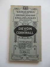 1923 DEVON & CORNWALL Cloth Backed Folding Road Map 'GEOGRAPHIA' No.8 4/6Net
-
$11.99 GBP
 Vintage Bartholomew's pocket plan of Glasgow & suburbs Scotland map index guide
-
$7.99 GBP
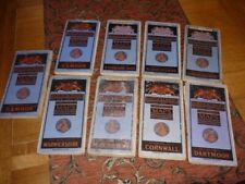 Vintage BARTHOLOMEWS Contoured Cloth mounted maps X 9
-
$12.95 GBP
 Vintage - The Authentic Map of London Alexander Gross H16
-
$6.00 GBP
 GRANTHAM British Geological Survey Geology Map - 1972 Solid and Drift Edition
-
$18.00 GBP
 1920's-1940's? INDIA Folding Paper Maps x 4 N. W. FRONTIER Punjab BALAGHAT..&c
-
$7.00 GBP
 BARTHOLOMEWS MAP 1898 NORTH LANCASHIRE 1/2 INCH TOURISTS AND CYCLISTS j walker
-
$20.00 GBP
 Job Lot of Vintage Ordnance Survey Maps x33 Bartholomews Geographic OS
-
$25.00 GBP
 Maps Of Ringwood & New Forest Fold Out Antique Map Bournemouth
-
$5.00 GBP
 VINTAGE LINEN WARD LOCK MOTORING & TOURING MAP OF ENGLAND SHEET 12 - BIRMINGHAM
-
$45.00 GBP
 1919 Original Old Folding Muirhead Guide Tube & Tramway Map of London 17" x 13"
-
$25.00 GBP
 1951 Vintage Folding Map Hampshire & Dorset John Bartholomew 10" x 6.5"
-
$20.89 GBP
 VINTAGE FOLDING PAPER GEOLOGIC MAP N. DONEGAL IRELAND WALLACE PITCHER 1972 NICE!
-
$24.99 GBP
 1795 West Yorkshire Original Antique Map by John Stockdale
-
$8.50 GBP
 Beijing Tourist Map - China Cartographic Publishing House - English Edition 1986
-
$7.99 GBP
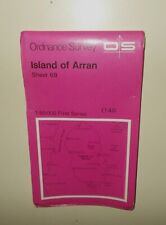 VINTAGE 1976 OS MAP OF ISLAND OF ARRAN
-
$5.00 GBP
 VINTAGE LINEN WARD LOCK MOTORING & TOURING MAP SHEET 3 - THE LAKE DISTRICT
-
$15.00 GBP
 Vintage Philips’ Cyclist Map Of The County Of Surrey
-
$17.00 GBP
 Philips Authentic Map of England Mounted on Cloth. Pocketbook Hardcover
-
$4.50 GBP
 NORTH MIDDLESBROUGH St Hilda's 1913 - Old Ordnance Survey Maps Godfrey Edition
-
$25.00 GBP
 1904 Antique Folding Guide Map Aberystwyth to Barmouth Wales 9" x 6.5"
-
$25.00 GBP
 Original 1904 Antique Map Empires of Babylonians Lydians Medes & Persians
-
$150.00 GBP
 Durham & Northumberland Large John Cary Maps, 1821 Census, Town Distances
-
$5.00 GBP
 Vintage Pinner & Hatch End Fold-Out Map 1940s Lock & Vince Surveyors - Excellent
-
$5.50 GBP
 OS SCOTLAND Sheet 8, 1/4inch:1mile. 1st edition c1905, rev 1914
-
$4.99 GBP
 c1900 Bazaar Exchange & Mart Tourists Route Map of England & Wales - Cycling
-
$7.99 GBP
 1952 HISTORICAL MAP SCOTLAND DEPICTING ARMS OF SCOTTISH FAMILY CLANS AND YEARS.
-
$15.99 GBP
 1891 Map of Berlin and environs - F.S. Weller / London, Cassell & Company
-
$1.99 GBP
 VINTAGE ORDNANCE SURVEY OS MAP OF TENBY - VINTAGE 1975
-
$15.00 GBP
 Vintage Bacon's Cycling And Motoring Map Of Norwich District Waistcoat Folding
-
$3.75 GBP
 ARNHEM AND THE THREE RIVERS 17 Sept 1944, WW2 Map
-
$12.00 GBP
 Bacon's new chart of north and central England map
-
$8.00 GBP
 Geographia Road Map of England & Wales
-
$7.99 GBP
 c.1950 Bartholomew Half-Inch Map Collection x 8
-
$15.00 GBP
 c.1902 Bacon's COUNTY MAP of LEICESTER & RUTLAND
-
$7.30 GBP
 Vintage Bacon's Cycling Road Map 50 Miles Around Birmingham
-
$4.95 GBP
 THE DEVELOPMENT OF ALLIED STRATEGY NORTH OF THE SEINE, 1944, WW2 Map of OVERLORD
-
$5.00 GBP
 Bartholomew's SUSSEX Half-Inch Sheet 32 - 1933 Vintage Cloth Map
-
$10.00 GBP
 VINTAGE STANFORD'S MAP OF THE RIVER THAMES FROM RICHMOND TO LECHLADE DATED 1948
-
$9.99 GBP
 REID'S PLAN NEWCASTLE UPON TYNE SCALE 4" TO 1 MILE
-
$12.50 GBP
 Bacon's Large-Print Motor Map of South Central England
-
$6.49 GBP
 Vintage Europa BP Map Touring Service Fold Out Paper Ephemera Travel
-
$20.00 GBP
 ANTIQUE FOLDING LINEN ORDNANCE MAP OF DROITWICH BROMSGROVE & REDDITCH
-
$6.00 GBP
 BRIDPORT British Geological Survey Map - 1968 Solid and Drift Edition
-
$10.00 GBP
 Admiralty Chart 871 - Rivers Tamar, Lynher & Tavy
-
$26.00 GBP
 1880s Map Dorsetshire by J & C Walker Hand Coloured Parliamentary Divisions
-
$430.00 GBP
 1808 Bowles and Carver Folding Road Map of England and Wales - Very Rare
-
$3.00 GBP
 1943 Ordnance Survey Map 181 Chichester WWII Non-Original Cover
-
$6.50 GBP
 Hastings 184 & Swindon 157 Seventh Series One Inch Ordnance Survey Map
-
$20.00 GBP
 France Sheet 51c Edition 1 ww1 Era Map 1:40,000
-
$9.95 GBP
 VINTAGE ONE INCH ORDINANCE SURVEY SCOTTISH 6 MAP BUNDLE 1950'S 1960'S
-
$1.00 GBP
 1992 low fly Map of Norway coast
-
$35.00 GBP
 1945 Vintage Folding Map Devon & Cornwall England John Bartholomew 14" x 10"
-
$4.00 GBP
 Historical Map of Wales and Monmouth L Bullock John Bartholomew ⭐️MAKE AN OFFER
-
$15.00 GBP
 Vintage W & A Bates Road Map Of Eastern Counties Tyres
-
$10.00 GBP
 Nester's New York City Maps Vintage Folding Paper Map
-
$8.95 GBP
 1984 Vintage Filofax Map Pages - 3 Double sided Pages - Ref MO7
-
$5.00 GBP
 Reproduction - Map of Historic York - 18” x 15”
-
$14.99 GBP
 ORDNANCE SURVEY CLOTH TOURIST MAP OF THE LAKE DISTRICT 1" TO 1 MILE 1920
-
$7.50 GBP
 London SE 171 & Eastbourne 183 Seventh Series One Inch Ordnance Survey Map
-
$20.00 GBP
 Belgium B Series Sheet 28 N.W. Folding Map 1:20,000 Ordnance Survey 1915 ww1
-
$3.50 GBP
 Vintage Imray's Map of Inland Waterways of England & Wales.
-
$15.00 GBP
 1917 Devon Map Ordnance Survey Office Boundary Commission
-
$4.25 GBP
 ADVANCE INTO BELGIUM & DEVELOPMENT OF BROAD FRONT POLICY, AUG 1944, WW2 Map
-
$5.00 GBP
 Navigation Instruction map 5062 Bristol Channel 1967
-
$15.00 GBP
 Bartholomews Half Inch Maps Sheet 5 New Forest
-
$4.50 GBP
 OXFORD 1898 - Old Ordnance Survey Maps Godfrey Edition
-
$4.50 GBP
 Britain a map for tourists A British Travel Publication
-
$10.00 GBP
 VINTAGE MAPS - SELECTION OF 5 OLD LONDON MAPS
-
$55.00 GBP
 Stanford's Road and Railway Map of Scotland - 1858 - 24 Panels Laid On Linen
-
$9.29 GBP
 Historical Map of Scotland by LG Bullock Bartholomew Folded Map
-
$6.99 GBP
 Vintage original - early 1920s - Thomas Cook Map of Central & Southern Europe
-
$7.95 GBP
 North Wales Vintage Bartholomew's Map, Revised Half-Inch Contoured, Sheet 27
-
$6.00 GBP
 SCARBOROUGH British Geological Survey Geology Map 1967 Drift Edition
-
$15.00 GBP
 Vintage Bacon's New Cycling Road Map Of Reading And District
-
$5.00 GBP
 VINTAGE MAP - 'STREET PLAN OF COLCHESTER'.
-
$4.99 GBP
 The Maltese Islands Valletta Sliema Mdina Map - Visitor Colourmaster Series
-
$8.99 GBP
 VINTAGE AA THE AUTOMOBILE CLOTH MAP Of ENGLAND & WALES - 4 Miles To 1” SHEET 10
-
$7.00 GBP
 Vintage Cloth Map 1924 - Edward Stanford Ltd 73SW Battlesbridge Rawreth Wickford
-
$12.00 GBP
 Stanford's 1930s Map of Canals & Rivers Navigable by Small Craft
-
$25.00 GBP
 1938 Vintage Folding County Map Gloucestershire 12.5" x 10.75"
-
$25.00 GBP
 1933 Vintage Folding Guide Map The Western Highlands Scotland 13" x 11.25"


