
-
$30.00 GBP

 1882 Map of the Shaktu Valley Punjab Waziristan Pakistan antique vintage
-
$60.00 GBP
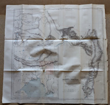
 1882 Map of the Rovuma River Tanzania Mozambique antique vintage
-
$60.00 GBP
 1882 Map of Sources Irawadi River Pundit Journey Tibet Assam antique vintage
-
$25.00 GBP
 Original Map of River Thames Benson to Purley 1950 8.75" x 5"
-
$12.00 GBP
 Stanford's 1930s Map of Canals & Rivers Navigable by Small Craft
-
$24.99 GBP
 Grand Union Canal Daventry and Leicester section map of reservoirs
-
$4.99 GBP
 THE ADVANCE TO THE RIVER SEINE & LIBERATION OF PARIS, WW2 Map of OVERLORD 1944
-
$3.75 GBP
 ARNHEM AND THE THREE RIVERS 17 Sept 1944, WW2 Map
-
$4.25 GBP
 THE CROSSING OF THE RIVER SEINE 21 ARMY GROUP 25-27 AUG 1944, WW2 OVERLORD Map
-
$8.00 GBP
 Stanfords Canoeing Map England & Wales c1968 Scale 14 miles - Inch Rivers Canals
-
$3.50 GBP
 OPERATIONS TO CLEAR TYHE WEST BANK OF THE RIVER MAAS 1944, WW2 Map
-
$10.00 GBP
 1882 Map of Marhatta Country Bombay Mumbai India antique vintage
-
$3.99 GBP
 THE DEVELOPMENT OF ALLIED OPERATIONS EAST OF THE RHINE March/April 1945 WW2 Map
-
$25.00 GBP
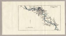
 Original Map of River Thames Purley via Reading to Wargrave 1950 9" x 6"
-
$25.00 GBP
 Original Map of River Thames Cirencester to Northmoor 1950 14" x 5.5"
-
$25.00 GBP
 Original Map of River Thames Nuneham & Abingdon to Benson 1950 8" x 6"
-
$4.95 GBP
 Stanfords Map Of The River Thames Lechlade To Hammersmith, 2000 Edition Vintage
-
$59.00 GBP
 Panorama of the Rhine (Panorama des Rheins), Delkeskamp, 1837
-
$22.00 GBP
 The river Mersey from Rock lighthouse to Garston. Rare 1875 76cm panoramic map
-
$9.99 GBP
 Stanfords Canoeing Map England & Wales c1968 Scale 14 miles - Inch Rivers Canals
-
$30.00 GBP
 c.1930's Blake's Folding Map of the Rivers & Broads of Norfolk & Suffolk
-
$25.00 GBP
 Original Map of River Thames Wargrave via Maidenhead to Boveney 1950 10.5" x 6"
-
$12.50 GBP
 Antique River Rhein/Rhine Fold Out Map with Postcard Images, K Suder of Mainz
-
$25.00 GBP
 Original Map of River Thames Boveney via Windsor to Staines 1950 8.5" x 5"
-
$20.01 GBP
 Map. A. Legun "Upper Don" Table of riffles. No 15 Russian Empire.
-
$500.00 GBP
 1st Ed. Antique 1889 Victorian Map Up Down the River Bennet's Map & Guide Thames
-
$28.02 GBP
 Vintage Rhine Fold Out Map Gorgeous Color No Rips or Tears Der Rhein German Map
-
$28.02 GBP
 Map. A. Legun "Upper Don" Riffles. No 14 Russian Empire.
-
$25.00 GBP
 Original Map of River Thames Northmoor to Oxford & Sandford 1950 7.25" x 5.25"
-
$25.00 GBP
 1885 Antique Map of the Rhine - Mayence to Coblenz - Virtue & Co Ltd 13" x 10.5"
-
$15.00 GBP
 Original Map of River Thames Staines to Hampton Wick 1950 9.25" x 5"
-
$93.04 GBP
 Vintage New York Map Delaware and Hudson River Canal w/Railroads Mines 1828 1898
-
$775.00 GBP
 London Panorama of the River Thames, Oxford to London, C.W.Bacon Original c 1890
-
$28.02 GBP
 Map. A. Legun "Upper Don" Riffles. No 13 Russian Empire.
-
$3.20 GBP
 1972 Army Engineers Folded Map OHIO RIVER BASIN MAP, PLAN OF DEVELOPMENT
-
$60.03 GBP
 Map. Improving navigation conditions in the rapids part of the Danube River.
-
$28.02 GBP
 Map. A. Legun "Upper Don" No 11 Russian Empire.
-
$28.02 GBP
 Map. A. Legun "Upper Don" drawing of a barge, Stone caravan barge. No12 Russia.
-
$70.43 GBP
 Antique Map Susquehanna Delaware Mohawk River Property Grants w/Names 1849 Pease
-
$38.34 GBP
 Carte de Pilotage du Danube du km 1880 (Devin) au hm 1707 (Szob) échelle 1:10000
-
$15.97 GBP
 1855 COAST SURVEY MAP ~ LONG ISLAND, N.J., DE, CT, R.I. ~ HUDSON RIVER
-
$20.00 GBP
 1920s-1930s Relief-Panorama of the Rhine, Color Foldout Map, Hoursch 64" long
-
$750.00 GBP
 Original 1879 London Steamboat Company Map (& Timetable)
-
$40.01 GBP
 VINTAGE 1990 Creative Cartoon MAP OF SOLDOTNA ALASKA Kenai River
-
$90.23 GBP
 1907 Rand, McNally & Co. Pocket Alaska Map Folding Towns Lakes Rivers Populat
-
$40.02 GBP
 1930 Motor Routes Virginia Seashore Folding Map James River Bridge Am Auto Assoc
-
$6.40 GBP
 1940's CHESTER-BRIDGEPORT FERRY Map Delaware River New Jersey Pennsylvania
-
$5.60 GBP
 Lower Deschutes River Public Lands Map, 1990s/early 2000s?
-
$13.99 GBP
 FOLDING SKETCH MAP BATTLE PLAN PENINSULAR WAR RIVERS DOURO AND MINHO SOULT 1809
-
$2.76 GBP
 Upper Missouri National Wild & Scenic River Maps 3 & 4, Dept Of The Interior.
-
$10.40 GBP
 COAST GEODETIC SURVEY COLUMBIA RIVER PACIFIC OCEAN TO HARRINGTON POINT MAP 1958
-
$18.27 GBP
 USDA National Forest Service Map WHITE RIVER - Colorado - 1979 revised 1985 -
-
$10.81 GBP
 Vintage NEW ORLEANS LA Visitor's Guide MAP - Mississippi River Steamer President
-
$14.37 GBP
 Vintage FISHING MAP CARIBOU BRITISH COLUMBIA CANADA Sport Fishing Canada Lakes
-
$4.80 GBP
 Tijuana River Estuarine Reserve Map San Diego CA Border Field State Park Imperia
-
$17.60 GBP
 Antique NY Map Fort Bull William Mohawk River Wood Creek French Indian War 1849
-
$16.01 GBP
 Vintage U.S. Coast & Geodetic Survey Map Long Island Sound East River 1942
-
$77.42 GBP
 Antique Nouveau Panorama Du Rhin From Mannheim To Cologne D Kapp Fold Out Book
-
$21.70 GBP
 THE RHINE (1964) Fold-Out Historical Map, German River, Germany, 42 x 7 Inches
-
$36.02 GBP
 Folded Color Soil Survey Map Russell Kansas Bunker Hill Smoky Hill River 1903
-
$220.08 GBP
 PLAN OF PART OF THE CHARLES RIVER BOSTON MASSACHUSETTS HUGE FOLDING MAP 1882
-
$8.00 GBP
 2020 PLYMOUTH MASSACHUSETT 400th anniversary MAP - 35 x 23 inches (P4)
-
$12.00 GBP
 Hidden River Mammoth Onyx Cave Map 1931
-
$16.01 GBP
 Vintage U.S. Coast & Geodetic Survey Map San Carlos Bay & Caloosahatchee River
-
$32.02 GBP
 1890 St Croix, Hudson rivers + Lake Ontario Survey map - 35.2" x 25.2" Nautical
-
$32.02 GBP
 Mississippi River, Revetment of Banks Below Cairo, Illinois, 1912 - With Map
-
$12.81 GBP
 Vintage West Branch Watershed Map of Westfield River 1964 11” X 14”
-
$10.40 GBP
 Lake Tawakoni & Iron Bridge Dam Folding Map Sabine River Texas
-
$36.02 GBP
 Folded Color Soil Survey Map Caldwell Idaho Nampa Roswell Boise River 1901
-
$16.01 GBP
 1932 ORIGINAL COLOR MAP of NILE RIVER VALLEY Africa ~ Authentic Dated Vintage
-
$36.02 GBP
 Folded Map Alaska Koyukuk Chanadlar River Geology Geologic Notes Alaskan 1899
-
$36.02 GBP
 Folded Soil Survey Map Minidoka Idaho Acequia Rupert Heyburn Snake River 1907
-
$27.98 GBP
 1909 CUNNINGHAM GROUP COAL MINING CLAIMS MAP, BERING RIVER REGION, ALASKA
-
$7.96 GBP
 1972 Army Engineers Folded Map///OHIO RIVER BASIN MAP, PLAN OF DEVELOPMENT
-
$76.04 GBP
 Examination of Harlem River, New York, at Johnson Iron Works, 1912 - With Maps
-
$160.09 GBP
 antique Maps palisades interstate parkW Welch NY & NJ T Roosevelt F Vorhees
-
$36.02 GBP
 Folded Map Explorations in Alaska Lynn Canal Copper White River Eagle City 1899
-
$23.97 GBP
 1892 MAP of MISSISSIPPI RIVER Comm. / Triangulation & Stone Lines / Iowa
-
$64.04 GBP
 Examination of Ouachita River, from Camden to Arkadelphia, Ark. 1912 - With Maps
-
$36.02 GBP
 Map of York River, Virginia, West Point Bar 1894
-
$8.00 GBP
 1993 Kansas City Flooding USGS Survey
-
$40.02 GBP
 Examination of Red River of the North, Minnesota & North Dakota, 1912 - With Map
-
$48.02 GBP
 1893 MAP NEW ORLEANS HARBOR Mississippi River / Bank Protection / Cotton Wharf
-
$8.05 GBP
 1986 Chattahoochee River Recreation Map Fishing Rafting Canoeing 38”x25” Georgia
-
$5.60 GBP
 Vintage Rhein River From Mainz To Köln , Germany Map
-
$40.02 GBP
 Examination of Woodbury Creek, New Jersey, 1912 - Includes Maps


