 Antiques (UK)
Africa Maps
Asia Maps
Australia/Oceania Maps
Celestial Maps
Central America/Caribbean Maps
Curiosities Maps
Digital Maps
Europe Maps
Map & Globe Mixed Lots
Map & Globe Reproductions
North America Maps
South America Maps
World & Celestial Globes
World Maps

-
$9.00 GBP

 County map of Hertfordshire England hand coloured c1860
-
$9.00 GBP
 County map of Sussex England hand coloured c1860
-
$9.00 GBP
 County map of Shropshire England hand coloured c1860
-
$175.00 GBP
 1794 Country Around Manchester Large Folding Map by Stockdale 84 cm x 81 cm
-
$20.00 GBP
 Devonshire, 1784 county map, genuine antique 240 years old!
-
$85.00 GBP
 Antique Map of England by Petrus Bertius 1618
-
$9.00 GBP
 County map of Durham England hand coloured c1860
-
$9.00 GBP
 County map of West Riding Yorkshire England hand coloured c1860
-
$9.00 GBP
 County map of Essex England hand coloured c1860
-
$48.00 GBP
 ROBERT MORDEN - NORTH RIDING OF YORKSHIRE CAMDENS BRITANNIA 1695 FRAMED.
-
$9.00 GBP
 County map of Suffolk England hand coloured c1860
-
$55.00 GBP
 Antique map of Surrey by Richard Blome 1715
-
$9.00 GBP
 County map of Warwickshire England hand coloured c1860
-
$25.00 GBP
 Original Antique 1787 Copper Plate Engraved Map Of Somerset By JOHN CARY.
-
$18.99 GBP
 1843 Britannia Antiqua Map - S.Hall
-
$20.00 GBP
 1794 Buckinghamshire Original Antique Map by Thomas Conder
-
$85.00 GBP
 Antique Map of Scotland by Petrus Bertius 1618
-
$249.99 GBP
 1662 SCARCE WILLEM & JOAN BLEAU MAP DEVONSHIRE HAND COLOURED
-
$15.00 GBP
 Vintage Bacon's New Cycling Road Map Of Reading And District
-
$12.00 GBP
 1836. IRVINE AYRSHIRE. 6" TO THE MILE BURGH MAP. WITH REPORT ON THE BURGH
-
$75.00 GBP
 Antique Map of Britain by Petrus Bertius 1618
-
$50.00 GBP
 Robert Morden antique map of County Durham 1695, Framed
-
$100.00 GBP
 Antique map, Blome, Warwickshire, Description of the Kingdoms of England, 1673
-
$9.00 GBP
 County map of Leicestershire England hand coloured c1860
-
$50.00 GBP
 Antique map of Kent by Richard Blome 1715
-
$9.00 GBP
 County map of Wiltshire England hand coloured c1860
-
$15.00 GBP
 Vintage Bacon's Cycling Road Map Of The Environs London N.E.
-
$7.30 GBP
 Vintage Bacon's Cycling Road Map 50 Miles Around Birmingham
-
$39.99 GBP
 Admiralty Chart - No.2007 - DUMBARTON to GLASGOW, RIVER CLYDE - 1934 Edn.
-
$9.00 GBP
 County map of Northumberland England hand coloured c1860
-
$19.99 GBP
 1814 Germany by J. Russell Original Antique Map Over 200 Years Old
-
$48.00 GBP
 Antique Map Shropshire Herman Moll Vintage Picture Frame Glazed Salop UK 1700’s
-
$45.00 GBP
 Antique map of Warwickshire by Richard Blome 1715
-
$24.00 GBP
 London to Richmond, John Cary 1790 Antique Road Street Map Inns Parks
-
$9.00 GBP
 County map of Dorsetshire England hand coloured c1860
-
$80.00 GBP
 Antique Map of North Scotland by Petrus Bertius 1618
-
$12.00 GBP
 1701 ROBERT MORDEN MAP OF NORTHAMPTONSHIRE - Antique Framed Map Rob MORDEN
-
$75.00 GBP
 EUROPE EUROPA BY NICOLAS SANSON c1794 GENUINE COPPER ENGRAVED MAP
-
$50.00 GBP
 1831 Atlantic Ocean Daniel Lizars Large Hand Coloured Original Antique Map
-
$17.99 GBP
 1720 Abingdon - Fairford Gloucester - Monmouth Antique Road Map by Emanuel Bowen
-
$95.00 GBP
 Antique Map LONDON & Environs, John Russell, David Hughson Original 1808
-
$48.00 GBP
 POLAND, LITHUANIA, John Senex original antique map 1749
-
$9.00 GBP
 County map of Northamptonshire England hand coloured c1860
-
$9.00 GBP
 County map of North Riding Yorkshire England hand coloured c1860
-
$95.00 GBP
 MALTA VALLETTA c1679 BY FRANCESCO SCOTO GENUINE ORIGINAL BIRDS EYE VIEW MAP
-
$12.99 GBP
 COLERAINE VINTAGE MAP PORTNA, CARNROE LOCK, LOUGH BEG, RIVER BANN, LOUGH NEAGH
-
$85.00 GBP
 Antique Map of Wales by Petrus Bertius 1618
-
$20.00 GBP
 Hampshire, 1784 county map, genuine antique 240 years old!
-
$85.00 GBP
 Antique Map of Great Britain and Ireland by Petrus Bertius 1618
-
$39.99 GBP
 1661 House of Elzevir / Philipp Cluver, miniature map of Persia Iran
-
$19.99 GBP
 Admiralty Chart - No.2007 - DUMBARTON to GLASGOW, RIVER CLYDE - 1934 Edn.
-
$90.00 GBP
 Old Map, Robt. Morden, Northumberland, 1695-1722, antique original, Framed. &
-
$15.00 GBP
 Vintage Bacon's Cycling And Motoring Map Of Norwich District Waistcoat Folding
-
$40.00 GBP
 Antique map of Berkshire by Richard Blome 1715
-
$45.00 GBP
 Antique 18th century Nottinghamshire Map Robert Morden lot LH22
-
$30.00 GBP
 ANCIENT EGYPT, ALEXANDRIA, MEMPHIS, NILE, RED SEA original antique map SDUK 1844
-
$15.00 GBP
 Vintage Bacon's Cycling Road County Map Of The Lincoln
-
$9.00 GBP
 County map of Lancashire England hand coloured c1860
-
$40.00 GBP
 Antique map of Northamptonshire by Richard Blome 1715
-
$35.00 GBP
 HAMPSHIRE, DROXFORD, WICKHAM, FAREHAM, GOSPORT original antique map, MOGG, 1817
-
$35.00 GBP
 SURREY, MICKLEHAM, DORKING, CAPEL, WARNHAM, original antique map, MOGG, 1817
-
$75.00 GBP
 BRITISH ISLES BRITAIN UK Insulae Albion et Hibernia John Seller Antique Map 1694
-
$75.00 GBP
 Antique Map of North East England by Petrus Bertius 1618
-
$175.00 GBP
 AFRICA c1590 BY ABRAHAM ORTELIUS GENUINE ORIGINAL ENGRAVED MAP
-
$85.00 GBP
 Antique Map of South West England by Petrus Bertius 1618
-
$27.50 GBP
 HUNTINGDONSHIRE, ST NEOTS, BUCKDEN, antique road map, MOGG, 1817
-
$95.00 GBP
 Antique map HOO, CHATHAM, GILLINGHAM, High Halstow, Allhallows, Kent Hasted 1778
-
$40.00 GBP
 ITALY FORUM JULY VENICE c1590 BY ABRAHAM ORTELIUS GENUINE ORIGINAL ENGRAVED MAP
-
$65.00 GBP
 Antique Map HAMPSHIRE, Van Den Keere, Miniature Speed original 1646
-
$45.00 GBP
 Antique Map KENT & FRANCE with Roman/Saxon placenames Edward Hasted c1780
-
$195.00 GBP
 BRITISH ISLES Britain Anglia Scotia Hibernia, Mercator Hondius antique map 1607
-
$65.00 GBP
 ARMS OF THE COLLEGES CAMBRIDGE BY EMANUEL BOWEN c1720 GENUINE ANTIQUE ENGRAVING
-
$69.95 GBP
 London City Environs Civil War Map As Fortified in c1642 collectors 1775
-
$20.00 GBP
 Gloucestershire, 1784 county map, genuine antique 240 years old!
-
$99.00 GBP
 London, Southwark, St. Saviours, St. Georges, Stow's Survey, John Strype 1720
-
$55.00 GBP
 Antique map of Hampshire by Richard Blome 1715
-
$101.00 GBP
 Rutlandshire map 1722 by Robert Morden Original on laid paper hand color
-
$45.00 GBP
 Antique map of Lancashire by Richard Blome 1715
-
$30.00 GBP
 map Leicestershire John Aikin England Delineated Original with text c1803
-
$58.24 GBP
 Mallet Map TYPES OF SHIP 17th century original engraved print c1683
-
$25.00 GBP
 1737 ORIGINAL ANTIQUE COPPERPLATE MAP FLANDERS SPANISH NETHERLANDS - HERMAN MOLL
-
$55.00 GBP
 Antique map of Dorset by Richard Blome 1715
-
$6.00 GBP
 1720 Antique Road Map Maidenhead Henley Dorchester Abingdon ex-Britannia Depicta
-
$144.99 GBP
 1673 Antique Map; Devon by Richard Blome.
-
$45.00 GBP
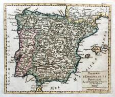 SPAIN AND PORTUGAL BY ROBERT DE VAUGONDY c1794 GENUINE ANTIQUE ENGRAVED MAP
-
$75.00 GBP
 Small Original Jodocus Hondius Map of Tartaria inc. Russia & China, c.1616
-
$42.75 GBP
 Africa and Mediterranean map 1800 engraved coloured by Wilkinson
-
$55.00 GBP
 Antique map of England by Richard Blome 1715
-
$45.00 GBP
 Antique map of Surrey by John Seller 1701
-
$49.00 GBP
 VINTAGE ADMIRALTY CHART. No.883. SCILLY ISLES, St MARY'S, CROW SOUND. 1900 Edn.
-
$225.00 GBP
 BRITISH ISLES, Insulae Albion et Hibernia, BLAEU Original antique map c1645
-
$175.00 GBP
 KENT, CANTIUM, John Norden & William Kip, Camden original antique map 1637
-
$39.99 GBP
 1661 House of Elzevir / Philipp Cluver, miniature map of Europe
-
$35.00 GBP
 HAMPSHIRE, TITCHFIELD, FAREHAM, PORTCHESTER, original antique map, MOGG, 1817
-
$28.00 GBP
 SCOTLAND, ANGUS, FIFE, original antique map, Perrot, 1828
-
$185.00 GBP
 PEMBROKESHIRE, WALES, Saxton & Kip, Camden Original antique map 1637
-
$35.00 GBP
 WILTSHIRE, CORSHAM, SOMERSET, BATHFORD, BATH, original antique map, MOGG, 1817
-
$60.32 GBP
 Moa Menorca Spain - Original Map by Roux - 1764
-
$19.99 GBP
 1832 German Confederation Original Antique Map by Thomas Starling
-
$350.00 GBP
 1793 Plan Manchester & Salford Large Folding Map by Charles Laurent 106 cm x 91


