 Antiques (UK)
Africa Maps
Asia Maps
Australia/Oceania Maps
Celestial Maps
Central America/Caribbean Maps
Curiosities Maps
Digital Maps
Europe Maps
Map & Globe Mixed Lots
Map & Globe Reproductions
North America Maps
South America Maps
World & Celestial Globes
World Maps

-
$145.00 GBP

 VINTAGE GEOGRAPHIA 1950s SCHOOL EDUCATIONAL GLASGOW STREET PLAN WALL MAP PRE M8!
-
$25.00 GBP
 100% ORIGINAL FOX HOUNDS HUNTING MAP OF GREAT BRITAIN BY HAMPTON C1984 VGC
-
$19.99 GBP
 1882 Egypt, Nubia & Abyssinia Original Antique Colour Map by Edward Weller
-
$54.00 GBP
 VINTAGE SCAN GLOBE A/S DENMARK 12" LIGHT UP WORLD EARTH GLOBE. MADE IN DENMARK.
-
$34.95 GBP
 Vintage Large Wooden Zodiac Astrology Globe & Stand - Rare
-
$20.00 GBP
 Globe EarthVintage Scan Globe World Map
-
$7.00 GBP
 Admiralty Sea chart St. George’s Channel 1987 No.1410
-
$29.99 GBP
 Illuminated Light Up Globe 1981 Earth Denmark Vintage Scan Globe World Map
-
$20.00 GBP
 The Making Of America National Geographic 8 Vintage Maps 1985-1987
-
$8.95 GBP
 1984 Vintage Filofax Map Pages - 3 Double sided Pages - Ref MO7
-
$29.99 GBP
 Scanglobe World Antique Danish Illuminated Globe Large - Light
-
$4.95 GBP
 Berwick Upon Tweed Holy Island Area OS Landranger Sheet 75 Paper 1:50,000 2000
-
$6.99 GBP
 VINTAGE MAP PRINT READY FOR FRAMING OF ANTIQUE 1715 THE TOTIUS EUROPE LITTORA
-
$208.91 GBP
 18" Large Fully Brass Armillary Sphere Engraved Nautical Astrolabe World Globes
-
$156.57 GBP
 Brass Sphere Engraved Antique Armillary 18" Nautical Finish Astrolabe Compass
-
$39.95 GBP
 World Globe Vintage 1982 Danish Scan-Globe A/S Denmark
-
$10.00 GBP
 Admiralty Chart 871 - Rivers Tamar, Lynher & Tavy
-
$19.99 GBP
 Wooden World Globe Map Dark Wood Vintage Spanish Decretive item 25cm Tall
-
$7.50 GBP
 Vintage Map of Greater London
-
$59.00 GBP
 Vintage Globe World Map Soviet Russian USSR 1985
-
$24.99 GBP
 Vintage Desk Top Mini Celestial Globe 1982 Rotating World 1980's Cold War Era
-
$12.00 GBP
 Vintage NORFOLK County Map Print Thomas Moule Wrightsons Foilgraphic
-
$6.00 GBP
 GLOSSOP British Geological Survey Map - 1981 Solid and Drift Edition
-
$6.00 GBP
 YORK British Geological Survey Map - 1983 Solid and Drift Edition
-
$4.00 GBP
 Denmark-Map & Visitor Guide 1988, Copenhagen City Map 2009, Copenhagen City GuId
-
$6.00 GBP
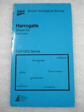 HARROGATE British Geological Survey Map - 1987 Solid Edition
-
$14.99 GBP
 ADMIRALTY SEA CHART. No. 1827. HARBOURS on the SOUTH-EAST COAST of ENGLAND. 1987
-
$8.50 GBP
 Beijing Tourist Map - China Cartographic Publishing House - English Edition 1986
-
$16.64 GBP
 1991 Oregon-Idaho Hell's Canyon Quadrangle US Geological Survey Map 30"x 23"
-
$16.29 GBP
 Map Solon Maine 1989 Topographic Geological Survey 1:24000 27 x 22" TOPO7
-
$16.29 GBP
 Map Misery Knob Maine USGS 1988 Topographic Geological 1:24000 27x22" TOPO17
-
$76.41 GBP
 خريطة خارطة جمهورية مصر العربية 1: 1000000 1981 vintage Map of Egypt maps Cairo
-
$14.99 GBP
 MAP OF KENT 1800'S 51 x 41cm WRIGHTSONS FOILGRAPHICS 1985 REPRODUCTION
-
$6.99 GBP
 Rare Ordnance Survey Map TM46 Leiston 1983 Sizewell, Westleton Dunwich, Minsmere
-
$9.99 GBP
 Admiralty Chart 1991 Harbours On The South Coast Of England
-
$15.00 GBP
 Vintage Shipping chart , RIVER MEDWAY- Garrison Point to Folly Point. 1985
-
$6.00 GBP
 STOCKTON British Geological Survey Map - 1987 Solid and Drift Edition
-
$6.00 GBP
 Scilly Isles Vintage Map St Marys Hugh Town Tresco St Martins Bryher St Agnes
-
$57.53 GBP
 Nautical Solid Brass World Globe With Wooden Base Vintage Armillary Sphere...
-
$10.81 GBP
 Canada Dept Mines & Resources Dawson Creek Prince George Aeronautical Map 1980
-
$15.99 GBP
 North Wales Vintage 80s Parchment Style Map 19"x15" Reproduction Print Near Mint
-
$6.00 GBP
 BRIGG British Geological Survey Map - 1982 Solid and Drift Edition
-
$18.99 GBP
 Admiralty Chart Map Italy De La Pointe De Senetose Au Cap Muro Large Maritime
-
$25.00 GBP
 Vintage 1980s TNT Tristar Parcels Express UK map by Cook, Hammond & Kell
-
$12.99 GBP
 1989 Illustrated Atlas of 19thC World Potter Tallis Beautiful Map Plates Repro
-
$20.00 GBP
 Putney Map 1636. Vintage 1980 Repro Print/Poster Nicholas Lane 81x53cm. Unused
-
$2.99 GBP
 Vintage 1988 Bruxelles Brussels Fold Out Tourist Street Plan + Metro Map
-
$40.00 GBP
 Vintage Rath Political Globe German 1985 21 cm diameter
-
$7.99 GBP
 1987 ADMIRALTY NAV. MAP: 2664:FRANCE: W. COAST.POINTE DE LA COUBRE TO D'ARCACHON
-
$6.00 GBP
 MASHAM British Geological Survey Map - 1985 Solid Edition
-
$6.00 GBP
 NOTTINGHAM British Geological Survey Map - 1980 Solid & Drift Edition
-
$10.00 GBP
 Original OS Map; Sheet SD 20 SE; 1973; Crosby Channel, Hightown, Lancashire
-
$3.60 GBP
 Grasses and Rushes and how to Identify Them by J. H. Crabtree vintage
-
$15.00 GBP
 .HARBOURS on SOUTH COAST of ENGLAND, 1982 ADMIRALTY SEA CHART. No.2172
-
$6.75 GBP
 1980s Street Road Plan & Guide Bournemouth & Poole, Christchurch Cinemas Parks
-
$7.00 GBP
 Vintage Clifford J. Utting York Street Plan Large Scale City Centre Plan c1980s
-
$5.00 GBP
 Vintage Primtemps Sponsored map of Paris dated 1986
-
$11.00 GBP
 Original OS Map 1:10,000 Sheet SP 36 NW 1985; Royal Leamington Spa, Warwickshire
-
$14.99 GBP
 Tourist Map of Beijing China PRC English Version 1983 Cartographic Publishing
-
$14.99 GBP
 1983 ORIGINAL GIANT COLOUR MAP PEOPLES REPUBLIC CHINA 62 X 46" IN FOLDER
-
$10.00 GBP
 Vintage 1980 reproduction map - America Septentrionalis: 1639
-
$12.00 GBP
 LARGE REPRINT OF 1860s MAP OF HAMPSHIRE, PRINTED IN 1980.
-
$2.99 GBP
 Ordnance Survey Map 1;50,000 129 Nottingham Loughborough 1987 Inc Melton Mowbray
-
$9.99 GBP
 LUNAR CHART SURFACE MAP AND DATA: PUB 1982 15 X 21 INCH WALL ART
-
$0.99 GBP
 vintage 1986 Orell Füssli ZÜRICH Switzerland map Deutsch/Français/English1:17500
-
$2.50 GBP
 Street Guide with street index Bearsden Milngavie 1980s
-
$7.50 GBP
 Framed Francis Holgate Design Of Sidmouth Devon Love Of Sidmouth 10x8 Inch
-
$4.99 GBP
 Vintage National Geographic Map - Yellowstone National Park 1989 - 40cm x 51cm
-
$3.49 GBP
 Vienna City Map 1980's
-
$9.99 GBP
 admiralty see navigation chart number 438
-
$29.99 GBP
 Voronezh, Russia Tourist map 1980 **very rare vintage item** Воронеж
-
$10.00 GBP
 Vintage Marine Chart - Admiralty 2052 Orfordness Ness to The Naze
-
$11.00 GBP
 OS Map; Sheet SP 49 SW; 1984; Hinckley, Leicestershire
-
$5.99 GBP
 3 Vintage AA Day Drives in Scotland - Central, North & South East Maps
-
$12.99 GBP
 Admiralty Chart Map Da Capo Gallo A Punta Priola Italy Italian Maritime Map
-
$19.99 GBP
 Tourist Map of Beijing China PRC English Version 1983 Cartographic Publishing
-
$10.00 GBP
 Original OS Map; 1:10,000; Sheet SP 13 SW; 1980; Snowshill, Gloucestershire
-
$11.00 GBP
 Original OS Map; 1:10,000; Sheet SP 69 NW; 1983; Leicester, Leicestershire
-
$15.00 GBP
 HARBOURS & ANCHORAGES in WEST SOLENT AREA, 1987 ADMIRALTY SEA CHART. No.2021
-
$36.00 GBP
 Vintage 1983 Danish Scan-Globe A/S Denmark World Globe 25cm
-
$12.00 GBP
 Original OS Map; 1:10,000; Sheet SK 49 SW; 1980; Rotherham, South Yorkshire
-
$9.99 GBP
 Scotland Touring Map & Information Booklet 1981 Bartholomew Large Good
-
$11.50 GBP
 Original OS Map; 1:10,000; Sheet SK 47 NW; 1980; Eckington, Yorkshire
-
$5.00 GBP
 1989 FOLDING MAP & INFO ON HISTORICAL FRANCE FROM NATIONAL GEOGRAPHIC HISTORY
-
$19.99 GBP
 Vintage Globe, Desktop Globe, Antique Globe
-
$11.00 GBP
 Original OS Map; 1:10,000; Sheet SP 69 NE; 1985; Great Glen, Leicestershire
-
$11.00 GBP
 ADMIRALTY SEA CHART. PLANS on The EAST COAST of IRELAND. No. 633....1977
-
$44.00 GBP
 VINTAGE ADMIRALTY CHART. No.2753. New York. 1984.
-
$2.99 GBP
 Ordnance Map 1;50k 103 Blackburn Burnley 1988 Skipton Darwen Rawtenstall Colne
-
$10.00 GBP
 Original OS Map; 1:10,000; Sheet SJ 49 NE; 1980; Windle, Merseyside
-
$10.50 GBP
 Original OS Map; 1:10,000; Sheet SP 34 NW; 1981; Oxhill, Warwickshire
-
$10.00 GBP
 Original OS Map; Sheet TL 04 NW 1989; Kempston, Bedfordshire
-
$12.00 GBP
 Original OS Map; 1:10,000; Sheet SD 70 SE; 1980; Radcliffe, G Manchester
-
$26.50 GBP
 Admiralty Sea Chart Channel Islands Approach Cherbourg France Vintage Navy Maps
-
$12.00 GBP
 Original OS Map; Sheet SD 30 NE; 1974; Haskayne, Aughton, Lancashire
-
$5.99 GBP
 Ordnance Survey Map of Worcester & Malverns - Landranger Sheet 150 (1980) WORCS
-
$3.79 GBP
 London Bus Tube and Street Tourist Map 1984
-
$11.00 GBP
 Original OS Map; 1:10,000; Sheet SK 58 NE; 1981; Langold, Nottinghamshire
-
$16.08 GBP
 Sand Springs Tulsa Oklahoma USGS Topographic Map Vintage Original Printed 1983
-
$11.64 GBP
 Canadian Dept of Mines & Resources Vernon-Golden Aeronautical Map June 1982


