
-
$31.88 GBP

 USGS Topo Map 7.5 Min Vintage : Caldor, CA 1973 Used BEAUTIFUL Rare Gem
-
$16.74 GBP
 Map Orrs Island Maine 1978 Topographic Geological Survey 1:24000 27 x 22" TOPO7
-
$19.13 GBP
 Map Tenants Harbor Maine 1973 Topographic Geo Survey 1:24000 27 x 22" TOPO9
-
$15.00 GBP
 Framed Large Admiralty Map (1977) Of North Atlantic Ocean
-
$12.00 GBP
 Original OS Map 1:10,000 Sheet SP 23 SW; 1979; Moreton-in-Marsh, Gloucestershire
-
$3.25 GBP
 VINTAGE SEA CHART / NAUTICAL MAP 1961 Ireland Castletown Harbour Bearhaven
-
$3.25 GBP
 VINTAGE SEA CHART / NAUTICAL MAP 1961 - Thames Estuary X 2 N& S - To Frame?
-
$45.00 GBP
 Vintage Admiralty Chart 1446 SCOTLAND - ABERDEEN HARBOUR
-
$4.00 GBP
 LONDON S.W. Map (Ordnance Survey, 1970, Sheet 170, One-Inch)
-
$12.00 GBP
 Original OS Map; 1:10,000; Sheet SD 61 NW; 1975; Heapey, Lancashire
-
$3.25 GBP
 VINTAGE SEA CHART / NAUTICAL MAP 1961 - Calais St Valery Treport Etaples, Etc
-
$3.25 GBP
 VINTAGE SEA CHART / NAUTICAL MAP 1961 - France - Ile Du Bec To Argenton Porsal
-
$10.00 GBP
 Original OS Map; Sheet SD 20 SE; 1973; Crosby Channel, Hightown, Lancashire
-
$16.74 GBP
 Map Jonesport Maine USGS 1977 Topographic Geological 1:24000 27x22" TOPO18
-
$11.96 GBP
 Map Cape Rosier Maine USGS 1979 Topographic Vtg Geological 1:24000 27x22" TOPO12
-
$14.35 GBP
 Map Hermon Maine USGS 1978 Topographic Geological 1:24000 27x22" TOPO14
-
$3.25 GBP
 VINTAGE SEA CHART / NAUTICAL MAP 1961 - Dunkerque, Ostend Niueport Zeebrugge
-
$3.25 GBP
 VINTAGE SEA CHART / NAUTICAL MAP 1961 - France - Ile De Bas & Roscoff
-
$25.00 GBP
 Chalfont St Giles Buckinghamshire 1972 Ordnance Survey Map SU 9892-9992 1:2500
-
$3.25 GBP
 VINTAGE SEA CHART / NAUTICAL MAP 1961 - France - Le Pouliguen, Le Croisic
-
$3.25 GBP
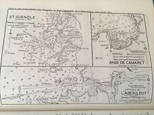 VINTAGE SEA CHART / NAUTICAL MAP 1961 - France St Guenole, L’Aberildut
-
$3.25 GBP
 VINTAGE SEA CHART / NAUTICAL MAP 1961 - France - Paimpol
-
$3.25 GBP
 VINTAGE SEA CHART / NAUTICAL MAP 1961 - France - Perros
-
$3.25 GBP
 VINTAGE SEA CHART / NAUTICAL MAP 1961 - Ireland - Baltimore & Crookhaven
-
$17.99 GBP
 National Geographic Map of The Heavens -Monthly Star Chart Both Hemispheres 1970
-
$3.25 GBP
 VINTAGE SEA CHART / NAUTICAL MAP 1961 - France - Brest Approaches
-
$19.95 GBP
 PTOLEMY LG VINTAGE MAP "MODERN" ITALY, 1520 (1970's FACSIMILE) IMAGE 59 x 39cm
-
$19.95 GBP
 PTOLEMY VINTAGE MAP "MODERN" HOLY LAND, 1520 (1970's FACSIMILE) IMAGE 57x38.5cm
-
$16.74 GBP
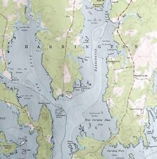 Map Harrington Maine USGS 1975 Topographic Geological 1:24000 27x22" TOPO14
-
$16.74 GBP
 Map Addison Maine USGS 1975 Topographic Vtg Geological 1:24000 27x22" TOPO12
-
$16.74 GBP
 Map Robbinston Maine 1977 Topographic Geological Survey 1:24000 27 x 22" TOPO8
-
$14.35 GBP
 Map Cherryfield Maine USGS 1978 Topographic Vtg Geological 1:24000 27x22" TOPO12
-
$3.25 GBP
 VINTAGE SEA CHART / NAUTICAL MAP 1961 - France - Rivers Aven & Belon, Houat,Tudy
-
$10.95 GBP
 Vintage Ordnance Survey Map - N. Derry/N. Antrim - No 2 - 1974
-
$3.25 GBP
 VINTAGE SEA CHART / NAUTICAL MAP 1961 - Cherbourg
-
$3.50 GBP
 Wales 1978 Vintage BP Road Map Sheet 4
-
$3.25 GBP
 VINTAGE SEA CHART / NAUTICAL MAP 1961 - Eyemouth Dunbar St Abbs - To Frame?
-
$3.25 GBP
 VINTAGE SEA CHART / NAUTICAL MAP 1961 - France Lannion River, Primer, Port Blanc
-
$16.74 GBP
 Map Speckled Mountain Maine 1970 Topographic Geo Survey 1:24000 27 x 22" TOPO4
-
$14.35 GBP
 Map Machias Bay Maine USGS 1977 Topographic Geological 1:24000 27x22" TOPO15
-
$3.25 GBP
 VINTAGE SEA CHART / NAUTICAL MAP 1961 - Ireland - Valencia Island - To Frame?
-
$3.25 GBP
 VINTAGE SEA CHART / NAUTICAL MAP 1961 - Rivers Crouch & Roach - To Frame?
-
$3.25 GBP
 VINTAGE SEA CHART / NAUTICAL MAP 1961 - France - Ile Noirmoutier, St Gilles
-
$12.00 GBP
 Original OS Map; 1:10,000; Sheet SE 84 NE; 1978; Londesborough, Humberside
-
$29.99 GBP
 JOHAN BLAEU MAP OF SUSSEX 1648 44x 57cm 1970'S NATIONAL LIBRARY OF SCOTLAND PRIN
-
$3.25 GBP
 VINTAGE SEA CHART / NAUTICAL MAP 1961 - Poole - To Frame?
-
$13.00 GBP
 Original OS Map; 1:10,000; Sheet SP 74 SE; 1973; Cosgrove, Northamptonshire
-
$15.00 GBP
 Original OS Map; 1:10,000; Sheet SD 40 SE; 1977; Rainford, Lancashire
-
$3.25 GBP
 VINTAGE SEA CHART / NAUTICAL MAP 1961 - France - Benodet, Loctudy
-
$3.25 GBP
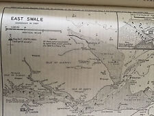 VINTAGE SEA CHART / NAUTICAL MAP 1961 - East Swale - To Frame?
-
$3.25 GBP
 VINTAGE SEA CHART / NAUTICAL MAP 1961 - Ireland Waterford & Dun Laoghaire Hbours
-
$3.25 GBP
 VINTAGE SEA CHART / NAUTICAL MAP 1961 Ireland - Slyne Approaches..to frame!
-
$3.25 GBP
 VINTAGE SEA CHART / NAUTICAL MAP 1961 - France - MORLAIX Road
-
$29.99 GBP
 JOHAN BLAEU MAP OF SURREY 1648 44x 57cm 1970'S NAT LIBRARY OF SCOTLAND PRINT
-
$3.25 GBP
 VINTAGE SEA CHART / NAUTICAL MAP 1961 -The Swellies & Menai Strait - To Frame?
-
$3.25 GBP
 VINTAGE SEA CHART / NAUTICAL MAP 1961 - Conway - To Frame?
-
$12.00 GBP
 Original OS Map; Sheet SD 30 NE; 1974; Haskayne, Aughton, Lancashire
-
$300.00 GBP
 *RARE 925 Silver World MAP Royal Geographical Society Map 1976 + COA +PAPERWORK
-
$11.00 GBP
 Admiralty Chart 1613: England: Eddystone Rocks to Berry Head, 1979 print,
-
$3.25 GBP
 VINTAGE SEA CHART / NAUTICAL MAP 1961 -Ireland - Galway & Tralee Bays & Fenit H
-
$129.99 GBP
 Job Lot Vintage Maritime Navigation Maps: England Channel Italy France 1960/70s
-
$3.00 GBP
 NORFOLK NATIONAL MAP SERIES (Bartholomew, 1976, Sheet 26, 1:100,000)
-
$3.25 GBP
 VINTAGE SEA CHART / NAUTICAL MAP 1961 - Beaulieu River - To Frame?
-
$12.50 GBP
 ADMIRALTY SEA CHART. BARRY & CARDIFF ROADS.No. 1182. SOUTH WALES. 1974-2012
-
$19.95 GBP
 PTOLEMY LG VINTAGE MAP "MODERN" BALKANS, 1520 (1970's FACSIMILE) IMAGE 55.5x43cm
-
$3.25 GBP
 VINTAGE SEA CHART / NAUTICAL MAP 1961 - Lamlash & Campbelton Loch To Frame?
-
$13.00 GBP
 Original OS Map; 1:10,000; Sheet SJ 57 SW; 1972; Manley, Cheshire
-
$13.00 GBP
 Original OS Map; 1:10,000; Sheet SK 59 NW; 1973; Conisbrough, Yorkshire
-
$3.25 GBP
 VINTAGE SEA CHART / NAUTICAL MAP 1961 - EXMOUTH - To Frame?
-
$9.99 GBP
 1971 OS Sheet Map Merionethshire Political Administrative Boundaries
-
$3.25 GBP
 VINTAGE SEA CHART / NAUTICAL MAP 1961 - WELLS By The Sea & BURNHAM - To Frame?
-
$3.25 GBP
 VINTAGE SEA CHART / NAUTICAL MAP 1961 - WALTON - To Frame?
-
$3.25 GBP
 VINTAGE SEA CHART / NAUTICAL MAP 1961 - Christchurch - To Frame?
-
$3.25 GBP
 VINTAGE SEA CHART / NAUTICAL MAP 1961 - KEYHAVEN - To Frame?
-
$3.25 GBP
 VINTAGE SEA CHART / NAUTICAL MAP 1961 - Blyth And Berwick - To Frame?
-
$3.25 GBP
 VINTAGE SEA CHART / NAUTICAL MAP 1961 - Menai Strait - To Frame?
-
$9.99 GBP
 1971 OS Sheet Map Anglesey & Caernarvonshire Political Administrative Boundaries
-
$14.00 GBP
 Original OS Map; 1:10,000; Sheet SK 38 SE; 1973; Sheffield, Derbyshire
-
$13.00 GBP
 Original OS Map; 1:10,560; Sheet SD 64 SW; 1971; Chipping, Lancashire
-
$13.00 GBP
 Original OS Map; 1:10,000; Sheet SJ 38 NE; 1978; Sefton Park, Merseyside
-
$13.00 GBP
 Original OS Map; 1:10,000; Sheet SD 49 SE; 1978; Underbarrow, Cumbria
-
$14.00 GBP
 Original OS Map; 1:10,000; Sheet SP 24 NW; 1971; Alderminster, Warwickshire
-
$8.00 GBP
 4 ORDNANCE SURVEY MAPS FROM THE 1970'S TRURO/LAND'S END/TORBAY/DARTMOOR
-
$11.50 GBP
 Yeovil Lydmarsh Turbury Wreath Farm Detailed Ordnance Survey Map 1975 35”x23”
-
$12.00 GBP
 Original OS Map; 1:10,000; Sheet SJ 54 NW; 1973; Macefen, Tushingham, Cheshire
-
$17.00 GBP
 NEW ZEALAND SEA CHART No.N.Z.23. NORTH ISLAND, NEW ZEALAND. 1978.
-
$11.50 GBP
 Yeovil Stocklinch Somerset Detailed Ordnance Survey Map 1976 35”x23” 1:2500
-
$12.00 GBP
 Original OS Map; 1:10,000; Sheet SE 93 NE; 1974; Walkington, Humberside
-
$2.99 GBP
 VINTAGE SEA CHART / NAUTICAL MAP 1961 - France - Les Sables D’olonne, St Martin
-
$3.50 GBP
 Southern Scotland 1978 Vintage Shell Road Map Sheet 6
-
$19.00 GBP
 ADMIRALTY CHART. No.2380. LOCH LINNHE, NORTHERN PART. 1991 Edition.
-
$11.50 GBP
 Ilford Yeovil Somerset Local Detailed 1:2500 Ordnance Survey Map 1974 35”x23”
-
$13.00 GBP
 Original OS Map; 1:10,000; Sheet SP 37 NW; 1977; Coventry, West Midlands
-
$9.99 GBP
 1971 OS Sheet Map Carmarthenshire Political Administrative Boundaries
-
$13.00 GBP
 Original OS Map; 1:10,560; Sheet SJ 66 SW; 1970; Wettenhall, Darnhall, Cheshire
-
$9.99 GBP
 Vintage Admiralty Nautical Chart South Foreland South Falls Head No. 1828 (1973)
-
$12.50 GBP
 ADMIRALTY SEA CHART. No.1975. THAMES ESTUARY, NORTHERN PART. 1973.
-
$9.99 GBP
 1971 OS Sheet Map Brecknockshire Political Administrative Boundaries
-
$16.74 GBP
 Map Searsport Maine 1973 Topographic Geological Survey 1:24000 27 x 22" TOPO8
-
$14.35 GBP
 Map Machias Maine USGS 1977 Topographic Geological 1:24000 27x22" TOPO15


