
-
$65.27 GBP

 Vintage Print of Antique Geographisch Map 1600s, Sweden Framed 62cmx49cmx2cm
-
$39.00 GBP
 VINTAGE ADMIRALTY CHART. No.1453. PA-KO LIEH-TAO, CHINA EAST COAST. 1961 Edn.
-
$40.65 GBP
 U S Department Of The Interior Geological Survey Rocky Mountain National Park...
-
$49.00 GBP
 VINTAGE ADMIRALTY CHART. No. 1170. COQUET to WHITBY. 1972 Edition.
-
$19.99 GBP
 Orig 1962 Goldthorpe Colliery Highgate Detailed OS Map Ideal Christmas Present
-
$3.25 GBP
 VINTAGE SEA CHART / NAUTICAL MAP 1961 - Sheerness & West Swale - To Frame?
-
$3.25 GBP
 VINTAGE SEA CHART / NAUTICAL MAP 1961 - Chichester - To Frame?
-
$12.99 GBP
 Antique Map of Lost Villages in Yorkshire, Leicestershire and Warwickshire 1951
-
$24.99 GBP
 Vintage Admiralty Nautical Navigation Chart Scotland West Coast Sound Of Islay
-
$3.25 GBP
 VINTAGE SEA CHART / NAUTICAL MAP 1961 - France - Concarneau, Port Breton, Louis
-
$13.99 GBP
 Antique/Vintage Map of Ethiopia - Debra Berhan Shoa - 1949
-
$12.99 GBP
 Antique/Vintage Map of Arizona (Balchin & Pye) - 1954
-
$7.99 GBP
 Vintage Street Plan Map of Ipswich in Suffolk c1960s - Barnett's, Street Index
-
$39.00 GBP
 VINTAGE ADMIRALTY CHART. No.2140. NATUNA KEPULAUAN, CHINA SEA. 1963 Edition.
-
$39.00 GBP
 VINTAGE ADMIRALTY CHART. No.3700. COLOMBO to GALLE, CEYLON. 1960 Edition.
-
$3.50 GBP
 Cheltenham & Evesham OS Map 1" 1968 - Paper - Sheet 144 - Genealogy -History
-
$3.25 GBP
 VINTAGE SEA CHART / NAUTICAL MAP 1961 Ireland Castletown Harbour Bearhaven
-
$3.25 GBP
 VINTAGE SEA CHART / NAUTICAL MAP 1961 - Thames Estuary X 2 N& S - To Frame?
-
$8.50 GBP
 Vintage Bartholomew's Revised Half Inch Contoured Map of Surrey Sheet 9 c1960
-
$17.99 GBP
 Antique/Vintage Map of Old Shore Lines Near Camber Castle - 1953
-
$3.79 GBP
 Vintage Map of Youth Hostels in England and Wales 1967
-
$4.50 GBP
 Herts & Bucks 1961 Bartholomew's Revised Half Inch Contoured Map Sheet 15
-
$17.99 GBP
 Antique/Vintage Map of Northern Papua, Bamu Purari Patrol 1936
-
$129.99 GBP
 Job Lot Vintage Maritime Navigation Maps: England Channel Italy France 1960/70s
-
$24.99 GBP
 Vintage Admiralty Nautical Navigation Chart Scotland Firth Clyde Western Approac
-
$17.99 GBP
 Antique/Vintage Map of the World (Fawcett) - 1949
-
$14.99 GBP
 Antique/Vintage Map of Swaziland Population and land use data - 1951
-
$3.00 GBP
 Copy of OS Map; 1:10,560; Sheet SP 46 NE; 1966; Grandborough, Warwickshire
-
$40.00 GBP
 ENGLISH CHANNEL, EASTERN SHEET, 1969 IMRAY, LAURIE, NORIE, .....SEA CHART, No.5c
-
$17.99 GBP
 Antique Map of The Adams Valley and Glaciers (J.D. Pascoe) - New Zealand - 1940
-
$16.74 GBP
 Map Pleasant Mountain Maine 1963 Topographic Geo Survey 1:24000 27 x 22" TOPO7
-
$14.35 GBP
 Map Black Mountain Maine USGS 1969 Topographic Geological 1:24000 27x22" TOPO17
-
$3.25 GBP
 VINTAGE SEA CHART / NAUTICAL MAP 1961 - France - Ile Du Bec To Argenton Porsal
-
$3.25 GBP
 VINTAGE SEA CHART / NAUTICAL MAP 1961 - Calais St Valery Treport Etaples, Etc
-
$25.00 GBP
 1966 Ordnance Survey map SP 90 SW Hyde Heath to Chartridge Buckinghamshire
-
$17.99 GBP
 Antique/Vintage Map of Urban Hinterlands - United Kingdom - 1950
-
$3.25 GBP
 VINTAGE SEA CHART / NAUTICAL MAP 1961 - Dunkerque, Ostend Niueport Zeebrugge
-
$19.99 GBP
 Orig 1961 Hemsworth, South Hiendley Detailed OS Map Ideal Christmas Present
-
$16.74 GBP
 Map Bristol Maine USGS 1969 Topographic Geological 1:24000 27x22" TOPO18
-
$17.99 GBP
 Antique/Vintage Map of The Foxe Basin Coasts of Baffin Island - 1943
-
$3.25 GBP
 VINTAGE SEA CHART / NAUTICAL MAP 1961 - France - Ile De Bas & Roscoff
-
$3.25 GBP
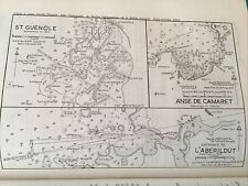 VINTAGE SEA CHART / NAUTICAL MAP 1961 - France St Guenole, L’Aberildut
-
$17.99 GBP
 Antique Map of Plottings of southern limits of drift ice, 1942 - 1946 pub
-
$3.25 GBP
 VINTAGE SEA CHART / NAUTICAL MAP 1961 - France - Perros
-
$3.25 GBP
 VINTAGE SEA CHART / NAUTICAL MAP 1961 - France - Brest Approaches
-
$11.50 GBP
 Yeovil Ilton Whetstones Almshouses 1966 Detailed Ordnance Survey Map 35”x23”
-
$3.25 GBP
 VINTAGE SEA CHART / NAUTICAL MAP 1961 - France - Paimpol
-
$9.99 GBP
 Antique/Vintage Map of Northwest Territories, Canada - 1949
-
$295.00 GBP
 RARE FRAMED 75 BY 47CM PEN & INK COAL SEAM MAP OF KIVETON & HARTHILL S YORKSHIRE
-
$3.25 GBP
 VINTAGE SEA CHART / NAUTICAL MAP 1961 - Ireland - Baltimore & Crookhaven
-
$3.25 GBP
 VINTAGE SEA CHART / NAUTICAL MAP 1961 - Cherbourg
-
$3.25 GBP
 VINTAGE SEA CHART / NAUTICAL MAP 1961 - France Lannion River, Primer, Port Blanc
-
$3.25 GBP
 VINTAGE SEA CHART / NAUTICAL MAP 1961 - Ireland - Valencia Island - To Frame?
-
$3.25 GBP
 VINTAGE SEA CHART / NAUTICAL MAP 1961 - France - Le Pouliguen, Le Croisic
-
$3.25 GBP
 VINTAGE SEA CHART / NAUTICAL MAP 1961 - France - Rivers Aven & Belon, Houat,Tudy
-
$3.25 GBP
 VINTAGE SEA CHART / NAUTICAL MAP 1961 - France - Ile Noirmoutier, St Gilles
-
$3.25 GBP
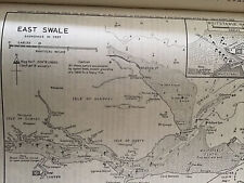 VINTAGE SEA CHART / NAUTICAL MAP 1961 - East Swale - To Frame?
-
$3.25 GBP
 VINTAGE SEA CHART / NAUTICAL MAP 1961 - Rivers Crouch & Roach - To Frame?
-
$15.99 GBP
 Antique Map of Queensland, Great Barrier Reef Low Isles - 1948
-
$3.25 GBP
 VINTAGE SEA CHART / NAUTICAL MAP 1961 - Eyemouth Dunbar St Abbs - To Frame?
-
$3.25 GBP
 VINTAGE SEA CHART / NAUTICAL MAP 1961 - France - MORLAIX Road
-
$8.50 GBP
 Shell Touring Map 1 South West England, 4 Miles to Inch 1966 G Philip
-
$49.00 GBP
 VINTAGE ADMIRALTY CHART. No.724. INDIAN OCEAN ISLANDS. 1968 Edition.
-
$3.25 GBP
 VINTAGE SEA CHART / NAUTICAL MAP 1961 - Ireland Waterford & Dun Laoghaire Hbours
-
$3.25 GBP
 VINTAGE SEA CHART / NAUTICAL MAP 1961 - Poole - To Frame?
-
$3.25 GBP
 VINTAGE SEA CHART / NAUTICAL MAP 1961 - Conway - To Frame?
-
$15.99 GBP
 Antique/Vintage Map of Libyan Frontiers (Sandford) - 1940
-
$3.25 GBP
 VINTAGE SEA CHART / NAUTICAL MAP 1961 - France - Benodet, Loctudy
-
$17.99 GBP
 Antique Map of Shallow Holes and Millstone Grit on the South Wales Coalfield
-
$3.25 GBP
 VINTAGE SEA CHART / NAUTICAL MAP 1961 -The Swellies & Menai Strait - To Frame?
-
$3.25 GBP
 VINTAGE SEA CHART / NAUTICAL MAP 1961 Ireland - Slyne Approaches..to frame!
-
$14.99 GBP
 Antique/Vintage Map of Irrigation in Spain - 1950
-
$17.99 GBP
 Antique/Vintage Map of Wartime Explorations in Central Borneo
-
$3.25 GBP
 VINTAGE SEA CHART / NAUTICAL MAP 1961 -Ireland - Galway & Tralee Bays & Fenit H
-
$17.99 GBP
 Antique Map of Population Increase and Immigration in the U.K between 1931 & 51
-
$3.25 GBP
 VINTAGE SEA CHART / NAUTICAL MAP 1961 - Lamlash & Campbelton Loch To Frame?
-
$12.50 GBP
 OS maps,1 965/71, 24 paper maps England, Gt Britain, Good to fair condition
-
$3.25 GBP
 VINTAGE SEA CHART / NAUTICAL MAP 1961 - EXMOUTH - To Frame?
-
$3.25 GBP
 VINTAGE SEA CHART / NAUTICAL MAP 1961 - Beaulieu River - To Frame?
-
$24.99 GBP
 Vintage Admiralty Nautical Navigation Chart Scotland Mull Kintyre Ardnamurchan
-
$3.25 GBP
 VINTAGE SEA CHART / NAUTICAL MAP 1961 - WALTON - To Frame?
-
$49.00 GBP
 VINTAGE ADMIRALTY CHART. No. 2375 GULF OF SUEZ. STRAIT OF GUBAL. 1965 Edition.
-
$3.25 GBP
 VINTAGE SEA CHART / NAUTICAL MAP 1961 - Christchurch - To Frame?
-
$3.25 GBP
 VINTAGE SEA CHART / NAUTICAL MAP 1961 - WELLS By The Sea & BURNHAM - To Frame?
-
$17.99 GBP
 Antique/Vintage Map of The East Coast Floods of 1953, United Kingdom
-
$3.25 GBP
 VINTAGE SEA CHART / NAUTICAL MAP 1961 - Menai Strait - To Frame?
-
$3.25 GBP
 VINTAGE SEA CHART / NAUTICAL MAP 1961 - KEYHAVEN - To Frame?
-
$19.99 GBP
 Orig 1962 Goldthorpe Bolton On Dearne Detailed OS Map Ideal Christmas Present
-
$12.50 GBP
 Yeovil Merryfield Broadfield Ashford 1966 Detailed Ordnance Survey Map 35”x23”
-
$19.99 GBP
 Antique Map of Geomorphological Features of the Ingleborough District - 1950
-
$19.99 GBP
 National Geographic Map - Eastern South America - 1955 - Vintage
-
$3.25 GBP
 VINTAGE SEA CHART / NAUTICAL MAP 1961 - Blyth And Berwick - To Frame?
-
$17.99 GBP
 Antique/Vintage Map of the Zubair Embayment (Iraq) - 1952
-
$19.99 GBP
 The Channel Islands And Adjacent Coast Of France Admiralty Chart No.2669
-
$20.00 GBP
 1967 Nigeria Map of Health Facilities
-
$39.00 GBP
 VINTAGE ADMIRALTY CHART. No. 3046. HASTING HARBOUR. INDIA. 1961 Edition.
-
$17.99 GBP
 Antique/Vintage Map of the Eastern Andes of Central Peru - 1947
-
$17.99 GBP
 Antique/Vintage Map of The Arctic Voyages of St Roch 1940-1944
-
$39.00 GBP
 VINTAGE ADMIRALTY CHART. No. 558. FALKLAND ISLANDS, 1980 Edition.
-
$24.00 GBP
 VINTAGE ADMIRALTY CHART. No. 2866. CAPE CANAVERAL to KEY WEST. 1962


