 Antiques (UK)
Africa Maps
Asia Maps
Australia/Oceania Maps
Celestial Maps
Central America/Caribbean Maps
Curiosities Maps
Digital Maps
Europe Maps
Map & Globe Mixed Lots
Map & Globe Reproductions
North America Maps
South America Maps
World & Celestial Globes
World Maps

-
$145.00 GBP

 VINTAGE GEOGRAPHIA 1950s SCHOOL EDUCATIONAL GLASGOW STREET PLAN WALL MAP PRE M8!
-
$125.00 GBP
 VINTAGE W AK JOHNSTON 1950s SCHOOL EDUCATIONAL ENGLAND & WALES COUNTIES WALL MAP
-
$9.99 GBP
 CORNWALL'S STRUCTURE & SCENERY Official guide Book - Tor Mark Press
-
$28.13 GBP
 Original MAP: THUN SWITZERLAND 1936,
-
$25.99 GBP
 Liverpool 1934 old pictorial map - reproduction - 91.19 x 59.4 cm
-
$18.99 GBP
 Milton Ernest (E), Bletsoe, Thurleigh, old map Bedfordshire 1950: 7SE
-
$18.99 GBP
 Burry Port, Pembrey, old map Carmarthen 1952: 57NE repro Wales
-
$23.99 GBP
 Milton Ernest (E), Bletsoe, Thurleigh, old map Bedfordshire 1950: 7SE - Antiqued
-
$23.99 GBP
 Milton Ernest (W), Felmersham, Pavenham, Radwell, old map Beds 1950: 7SW A
-
$18.99 GBP
 Milton Ernest (W), Felmersham, Pavenham, Radwell, old map Beds 1950: 7SW
-
$23.99 GBP
 London Festival of Britain pictorial map, modern reproduction
-
$23.99 GBP
 Pertenhall, old map Bedfordshire 1950: 5NW-NE - antiqued
-
$18.99 GBP
 Old Pictorial Map of Historic Canterbury 1952 - reproduction 59.4 x 42cm
-
$9.99 GBP
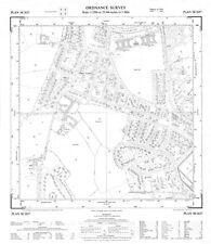
 LANCASHIRE Map - Sheet SD 83 - 1954 Ordnance Survey Map
-
$28.11 GBP
 1957 Ft. Meyers Lee Cty FLORIDA, PLAT MAP Residential Map - 4020 Rainbow Drive
-
$18.99 GBP
 Pertenhall, old map Bedfordshire 1950: 5NW-NE
-
$19.99 GBP
 Rothwell, Yorkshire 1958 - OS 25" scale - old map, new reprint
-
$29.99 GBP
 A Map of The Commonwealth of Nations or, The British Empire 1937 Repro Large
-
$25.99 GBP
 A map of Merseyside, with historical & literary allusions 1934- 59.4 x 42 cm
-
$15.99 GBP
 Brighton 1948 old pictorial map - reproduction - 42 x 29.7 cm A 3 size
-
$17.99 GBP
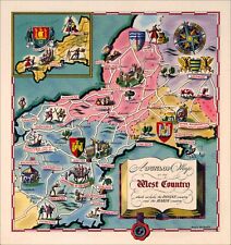 The West Country - pictorial map of south western England. Reproduction
-
$18.99 GBP
 Upper Dean, Swineshead, Melchbourne, Yielden (E), old map Beds 1950: 4NE
-
$18.99 GBP
 Podington, Wymington, Farndish, old map Bedfordshire 1950: 3SE
-
$18.99 GBP
 Cranfield (N), Bourne End, old map Bedfordshire 1951: 15SE
-
$18.99 GBP
 Sharnbrook, Souldrop, old map Bedfordshire 1950: 7NW
-
$18.99 GBP
 Shelton, Lower Dean, old map Bedfordshire 1950: 1SE
-
$18.99 GBP
 Riseley, old map Bedfordshire 1950: 4SE
-
$19.99 GBP
 West Park, Leeds, Yorkshire 1954 OS 25" scale - old map, new reprint
-
$29.99 GBP
 A Map of Scotland Portraying Her Agricultural Products & Fisheries 89.7 x 59.cm
-
$21.99 GBP
 Leeds pictorial history map - reproduction - 69.49 x 59.4 cm
-
$29.99 GBP
 Old Pictorial Map of Glasgow 1938 - reproduction 59.4 x 84.38 cm
-
$18.99 GBP
 Yielden (W), old map Bedfordshire 1950: 4NW
-
$18.99 GBP
 St Neots, Eynesbury, Hail Weston, Old Map Huntingdonshire, 1950: Part25
-
$19.99 GBP
 Pudsey (southwest), Yorkshire 1956 - OS 25" scale - old map, new reprint
-
$18.99 GBP
 Little Staughton, Keysoe, old map Bedfordshire 1950: 5SW-SE
-
$15.99 GBP
 Bath 1948 old pictorial map - reproduction - 42 x 29.7 cm A 3 size
-
$18.99 GBP
 Bolnhurst, Keysoe, old map Bedfordshire 1950: 8NW
-
$23.99 GBP
 Podington, Wymington, Farndish, old map Bedfordshire 1950: 3SE -antiqued
-
$18.99 GBP
 Odell, Harrold, Carlton, Chellington, old map Bedfordshire 1950: 6SE
-
$19.99 GBP
 Morley (west), Yorkshire 1956 - OS 25" scale - old map, new reprint
-
$18.99 GBP
 Eaton Socon (S), Little Barford, Wyboston, old map Bedfordshire 1950: 9SW
-
$19.99 GBP
 Bedquilts Rec. area, Leeds, Yorkshire 1955 OS 25" scale - old map, new reprint
-
$19.99 GBP
 Littlemoor area, Pudsey, Yorkshire 1956 - OS 25" scale - old map, new reprint
-
$23.99 GBP
 Upper Dean, Swineshead, Melchbourne, Yielden (E), old map Beds 1950: 4NE A
-
$39.99 GBP
 FLAT EARTH POSTER: Azimuthal Equidistant Projection - USGS Nautical Radar Map XL
-
$23.99 GBP
 Little Staughton, Keysoe, old map Bedfordshire 1950: 5SW-SE - Antiqued
-
$9.99 GBP
 YORKSHIRE MAP - Sheet SD 74 - 1954 Ordnance Survey Map
-
$23.99 GBP
 Riseley, old map Bedfordshire 1950: 4SE - antiqued
-
$23.99 GBP
 Yielden (W), old map Bedfordshire 1950: 4NW - antiqued
-
$23.99 GBP
 Shelton, Lower Dean, old map Bedfordshire 1950: 1SE Antiqued
-
$29.99 GBP
 Old Pictorial Map of London 1922 - reproduction 59.4 x 81.39 cm
-
$18.99 GBP
 Eaton Socon (N), Eaton Ford (+ St Neots, Hunts), old map Beds 1950: 9NW
-
$23.99 GBP
 Odell, Harrold, Carlton, Chellington, old map Bedfordshire 1950: 6SE antiqued
-
$23.99 GBP
 Bolnhurst, Keysoe, old map Bedfordshire 1950: 8NW Antiqued
-
$23.99 GBP
 Cranfield (N), Bourne End, old map Bedfordshire 1951: 15SE antiqued
-
$23.99 GBP
 Sharnbrook, Souldrop, old map Bedfordshire 1950: 7NW Antiqued look
-
$23.99 GBP
 Eaton Socon (S), Little Barford, Wyboston, old map Bedfordshire 1950: 9SW A
-
$23.99 GBP
 Eaton Socon (N), Eaton Ford (+ St Neots, Hunts), old map Beds 1950: 9NW Antiqued
-
$19.99 GBP
 Upper Moor Side, Leeds, Yorkshire 1956 - OS 25" scale - old map, new reprint
-
$17.99 GBP
 English Lake District - pictorial map of literary interest - repro 42 x 39.19 cm
-
$29.99 GBP
 A Map of Ireland Portraying their Agricultural Products & Fisheries 90 x 59.cm
-
$29.99 GBP
 A Map of England and Wales Portraying Agricultural Products & Fisheries 1929.
-
$19.99 GBP
 South Park Mills, Pudsey, Yorkshire 1956 - OS 25" scale - old map, new reprint
-
$12.83 GBP
 c.1950s Hoffmann La Roche Drug Co. Facsimile 1600s Historical Map Lot Vintage
-
$9.99 GBP
 CANADA & NORTHERN UNITIED STATES ROAD MAP
-
$9.99 GBP
 YORKSHIRE MAP - Sheet SD 84 - 1954 Ordnance Survey Map
-
$64.30 GBP
 2002 REPRINT 1950s Washington State Pictorial Map 38.5in x 26in FOLDED/GOOD COND
-
$9.99 GBP
 CHSHIRE Map - Sheet SJ 85 - 1954 Ordnance Survey Map
-
$40.17 GBP
 1950 CHESTER COUNTY PA, SCHUYKILL VALLEY FORGE PARK PHOENIXVILLE CC ATLAS MAP
-
$9.99 GBP
 PITLOCHRY Official guide Book
-
$40.17 GBP
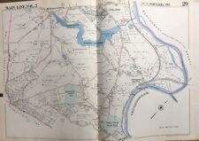
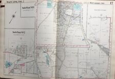
 1950 MAIN LINE CHESTER CO PA TREDYFFRIN WILLISTWN E. WHITELAND MALVERN ATLAS MAP
-
$40.17 GBP
 1950 MAIN LINE, CHESTER COUNTY PA. PHOENIXVILLE BORO RESERVOIR PARK ATLAS MAP
-
$40.17 GBP
 1950 CHESTER COUNTY PA, WILLISTOWN TWP RUSH HOSPITAL LINE RD-DARBY RD ATLAS MAP
-
$40.17 GBP
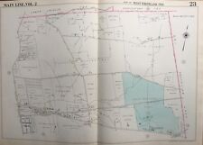
 1950 MAIN LINE, CHESTER COUNTY PA, EAST GOSHEN & WILLISTOWN TOWNSHIP ATLAS MAP
-
$40.17 GBP
 1950 MAIN LINE CHESTER CO. PA EAST GOSHEN & WILLISTOWN TWPs ROCKY HILL ATLAS MAP
-
$40.17 GBP
 1950 CHESTER CO. PA, W. GOSHEN TWP WEST CHESTER AIRPORT & COUNTRY CLUB ATLAS MAP
-
$40.17 GBP
 1950 CHESTER COUNTY PA, TREDYFFRIN & EAST WHITELAND TWPs PAOLI AIRPORT ATLAS MAP
-
$40.17 GBP
 1950 CHESTER COUNTY PA, WEST WHITELAND TWP, GROVE WHITFORD STATION ATLAS MAP
-
$40.17 GBP
 1950 MAIN LINE, CHESTER COUNTY PA. TREDYFFRIN -EASTTOWN JOINT SCHOOL ATLAS MAP
-
$40.17 GBP
 1950 CHESTER COUNTY PA, WEST WHITELAND TOWMSHIP GLEN LOCH STATION ATLAS MAP
-
$40.17 GBP
 1950 MAIN LINE CHESTER COUNTY PA EAST WHITELAND TWP IMMACULATA COLLEGE ATLAS MAP
-
$40.17 GBP
 1950 CHESTER COUNTY PA, TREDYFFRIN SCHUYKILL VALLEY FORGE PARK ATLAS MAP
-
$40.17 GBP
 1950 MAIN LINE CHESTER COUNTY PA, WILLISTOWN TOWNSHIP RADNOR HUNT CLUB ATLAS MAP
-
$40.17 GBP
 1950 MAIN LINE, CHESTER COUNTY PA, CHARLESTOWN VALLEY FORGE HOSPITAL ATLAS MAP
-
$40.17 GBP
 1950 MAIN LINE CHESTER COUNTY VALLEY GOLF CLUB PA EAST WHITELAND TWP ATLAS MAP
-
$40.17 GBP
 1950 MAIN LINE CHESTER COUNTY PA, TREDYFFRIN & EASTTOWN TOWNSHIP ATLAS MAP
-
$40.17 GBP
 1950 MAIN LINE CHESTER COUNTY PA TREDYFFRIN TOWNSHIP VALLEY FORGE PARK ATLAS MAP
-
$40.17 GBP
 1950 MAIN LINE CHESTER COUNTY PA, WEST WHITELAND TOWNSHIP EXTON ATLAS MAP
-
$40.17 GBP
 1950 MAIN LINE, CHESTER COUNTY PA, WEST WHITELAND TOWNSHIP & SCHOOL ATLAS MAP
-
$40.17 GBP
 1950 MAIN LINE CHESTER CO. PA W. GOSHEN TOWNSHIP HICKSITE FRIENDS CEM ATLAS MAP
-
$40.17 GBP
 1950 MAIN LINE CHESTER COUNTY PA EASTTOWN TOWNSHIP OLD ST. DAVID'S CH. ATLAS MAP
-
$40.17 GBP
 1950 MAIN LINE DELAWARE COUNTY PA NEWTOWN TWP BISHOP HOLLOW POLO CLUB ATLAS MAP
-
$64.30 GBP
 1950 MAIN LINE CHESTER COUNTY PA. WEST GOSHEN TWP GREENMOUNT CEMETERY ATLAS MAP
-
$40.17 GBP
 1950 MAIN LINE DELAWARE COUNTY PA MAPLE NEWTOWN HIGH SCHOOL TWP SCHOOL ATLAS MAP
-
$40.17 GBP
 1950 ATLAS MAP FLUSHING QUEENS NEW YORK ELECTCHESTER JEWISH CENTER 164-171TH ST
-
$40.17 GBP
 1950 MAIN LINE, DELAWARE COUNTY PA, NEWTOWN TWP ARONIMINK GOLF CLUB ATLAS MAP
-
$40.17 GBP
 1950 MAIN LINE, CHESTER COUNTY PENNSYLVANIA, INDEX PAGE COPY PLAT ATLAS MAP
-
$40.17 GBP
 1950 MAIN LINE CHESTER COUNTY PENNSYLVANIA CHARLESTOWN TOWNSHIP ATLAS MAP
-
$3.99 GBP
 Cardigan 1" To 1 Mile MOD O S Map
-
$23.99 GBP
 Eaton Socon (S), Little Barford, Wyboston, old map Beds 1950: 9SW antiqued


