 Antiques (UK)
Africa Maps
Asia Maps
Australia/Oceania Maps
Celestial Maps
Central America/Caribbean Maps
Curiosities Maps
Digital Maps
Europe Maps
Map & Globe Mixed Lots
Map & Globe Reproductions
North America Maps
South America Maps
World & Celestial Globes
World Maps

-
$20.18 GBP

 1940 VINTAGE WWII MAP OF TURKEY SYRIA PALESTINE ISRAEL JORDAN IRAQ ARMENIA
-
$17.99 GBP
 Antique/Vintage Map of Libyan Desert Routes of the L.R.D.G 1940-1941 - 1945pub
-
$18.30 GBP
 1940 ORIGINAL VINTAGE WWII MAP OF TRANSVAAL ORANGE FREE STATE SOUTH AFRICA
-
$14.39 GBP
 Antique/Vintage Map of Routes in Southern Iran, J.V. Harrison - 1942
-
$3.95 GBP
 RIVER SEINE ESTUARY, France D-Day Invasion OVERLORD Planning - WW2 Map 1943
-
$15.00 GBP
 OLD Framed MAP OF WILTSHIRE
-
$8.00 GBP
 Bartholomews Vintage Maps - Wales
-
$11.99 GBP
 1941 Vintage Map of the Atlantic Ocean
-
$9.95 GBP
 PORTSMOUTH HARBOUR, GOSPORT, PORTSEA Hampshire - Rare Vintage WW2 Naval Map 1943
-
$7.00 GBP
 OS maps 7th series + 1 New Popular 1 inch maps, 8 maps, good to fair condition
-
$4.95 GBP
 THE DEVELOPMENT OF ALLIED STRATEGY NORTH OF THE SEINE, 1944, WW2 Map of OVERLORD
-
$15.00 GBP
 Large Vintage Original Hand Drawn Pictorial Historical Map Scarborough Yorkshire
-
$25.00 GBP
 1942 43 ww2 OLD map of DARLINGTON
-
$32.44 GBP
 Palestine Map Before Nakba 1948 Atlas Maps خريطة فلسطين قبل النكبة خرائط اطلس
-
$13.99 GBP
 Antique/Vintage Map of Japanese occupied Malaya 1942 - 1945
-
$19.99 GBP
 Antique/Vintage Map of Libya , c1940s , Scarce , Mounted LEPTIS MAGNA
-
$10.00 GBP
 Vintage Admiralty Chart 2450, Portland to Owers 1922 Edition Updated 1942
-
$14.00 GBP
 ORIGINAL VINTAGE JAPANESE MAP OF AICHI PREFECTURE & NAGOYA (78x53cm)
-
$9.99 GBP
 National Geographic Map Of The Top Of The World Oct 1949
-
$9.99 GBP
 REID'S PLAN NEWCASTLE UPON TYNE SCALE 4" TO 1 MILE
-
$210.00 GBP
 French Wine Region Map Wines Of Bordeaux By Louis Larmat 1943
-
$49.00 GBP
 VINTAGE ADMIRALTY CHART. No.2460.KAMCHATRA to SAN FRANCISCO, BERING SEA.1942 Ed.
-
$9.99 GBP
 Antique 1960s London Map - Mounted - WANSTEAD FLATS, SNARESBROOK, REDBRIDGE
-
$7.50 GBP
 Antique Road Map Complete - 35 Miles Round To London - Geographers' Map Co. LTD
-
$14.99 GBP
 The Jarrold MAP of the BROADS (1946)
-
$3.35 GBP
 BAIE DE LAMPAUL, France D-Day Planning - Rare Vintage WW2 Map 1943
-
$8.00 GBP
 Geographia Road Map of England & Wales
-
$3.95 GBP
 GOREY, JERSEY, Channel Islands - Rare Vintage naval WW2 map 1943
-
$32.44 GBP
 Palestine Map Before Nakba 1948 Atlas Maps خريطة فلسطين قبل النكبة خرائط اطلس
-
$19.99 GBP
 Antique/Vintage Map of Libya , c1940s , Scarce , Mounted
-
$19.99 GBP
 Antique/Vintage Map of Libya , c1940s , Scarce , Mounted
-
$15.99 GBP
 Antique Map of Queensland, Great Barrier Reef Low Isles - 1948
-
$13.00 GBP
 Vintage Scotland (Eastern) Illustrated Guidebook & Tour Maps by Ward.Lock.& Co
-
$4.99 GBP
 WW2 Revision 1940 Vintage Paper Sheet Map Tunbridge Wells Kent Sheet 125
-
$4.95 GBP
 RIVER BLACKWATER, Bradwell Quay, Essex WW2 Naval Map 1943, topology
-
$21.99 GBP
 VINTAGE SCARCE MAP from The 1940s Wartime Of Wales , Snowdonia
-
$7.50 GBP
 BRIGHTLINGSEA HARBOUR, Essex WW2 Naval Map 1943 (inc. Railways)
-
$5.00 GBP
 Vintage Pinner & Hatch End Fold-Out Map 1940s Lock & Vince Surveyors - Excellent
-
$18.30 GBP
 1943 VINTAGE WWII MAP TURKEY ARMENIA CYPRUS SYRIA VERSO SAUDI ARABIA PALESTINE
-
$16.37 GBP
 1940 VINTAGE WWII MAP OF SOUTH AFRICA / CITY OF CAPE TOWN KAPSTAAD INSET MAP
-
$14.99 GBP
 National Geographic Map - Europe and The Near East - 1949 - Vintage
-
$4.99 GBP
 WW2 Revision 1940 Vintage Paper Sheet Map South East London Sevenoaks Sheet 115
-
$9.99 GBP
 Antique 1940s London Map - Mounted - Colour - TOOTING, MITCHAM
-
$5.00 GBP
 c1940s KENT County Road Map - Geographers Map Co
-
$4.99 GBP
 WW2 Revision 1940 Vintage Cloth Sheet Map Weald Of Kent Sheet 126 Ord. Survey
-
$19.99 GBP
 National Geographic Map - Northern And Southern Hemispheres - 1943 - Vintage
-
$19.99 GBP
 National Geographic Map - Northwestern Africa - 1966 - Vintage
-
$79.95 GBP
 BSAA BRITISH SOUTH AMERICAN AIRWAYS VINTAGE NAVIGATION MAP 1940'S DAKAR NATAL
-
$19.99 GBP
 National Geographic Map - British Isles - 1949 - Vintage
-
$9.00 GBP
 O/S Map, Swansea Area, 1948 Civil Serice Commission Exam.
-
$22.99 GBP
 Yorkshire - a pictorial history map, 1949. Reproduction
-
$17.99 GBP
 Antique/Vintage Map of Population Distribution in Malaya 1945 - E.H.G Dobby
-
$190.00 GBP
 SET OF 6 VINTAGE ADMIRALTY HYDROGRAPHIC CHARTS, PACIFIC, ATLANTIC, INDIAN 1940'S
-
$7.99 GBP
 Antique/Vintage Map of Coastal Scenery of the United Kingdom - 1944
-
$19.99 GBP
 National Geographic Map - Australia - 1948 - Vintage
-
$9.99 GBP
 Vintage 1940s London Map - Mounted - Colour - HIGHGATE MUSWELL HILL FINCHLEY
-
$18.99 GBP
 Swansea SW, Brynmill, Black Pit, Mayals, old map Glamorgan 1948: 23SE Wales
-
$9.99 GBP
 Antique 1940s London Map - Mounted - Colour - EDGWARE, QUEENSBURY, STANMORE
-
$24.99 GBP
 National Geographic Map - Indian Ocean- 1941 - Vintage
-
$4.95 GBP
 THE OPERATIONS OF SECOND BRITISH ARMY WEST OF THE ORNE 10-18 JULY 1944, WW2 Map
-
$5.00 GBP
 Daily Telegraph War Map No. 9 Invasion Map - WW2 - Good Condition
-
$9.99 GBP
 Vintage WW2 Kettering and Huntington 1940 Linen Backed OS Sheet 74
-
$10.00 GBP
 Vintage S’algar San Luis Menorca Map 1970s
-
$4.25 GBP
 ADVANCE INTO BELGIUM & DEVELOPMENT OF BROAD FRONT POLICY, AUG 1944, WW2 Map
-
$3.75 GBP
 ARNHEM AND THE THREE RIVERS 17 Sept 1944, WW2 Map
-
$3.99 GBP
 THE ALLIED ARMIES CLOSE TO THE RHINE. BATTLE POST ARDENNES March 1945, WW2 Map
-
$18.99 GBP
 Rhymney south, old map Monmouth 1948: 16NE repro Wales
-
$10.00 GBP
 Ordinance survey maps, on cloth New Popular edition, 1 inch, 1947. 5 maps
-
$12.97 GBP
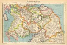 Antique Map 1947 Bartholomew Scottish Borders
-
$4.95 GBP
 BRITISH and CANADIAN OPERATIONS 28 JULY - 4 AUGUST 1944, WW2 OVERLORD Map
-
$7.50 GBP
 BUDE, Cornwall, rare WW2 Naval Map 1943
-
$4.95 GBP
 THE OPERATIONS OF SECOND BRITISH ARMY EAST OF THE ORNE 18-21 JULY 1944, WW2 Map
-
$6.99 GBP
 Salisbury Plain Vintage Old Revised Half Inch Bartholomews Map 1937 Reading
-
$9.99 GBP
 Antique 1940s London Map - Mounted - Colour - FOREST HILL, EAST DULWICH
-
$3.50 GBP
 Halford's Pocket Touring Atlas of Great Britain & Ireland, maps, guides. Vintage
-
$4.75 GBP
 THE CLOSING OF THE FAILASE "POCKET" AS AT 18-20 AUGUST 1944, WW2 Map
-
$24.99 GBP
 National Geographic Map - Africa - 1943 - Vintage
-
$12.97 GBP
 Antique Map 1947 Bartholomew Texas and Oklahoma USA
-
$35.00 GBP
 Pilgrims Map of the Holy Land Israel Palestine Jerusalem 1942
-
$11.99 GBP
 Vintge 1940 Map of Classical Lands of the Mediterranean
-
$3.95 GBP
 Fine, Ordnance Survey One-inch map - Sheet 189, Land's End. Cloth Edition 1946
-
$3.75 GBP
 Coast around LITTLEHAMPTON, Sussex - Rare Vintage WW2 Naval Map 1943 topology
-
$4.75 GBP
 Askrigg & Settle OS New Popular Edition One Inch Map 1947 Sheet 90 Cloth
-
$5.00 GBP
 Vintage Halford's Pocket Touring Atlas of Great Britain & Ireland (c1941)
-
$15.99 GBP
 Antique/Vintage Map of The Western Frontiers of Libya - K.S. Sandford - 1942
-
$8.99 GBP
 AFRICA (NE) Anglo Egyptian Sudan with large inset of Egypt - Vintage Map 1945
-
$4.95 GBP
 FIRST CANADIAN ARMY OPERATIONS, CAEN-FALAISE 7-8 AUGUST 1944, WW2 OVERLORD Map
-
$6.50 GBP
 THE BATTLE OF THE RHINELAND January 1945, WW2 Map, British, Canadian & US Armies
-
$3.49 GBP
 ST.GERMANS or LYNHER RIVER; SALTASH, Cornwall WW2 Naval Military Map 1944
-
$3.49 GBP
 HASTINGS, Sussex - Rare vintage WW2 Naval Military Map 1943
-
$15.00 GBP
 1940 Ordnance Survey Map Exeter War Office Edition Sheet 138, 1 inch 1 mile
-
$18.99 GBP
 Newport northeast, Caerleon, Christchurch, old map Monmouth 1949: 29SW Wales
-
$3.45 GBP
 TREPORT, France D-Day Planning - Rare Vintage WW2 Overlord Map 1943
-
$18.99 GBP
 Llandegfan, Llansadwrn, old map Anglesey 1949: 19NE repro Wales
-
$9.99 GBP
 Vintage WW2 Kington Hereford 1940 Linen Backed OS Sheet 80
-
$7.50 GBP
 Snowdon ORDNANCE SURVEY MAP One inch Wall Decor
-
$9.99 GBP
 Antique 1960s London Map - Mounted - KENSAL GREEN WILLESDEN KILBURN BRONDESBURY
-
$18.99 GBP
 Pontypridd west, Hafod, old map Glamorgan 1948: 28SW repro Wales
-
$121.64 GBP
 1941 Vermont Forest Service Ski Runs & Ski Tails Mount Mansfield Map
-
$23.87 GBP
 1944 ORIGINAL VINTAGE MAP OF IRAN IRAQ KUWAIT / VERSO BRITISH INDIA


